Features:
For those who want to get in a bit of hill work and some greenery (Bukit=Hill), these three areas all within a couple of km of each other make for a good run either standalone or in combination. We’ve created a map that does the perimeter of each area and shows the best running connections between the three parks.
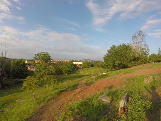
The Bukit Cina hillside dates back to the 15th century features a temple, burial ground, and a well. There’s a series of paths, including a fairly open path following the perimeter of the park, a loop of about 3 km. It’s a popular spot for running. Since it’s fairly open, best to avoid the heat of the day.
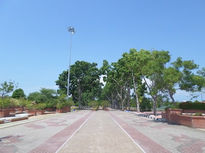
Bukit Serindit is about 1 km east of Bukit Cina. This is also a hilly area, and location of two adjacent recreational parks. There are paths for walking and running, sports fields, and small lakes. A loop around these areas could add up to 2-3 km.
From the south end of Bukit Serindit, it’s about 1 km south to St. John’s Hill, where there’s a pleasant, shaded road to St. John’s Fort, which is a good spot for hill practice! The road to get there, Jalan Ayer Leleh, is not that pretty, but it is runnable.
To return to Bukit Cina, use side roads: Lorong Tambi Abdullah 3&6, and Lorong Laksamana Cheng Ho 1. Or, use Highway the main road Route 5, which is runnable but not pleasant.
- 3 km (1.8 miles) loop
- 35m
- Just off Highway 5 at Jalan Puteri Hang Li Poh Road
- Bus access to area

Comment on this Route/Share a Photo!
Share your feedback on this route and see that of other Great Runs users. Click on the image icon to upload a photo. And please let us know if there are notes or changes we should incorporate!