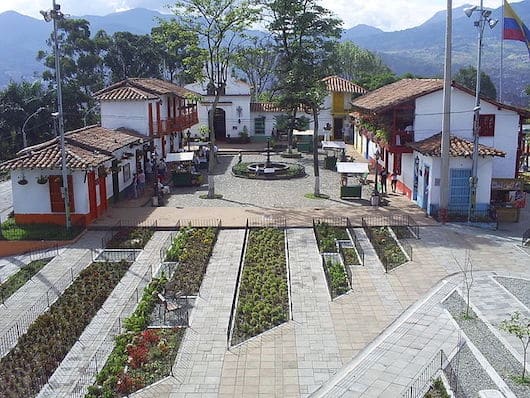
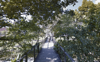
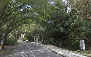
A great spot for some hill work in central Medellín, with the reward of shade, greenery, and wonderful hilltop views. This is a 2.6 km out and back route to the top of Nutibara Hill. One can follow a path/sidewalk along the main road to the summit and a viewpoint (Mirador). It’s a steep climb — 100m over 1.3 km, with 6-10% grades. There are also several several side paths and stairs. At the summit, there’s also Pueblo Paisa, a composite of a typical town in the region.
Paths in Park. Google Street View.
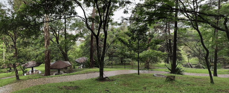
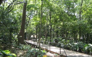
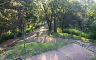
Add-Ons: There are several several side paths and stairs in the park. One can also combine Nutibara Hill with Parques del Río Medellín, a riverside pedestrian path that goes for ~1.5 km between Avenida 33 (just north of Nutibara Hill) and Aveninda San Juan, with a couple of pedestrian bridges.
A great spot for some hill work in central Medellín, with the reward of shade, greenery, and wonderful hilltop views. This is a 2.6 km out and back route to the top of Nutibara Hill. One can follow a path/sidewalk along the main road to the summit and a viewpoint (Mirador). It’s a steep climb — 100m over 1.3 km, with 6-10% grades. There are also several several side paths and stairs. At the summit, there’s also Pueblo Paisa, a composite of a typical town in the region.
Paths in Park. Google Street View.
Add-Ons: There are several several side paths and stairs in the park. One can also combine Nutibara Hill with Parques del Río Medellín, a riverside pedestrian path that goes for ~1.5 km between Avenida 33 (just north of Nutibara Hill) and Aveninda San Juan, with a couple of pedestrian bridges.
Scroll Down For Route Maps
Essentials
2.6 km (1.6 miles) out and back, with add-on options
88m (290 feet)
Either off Calle 30A at the south end or Calle 32D at the north end
Off Calle 30A at the south end or Calle 32D at the north end
Just north of central Medellín, one can put together a quite nice run incorporating Parque Norte, the adjacent Botanical Gardens, and the campus of Universidad de Antioquia. Good transport access at Universidad Cll.73 metro.
The largest green space in the city, and a great place for a hilly, verdant run. The ~1.5 km, 120m climb to the summit is rewarded with great views. Trail runners will enjoy rugged, interior trails. Add on with Estadio running track, adjacent university paths.
A favorite, hilly 10k road loop among locals. The route follows the 'Transversales' in the El Poblado neighborhood. A busy road, but decent sidewalks and a nice tree canopy in parts.
A 40,000-acre nature preserve located 30 km from Medellín and reachable via public transport. There are 54 km of trails of varying levels of difficulty and length. There's a rich variety of plants, wildlife, and some notable archeological sites.
Share your feedback on this route and see that of other Great Runs users. Click on the image icon to upload a photo. And please let us know if there are notes or changes we should incorporate!
Subscribe
0 Comments
Oldest
Newest
Inline Feedbacks
View all comments
Essentials
2.6 km (1.6 miles) out and back, with add-on options
88m (290 feet)
Either off Calle 30A at the south end or Calle 32D at the north end
Off Calle 30A at the south end or Calle 32D at the north end

Review or Comment on This Route/Share a Photo!
Share your feedback on this route and see that of other Great Runs users. Click on the image icon to upload a photo. And please let us know if there are notes or changes we should incorporate!