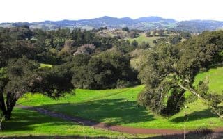
Calistoga Loop: This preferred loop on the Silverado Trail in Calistoga starts out on Lincoln Ave, then turns RIGHT onto the wide shoulder of the Silverado Trail. Next, turn RIGHT onto Dunaweal. To close the loop, either turn RIGHT onto the bike path off Denuaweal or RIGHT onto 128 and return to the start (5 miles). ROUTE MAP.
Deer Park Loop: Another Silverado Trail loop for those in the Deer Park area, this route starts at the intersection with Deer Park Road, then turns LEFT onto Sanitarium Road. Bear LEFT onto Crystal Springs Road, then turn LEFT to take The Silverado Trail back to the start. ROUTE MAP.
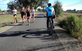
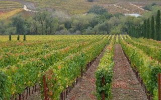
Finnell Road/Yountville Cross Road: This route in Yountville combines charming neighborhood running with scenic rural vineyards. It’s a flat course reaching up to 5 miles out and back. Start from the center of Yountville and follow Finnell Road as it bends east, then north to Yountville Creek Road. Turn RIGHT onto Yountville Creek and the scenery opens up from a quaint neighborhood to an expanse of vineyards and mountains beyond. Follow Yountville Creek Road to its intersection with The Silverado Trail after about 2.5 miles, then return to the start. There is also an option to add on a loop of the Napa River Ecological Reserve Trail, a 1 mile dirt tour off of Yountville Creek Road. ROUTE MAP.
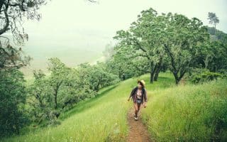
Mount St. Helena and Robert Louis Stevenson State Park: One of the highest peaks rising from the Napa Valley, Mt. St. Helena is the jewel of Robert Louis Stevenson State Park, where the author of Treasure Island honeymooned. There are plenty of trails throughout the park, but there are some favorite sections for runners seeking a more challenging Napa running route. One is the road to the summit of Mount St. Helena itself. Though the trail begins as a narrow rocky singletrack (not great for running), after the first mile the trail opens to a smooth gravel road, with great views the whole way up. At about 10 miles out and back, it’s a tough climb — 1900 feet over 4.7 miles, with grades of 8-10%. ROUTE MAP.
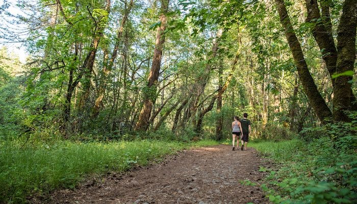
Bothe-Napa Valley State Park: For trail runners with enough time on their hands to make it to Calistoga, the Bothe-Napa State Park is a favorite destination. With 10 miles of trails through inland redwoods, rolling hills, and historic sites, running here is never boring. The Park Info brochure has a trail map, p.6. One favorite route traverses Coyote Peak on a 5 mile “lollipop” route. Start at the Redwood Trailhead, follow the Ritchey Creek to the Spring Trail, then turn LEFT. Bear RIGHT onto the South Fork Trail, then the Coyote Peak Trail, which will take you over the vista and back to the Redwood Trail. PARK INFO & ROUTE MAP.
Calistoga Loop: This preferred loop on the Silverado Trail in Calistoga starts out on Lincoln Ave, then turns RIGHT onto the wide shoulder of the Silverado Trail. Next, turn RIGHT onto Dunaweal. To close the loop, either turn RIGHT onto the bike path off Denuaweal or RIGHT onto 128 and return to the start (5 miles). ROUTE MAP.
Deer Park Loop: Another Silverado Trail loop for those in the Deer Park area, this route starts at the intersection with Deer Park Road, then turns LEFT onto Sanitarium Road. Bear LEFT onto Crystal Springs Road, then turn LEFT to take The Silverado Trail back to the start. ROUTE MAP.
Finnell Road/Yountville Cross Road: This route in Yountville combines charming neighborhood running with scenic rural vineyards. It’s a flat course reaching up to 5 miles out and back. Start from the center of Yountville and follow Finnell Road as it bends east, then north to Yountville Creek Road. Turn RIGHT onto Yountville Creek and the scenery opens up from a quaint neighborhood to an expanse of vineyards and mountains beyond. Follow Yountville Creek Road to its intersection with The Silverado Trail after about 2.5 miles, then return to the start. There is also an option to add on a loop of the Napa River Ecological Reserve Trail, a 1 mile dirt tour off of Yountville Creek Road. ROUTE MAP.
Mount St. Helena and Robert Louis Stevenson State Park: One of the highest peaks rising from the Napa Valley, Mt. St. Helena is the jewel of Robert Louis Stevenson State Park, where the author of Treasure Island honeymooned. There are plenty of trails throughout the park, but there are some favorite sections for runners seeking a more challenging Napa running route. One is the road to the summit of Mount St. Helena itself. Though the trail begins as a narrow rocky singletrack (not great for running), after the first mile the trail opens to a smooth gravel road, with great views the whole way up. At about 10 miles out and back, it’s a tough climb — 1900 feet over 4.7 miles, with grades of 8-10%. ROUTE MAP.
Bothe-Napa Valley State Park: For trail runners with enough time on their hands to make it to Calistoga, the Bothe-Napa State Park is a favorite destination. With 10 miles of trails through inland redwoods, rolling hills, and historic sites, running here is never boring. The Park Info brochure has a trail map, p.6. One favorite route traverses Coyote Peak on a 5 mile “lollipop” route. Start at the Redwood Trailhead, follow the Ritchey Creek to the Spring Trail, then turn LEFT. Bear RIGHT onto the South Fork Trail, then the Coyote Peak Trail, which will take you over the vista and back to the Redwood Trail. PARK INFO & ROUTE MAP.


Review or Comment on This Route/Share a Photo!
Share your feedback on this route and see that of other Great Runs users. Click on the image icon to upload a photo. And please let us know if there are notes or changes we should incorporate!