Features:
Categories:
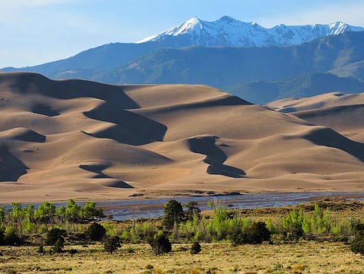
Great Sand Dunes National Park is famous for having North America’s tallest dunes, but the park also features 14,00-foot alpine peaks, forest, grasslands, and wetlands. It’s located between Denver and Albuquerque. In addition to our thoughts on ‘running’ the dunes trails — certainly a unique, but challenging experience — we also provide some recommendations on the best places to run in Great Sand Dunes National Park. The best running options that aren’t sand dunes or more serious trail runs are in the gorgeous grasslands and wetlands areas of the park. There are great grasslands for running between the park entrance and the Visitor Center. Also at the north end of the park, where they’re less visited and remote. PRO TIP: There can be some gorgeous desert blooms in spring.
RUNNING THE DUNES
Any visitor to the park will want to take a walk or hike in the dunes. The further you get from the Main Use Area, the more enjoyable, singular experience you’ll have. It is possible to run on the dunes trails, but it’s a major challenge, owing to the soft sand surface. But we suspect many runners will want to try it anyway, even for a few minutes. And…it’s something to run down the dunes! Note these aren’t formal trails, but areas you can zigzag up to the ridge lines.
The large, main dunefield covers approximately 30 square miles,. It is up to 8 miles long and 6 miles wide, and the tallest dune rises to 750 feet. There is no specific trail per se — you can just run in the dunes fields. Note that the dunes are very exposed and the sand surface can be up to 150°. The High Dune on the first ridge is a 2.5 mile hike, while the Star Dune offers a longer and more remote experience. Another good option is the dune trail from the Castle Creek Picnic area: 3 miles round trip, 400 foot elevation gain. Best done near sunrise or sunset to get the best light and views.
RUNNING THE TRAILS
Outside of the dunes, there are some wonderful trails in Great Sand Dunes National Park. We note that this is mainly hiking/trail running territory. Nearly all of the trails are fairly narrow, have some challenging footing, and an elevation gain. Also note that a 4WD vehicle is needed to access some of these trailheads. Our recommendations for some of the more ‘runnable’ trails:
Mosca Pass Trail. 7 miles RT, 1400 foot elevation gain. Mainly forested terrain, views of Mosca Creek, meadows, some ridges. Still a challenge.
Alpine Trails. These are more remote trails, but worth the effort for their gorgeous scenery. More for hiking or advanced trail running.

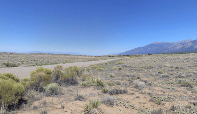
Grasslands Trails. The most ‘runnable’ parts of the park and also very scenic. There can be incredible wildflower blooms in mid-August. The easiest access is the many miles of grasslands and shrublands from the park entrance road, between the park entrance sign and the Visitor Center.
Grasslands can also be accessed at the northern end of the park. One of the best bets for running is the historic Liberty Stage Road, accessed from the Liberty Gate parking area after a run through a small subdivision. There are other generally flat, gravel roads and paths in this area that are great for running — but remote. MORE INFO
Wetlands Trails. The Wetlands within the Park are not open to the public. There are some wetlands trails adjacent to the park that are open to the public, some of which are very suitable for running. See this page for more info on the numerous access points. NOTE: Generally closed to the public February 15-July 15.
One of the more beautiful and accessible spots for enjoying the wetlands on foot is the Blanca Wetlands, located south of the Park near Alamosa. It’s administered by the Bureau of Land Management.


Comment on this Route/Share a Photo!
Share your feedback on this route and see that of other Great Runs users. Click on the image icon to upload a photo. And please let us know if there are notes or changes we should incorporate!