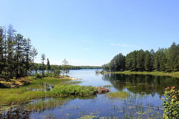
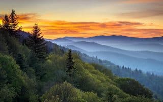
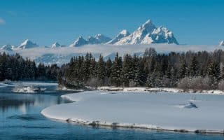
Voyageurs National Park is a different type of National Park. Located in northern Minnesota near the Canadian border, Voyageurs is a water-based park known for its lakes and islands, with a maze of interconnected waterways. Many visitors choose to navigate the park by watercraft. For runners, there are a number of easy and scenic hiking trails in the park, accessible by car. There are also some more challenging backcountry trails accessible only by boat. Note that Voyageurs is an
incredible winter running destination. In fact, there are more places available to run in Voyageurs in winter than summer! In addition to snowmobile trails, cross country trails, and snowshoe trails that can be run on, there are specially designated
ice roads, which are maintained roads on frozen lakes. See this
winter guide, which has trail information, conditions, and maps.
For summer running, this
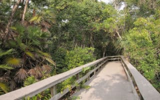
page has a list of all the hiking trails, with distances and difficulty ratings. Below is our list of the best places to run in Voyageurs National Park, generally near one of the three main visitor centers. Most of the trails are fairly wooded.
Note:
It can be buggy in summer. It’s gorgeous and less buggy in fall. And winter temperatures can be extreme.Rainy Lake Area
Oberholtzer Trail. 1.7 mile loop, easy. From just outside the Rainy Lake Visitor Center, trail leads to two overlooks to see the diversity of forest and wetland types
Rainy Lake Recreation Trail. 1.75 miles one-way, easy. Trail is along the park road, into the woods, and around rock outcrops, with forest, lake, and marsh scenery.
Park Road & Route 11. For road running, it’s possible to run on the Park Road for the ~2 miles to Rt. 11, and then along Route 11 east toward Island View or west toward International Falls . It’s popular with bikers. There’s no shoulder but the traffic is generally not heavy. There are a few spots with a dedicated bike path. From the Rainy Day Lake Visitor Center, it’s 12 miles to International Falls/U.S-Canada Border.
Tilson Ski Trails. There are 10 miles X-C trails maintained by the Minnesota Department of Natural Resources. They can be used in summer for trail running. Access from Rainy Day Lake Visitor Center using the 1-mile Tilson Connector Trail.
Lake Kabetogama Area
Echo Bay Trail. 2.5 mile loop, easy. Wide path through aspens to pines, passing through lowlands and rocky outcrops. Three miles from the Kabetogama Lake Visitor Center off Country Road 122.
Kab-Ash Trail. Long, strenuous trail with challenging footing. More of a backcountry hiking trail, advanced trail runners will enjoy!
Ash River Visitor Center Area
Blind Ash Bay Trail. 2.5 mile loop, moderate. For more advanced trail runners. Narrow, winding, rocky trail through a boreal forest, with spectacular scenery at the overlook. Trailhead is at the Kabetogama Lake Overlook near the Ash River Visitor Center.
Voyageurs National Park is a different type of National Park. Located in northern Minnesota near the Canadian border, Voyageurs is a water-based park known for its lakes and islands, with a maze of interconnected waterways. Many visitors choose to navigate the park by watercraft. For runners, there are a number of easy and scenic hiking trails in the park, accessible by car. There are also some more challenging backcountry trails accessible only by boat. Note that Voyageurs is an
incredible winter running destination. In fact, there are more places available to run in Voyageurs in winter than summer! In addition to snowmobile trails, cross country trails, and snowshoe trails that can be run on, there are specially designated
ice roads, which are maintained roads on frozen lakes. See this
winter guide, which has trail information, conditions, and maps.
For summer running, this
page has a list of all the hiking trails, with distances and difficulty ratings. Below is our list of the best places to run in Voyageurs National Park, generally near one of the three main visitor centers. Most of the trails are fairly wooded.
Note:
It can be buggy in summer. It’s gorgeous and less buggy in fall. And winter temperatures can be extreme.Rainy Lake Area
Oberholtzer Trail. 1.7 mile loop, easy. From just outside the Rainy Lake Visitor Center, trail leads to two overlooks to see the diversity of forest and wetland types
Rainy Lake Recreation Trail. 1.75 miles one-way, easy. Trail is along the park road, into the woods, and around rock outcrops, with forest, lake, and marsh scenery.
Park Road & Route 11. For road running, it’s possible to run on the Park Road for the ~2 miles to Rt. 11, and then along Route 11 east toward Island View or west toward International Falls . It’s popular with bikers. There’s no shoulder but the traffic is generally not heavy. There are a few spots with a dedicated bike path. From the Rainy Day Lake Visitor Center, it’s 12 miles to International Falls/U.S-Canada Border.
Tilson Ski Trails. There are 10 miles X-C trails maintained by the Minnesota Department of Natural Resources. They can be used in summer for trail running. Access from Rainy Day Lake Visitor Center using the 1-mile Tilson Connector Trail.
Lake Kabetogama Area
Echo Bay Trail. 2.5 mile loop, easy. Wide path through aspens to pines, passing through lowlands and rocky outcrops. Three miles from the Kabetogama Lake Visitor Center off Country Road 122.
Kab-Ash Trail. Long, strenuous trail with challenging footing. More of a backcountry hiking trail, advanced trail runners will enjoy!
Ash River Visitor Center Area
Blind Ash Bay Trail. 2.5 mile loop, moderate. For more advanced trail runners. Narrow, winding, rocky trail through a boreal forest, with spectacular scenery at the overlook. Trailhead is at the Kabetogama Lake Overlook near the Ash River Visitor Center.


Review or Comment on This Route/Share a Photo!
Share your feedback on this route and see that of other Great Runs users. Click on the image icon to upload a photo. And please let us know if there are notes or changes we should incorporate!