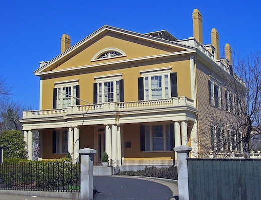
This is a ‘runseeing’ tour of the most central historic section of New Bedford. The city was one of the world’s most important whaling ports during the first half of the 19th century, and today it’s a treat to walk around the historic districts to see the impressive captains homes and other architectural highlights. We’ve mapped a 4.3 mile route that covers some of the principal historic streets and a jaunt out to Buttonwood Park. Use our map as a guideline to explore more on your own. The New Bedford Preservation Society has put together five self-guided walking tours, with excellent details on the historic homes. It’s also a National Historical Park.
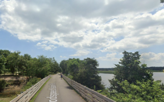
The main route covers the historic section south of Route 6 to Allen St., and west of the JFK Memorial Highway. County St. is an important historic street and is a good anchor for the route. Start at County & Elm, and run for 0.5 miles south to Russell St. This section is lined with stately homes — many with Widow’s Walks. Loop back along cobblestoned Acushnet St. and explore the area around Custom House Square and the Whaling Museum (very worth a visit). Next, head west along William St. — another pretty, cobbled street — and continue west for 1 mile along Court St. to Buttonwood Park. This is a historic park designed by the famed architectural firm of Frederick Law Olmsted, and work is ongoing to improve/restore its condition. Use Union St. or one of the other streets to return to the start.
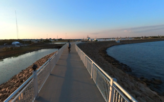
Add-On Options: Explore other streets in the historic center. You can also run north on County St. for 1 mile to Clasky Common Park & the Acushnet Heights Historic District, or south on County St. to Cove St. to join our waterfront route. Also, it’s scenic to run over the Roland Hebert Bridge to Pope’s Island or all the way to Fairhaven (1.5 miles). There’s a decent sidewalk on the bridge and goodviews of Buzzards Bay.
This is a ‘runseeing’ tour of the most central historic section of New Bedford. The city was one of the world’s most important whaling ports during the first half of the 19th century, and today it’s a treat to walk around the historic districts to see the impressive captains homes and other architectural highlights. We’ve mapped a 4.3 mile route that covers some of the principal historic streets and a jaunt out to Buttonwood Park. Use our map as a guideline to explore more on your own. The New Bedford Preservation Society has put together five self-guided walking tours, with excellent details on the historic homes. It’s also a National Historical Park.
The main route covers the historic section south of Route 6 to Allen St., and west of the JFK Memorial Highway. County St. is an important historic street and is a good anchor for the route. Start at County & Elm, and run for 0.5 miles south to Russell St. This section is lined with stately homes — many with Widow’s Walks. Loop back along cobblestoned Acushnet St. and explore the area around Custom House Square and the Whaling Museum (very worth a visit). Next, head west along William St. — another pretty, cobbled street — and continue west for 1 mile along Court St. to Buttonwood Park. This is a historic park designed by the famed architectural firm of Frederick Law Olmsted, and work is ongoing to improve/restore its condition. Use Union St. or one of the other streets to return to the start.
Add-On Options: Explore other streets in the historic center. You can also run north on County St. for 1 mile to Clasky Common Park & the Acushnet Heights Historic District, or south on County St. to Cove St. to join our waterfront route. Also, it’s scenic to run over the Roland Hebert Bridge to Pope’s Island or all the way to Fairhaven (1.5 miles). There’s a decent sidewalk on the bridge and goodviews of Buzzards Bay.

Review or Comment on This Route/Share a Photo!
Share your feedback on this route and see that of other Great Runs users. Click on the image icon to upload a photo. And please let us know if there are notes or changes we should incorporate!