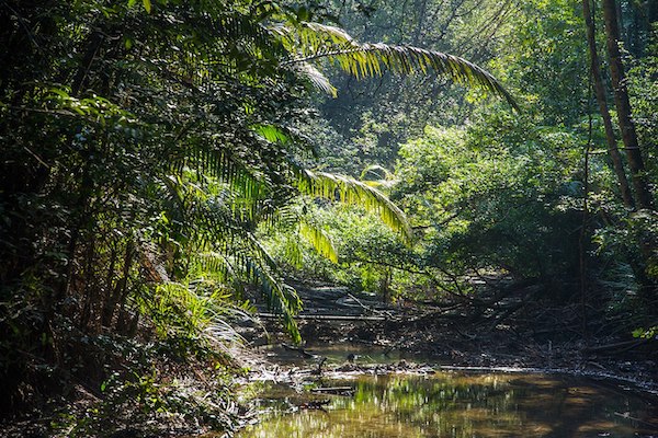
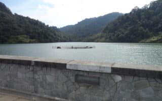
Penang National Park is a 1,300 hectare park located in north-west corner of the island in Teluk Bahang. The park is a major preserve, and is known for its lush jungle-like terrain, where visitors can hike to remote beaches.
Monkey Beach – Wikimedia Commons
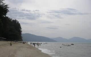
For running, the best option is the coastal hiking path, which is 5 km one-way from the Park Office in Teluk Bahang to the Muka Head Lighthouse. It is a narrow, rugged path, with lush foliage. It’s 3.5 km to Monkey Beach, and then it’s a very steep, 200m climb for 1 km to the Lighthouse, with grades of 15-20%. There aren’t water views except for the ~1 km section along Monkey Beach. Note: this is a rugged trail run, and the path can be wet and muddy with tree roots and other obstacles.
For an even more rugged and challenging trail run, the other major trail in the Park is over the hills, through the jungle to some of the more remote beaches, and a Turtle Sanctuary. See the attached park trail map.
Penang National Park is a 1,300 hectare park located in north-west corner of the island in Teluk Bahang. The park is a major preserve, and is known for its lush jungle-like terrain, where visitors can hike to remote beaches.
Monkey Beach – Wikimedia Commons
For running, the best option is the coastal hiking path, which is 5 km one-way from the Park Office in Teluk Bahang to the Muka Head Lighthouse. It is a narrow, rugged path, with lush foliage. It’s 3.5 km to Monkey Beach, and then it’s a very steep, 200m climb for 1 km to the Lighthouse, with grades of 15-20%. There aren’t water views except for the ~1 km section along Monkey Beach. Note: this is a rugged trail run, and the path can be wet and muddy with tree roots and other obstacles.
For an even more rugged and challenging trail run, the other major trail in the Park is over the hills, through the jungle to some of the more remote beaches, and a Turtle Sanctuary. See the attached park trail map.
Scroll Down For Route Maps
Essentials
5 km (3.1 miles) one-way; It's 3.5 km to Monkey Beach, after which the trail becomes super steep!
257m (844 feet) -- but most of this is in the 1 km from the Beach to the Lighthouse -- very steep!
A 'runseeing' tour of George Town, Penang's colorful, multi-cultural capital city, which is also a UNESCO Heritage site. Includes a nice section along the water, with a return through Old Town, passing numerous landmarks and sites.
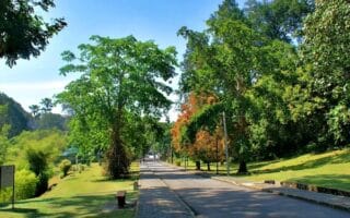
One of the most popular spots for a run in Penang. Located 8 km west of Georgetown, the beautifully landscaped gardens have paved paths passing by numerous species. A loop around the perimeter is about 2.5 km. Note: Hilly!
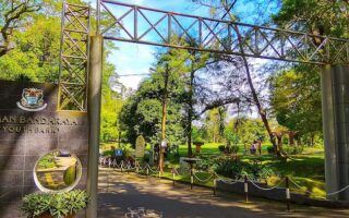
City Park, also known as Youth Park, is a pleasant, green space in the western part of George Town. We recommend combining City Park with the nearby Jesselton neighborhood, for a 7 km run. Additional running options in area.
Located near George Town, Air Itam Dam is a green oasis, with numerous trails and quiet roads for running: We've mapped two routes that can be done separately or combined: A 2.8 km flat, paved loop around the dam, and a hillier, more rugged 'Temple Loop'.
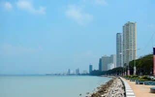
There are numerous beaches located on the island of Penang. These are our recommendations for the most suitable for running. The best: Batu Ferringhi Beach, located on Penang's northern coast. It's 2 km long and fairly wide.
Share your feedback on this route and see that of other Great Runs users. Click on the image icon to upload a photo. And please let us know if there are notes or changes we should incorporate!
Subscribe
0 Comments
Oldest
Newest
Inline Feedbacks
View all comments
Essentials
5 km (3.1 miles) one-way; It's 3.5 km to Monkey Beach, after which the trail becomes super steep!
257m (844 feet) -- but most of this is in the 1 km from the Beach to the Lighthouse -- very steep!


Review or Comment on This Route/Share a Photo!
Share your feedback on this route and see that of other Great Runs users. Click on the image icon to upload a photo. And please let us know if there are notes or changes we should incorporate!