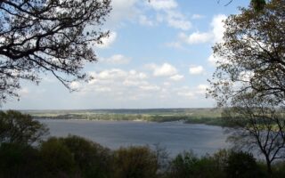
The Rock Island Greenway offers the best opportunity for a long off-road run in the Peoria area. The paved multi-use trail runs for 13 miles from Peoria to Dunlap. The trail connects several residential communities, with the northern 4 miles past Alta passes by farmland. There are a couple of short on-road sections. This trail map is a helpful resource for segment details, access, and parking.
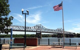
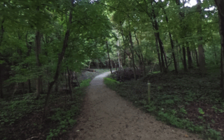
The trail starts near the Bob Michel Bridge near downtown. The first ~2 miles overlaps with the Riverfront trail, then along Abington St. to Glen Oak Park. Continue north through Peoria Heights, where you can connect to the popular Grandview Drive running route using E Bishop Ave. or East Glen Ave. It’s a steady, 350-foot climb over ~4 miles from Glen Oak Park to Donovan Park. Donovan Park is a nice detour, with a couple of miles of trails and an observatory. The next ~3 miles are more residential, but then the trail becomes more pastoral for the northern ~5 miles north of Highway 6. North of Alta, the trail is gravel-surfaced. The north end of the trail is in Dunlap, where you can continue onto the Rock Island State Trail for many miles further north.
Add-Ons/Variations: Connect to Grandview Drive using E Bishop Ave. or East Glen Ave. Additional trails in Glen Oak Park, Donovan Park.
The Rock Island Greenway offers the best opportunity for a long off-road run in the Peoria area. The paved multi-use trail runs for 13 miles from Peoria to Dunlap. The trail connects several residential communities, with the northern 4 miles past Alta passes by farmland. There are a couple of short on-road sections. This trail map is a helpful resource for segment details, access, and parking.
The trail starts near the Bob Michel Bridge near downtown. The first ~2 miles overlaps with the Riverfront trail, then along Abington St. to Glen Oak Park. Continue north through Peoria Heights, where you can connect to the popular Grandview Drive running route using E Bishop Ave. or East Glen Ave. It’s a steady, 350-foot climb over ~4 miles from Glen Oak Park to Donovan Park. Donovan Park is a nice detour, with a couple of miles of trails and an observatory. The next ~3 miles are more residential, but then the trail becomes more pastoral for the northern ~5 miles north of Highway 6. North of Alta, the trail is gravel-surfaced. The north end of the trail is in Dunlap, where you can continue onto the Rock Island State Trail for many miles further north.
Add-Ons/Variations: Connect to Grandview Drive using E Bishop Ave. or East Glen Ave. Additional trails in Glen Oak Park, Donovan Park.

Review or Comment on This Route/Share a Photo!
Share your feedback on this route and see that of other Great Runs users. Click on the image icon to upload a photo. And please let us know if there are notes or changes we should incorporate!