Chandler is located to the far southeast of Phoenix, and features some great multi-use paths in addition to the fantastic San Tan Mountain Regional Park.
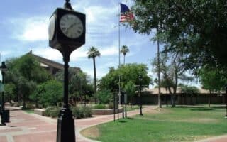
Veterans Oasis Park: Pretty park with wetlands and a good feel of the Sonoran desert landscape. The main concrete loop around Veterans Oasis Lake is only about 1 mile, but a network of dirt paths radiating out from the park make this a true oasis for running in the heart of Chandler.
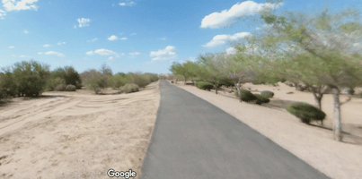
Chandler Paseo Trail: Stretching along the narrow Consolidated Canal, the Chandler Paseo Trail unfurls for 6.5 miles of relatively uninterrupted waterside running. The trail is paved on the east side and gravel on the west side. There are some occasional small bridges for crossing. TRAIL MAP
Wikimedia Commons
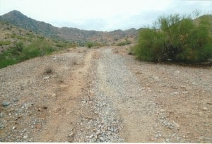
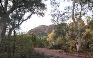
San Tan Mountain Regional Park: Southern Chandler rises to meet the mountains of San Tan Mountain Regional Park, where runners can explore miles of trails in 10,000 miles of desert. Many of the trails are quite wide and not too hilly. The trail map shows the trails’ length and difficulty level. The roughly 8-mile multi-use path is a good bet for anybody. TRAIL MAP.
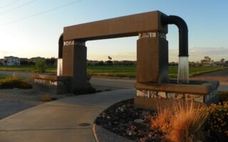
Queen Creek Wash Trail. The Queen Creek Wash Trail (also known as the Queen Creek Multi-Use Trail) is a paved, 4.8 mile path running diagonally through Queen Creek. As part of this trail, the Mansel Carter Oasis in southwest Chandler is a nice spot for a short run or laps. ROUTE MAP. NEW: An extension was opened in 2024, from the Crismon Road alignment to Rittenhouse Road, so it is now ~6 miles. . Also a 1/2 mile connection to the
Sonoqui Wash Trail: The sister to the Queen Creek Trail is the Sonoqui Wash, a 3.8 mile multi-use trail stretching from Riggs Road to Power Road. Part paved and part gravel, the trail weaves in and out of a rural desert landscape. Parking at the Horseshoe Park & Equestrian Centre, where there are an additional 1.3 miles of trails for running. TRAIL INFO. NEW: Eventual connection to the Queen Wash Trail, using Signal Butte Rd.
Chandler is located to the far southeast of Phoenix, and features some great multi-use paths in addition to the fantastic San Tan Mountain Regional Park.
Veterans Oasis Park: Pretty park with wetlands and a good feel of the Sonoran desert landscape. The main concrete loop around Veterans Oasis Lake is only about 1 mile, but a network of dirt paths radiating out from the park make this a true oasis for running in the heart of Chandler.
Chandler Paseo Trail: Stretching along the narrow Consolidated Canal, the Chandler Paseo Trail unfurls for 6.5 miles of relatively uninterrupted waterside running. The trail is paved on the east side and gravel on the west side. There are some occasional small bridges for crossing. TRAIL MAP
Wikimedia Commons
San Tan Mountain Regional Park: Southern Chandler rises to meet the mountains of San Tan Mountain Regional Park, where runners can explore miles of trails in 10,000 miles of desert. Many of the trails are quite wide and not too hilly. The trail map shows the trails’ length and difficulty level. The roughly 8-mile multi-use path is a good bet for anybody. TRAIL MAP.
Queen Creek Wash Trail. The Queen Creek Wash Trail (also known as the Queen Creek Multi-Use Trail) is a paved, 4.8 mile path running diagonally through Queen Creek. As part of this trail, the Mansel Carter Oasis in southwest Chandler is a nice spot for a short run or laps. ROUTE MAP. NEW: An extension was opened in 2024, from the Crismon Road alignment to Rittenhouse Road, so it is now ~6 miles. . Also a 1/2 mile connection to the
Sonoqui Wash Trail: The sister to the Queen Creek Trail is the Sonoqui Wash, a 3.8 mile multi-use trail stretching from Riggs Road to Power Road. Part paved and part gravel, the trail weaves in and out of a rural desert landscape. Parking at the Horseshoe Park & Equestrian Centre, where there are an additional 1.3 miles of trails for running. TRAIL INFO. NEW: Eventual connection to the Queen Wash Trail, using Signal Butte Rd.
The city of Mesa sits east of Phoenix and Tempe. It’s the gateway to some of the Phoenix metro area’s top trail running spots. We love running in Red Mountain Park, Pioneer Park, the Usery Mountain trails, and around Saguaro Lake.
There's some excellent running in Gilbert, located southeast of Phoenix, including a large network of paved multi-use trails and the wetland trail at Riparian Preserve. The Hieroglyphics Trail is a good spot for a scenic, gentle trail run.
Glendale and Peoria make up the majority of the suburbs northeast of Phoenix. Favorite running spots include Thunderbird Paseo Park, the Arrowhead Lakes residential area, New River/Skunk Creek multi-use trails, and White Tank Mountain Regional Park.
Great destination run 60 miles from Phoenix. Combine the Boyce Arboretum's trails through the world's deserts with the a section of the 11.6 mile recreational trail through Superior and the Sonoran desert.
Share your feedback on this route and see that of other Great Runs users. Click on the image icon to upload a photo. And please let us know if there are notes or changes we should incorporate!
 een Creek Wash Trail. The Queen Creek Wash Trail (also known as the Queen Creek Multi-Use Trail) is a paved, 4.8 mile path running diagonally through Queen Creek. As part of this trail, the Mansel Carter Oasis in southwest Chandler is a nice spot for a short run or laps. ROUTE MAP. NEW: An extension was opened in 2024, from the Crismon Road alignment to Rittenhouse Road, so it is now ~6 miles. . Also a 1/2 mile connection to the
Review or Comment on This Route/Share a Photo!
Share your feedback on this route and see that of other Great Runs users. Click on the image icon to upload a photo. And please let us know if there are notes or changes we should incorporate!