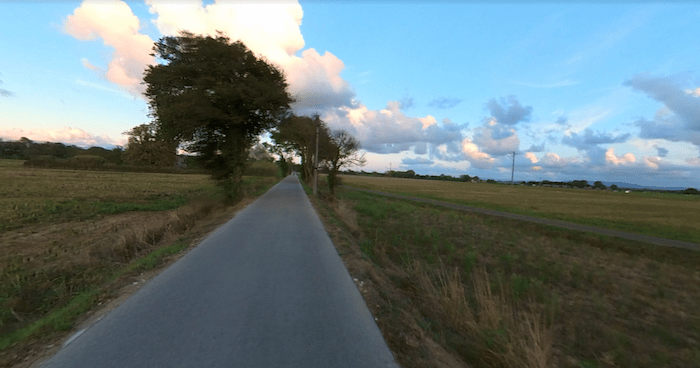
The best bet for a long off-road run in the Pisa area is to choose a section of the Ciclopista del Trammino. The paved multi-use path runs from near the center west to the Pisa Marina for 11 km, and then south for another 1.5 km, paralleling the SP224. The path is quite open and pastoral, passing through fields and farms. There are kiosks and good signage along the way.
The Pisa end of the path starts at the Piazza Vittorio Emanuele south of the Arno River as the L.go Uliano Martini, and then is on road (Via Livornese) for 1.6 km, then becoming a dedicated path again at Via Isola del Giglio for 8 km to the Marina. Then the path turns south for the final 1.8 km. Choose any section!
Add-Ons/Combination: At the Marina, can add or combine with our Marina/Waterfront Route.


Review or Comment on This Route/Share a Photo!
Share your feedback on this route and see that of other Great Runs users. Click on the image icon to upload a photo. And please let us know if there are notes or changes we should incorporate!