Features:
Categories:
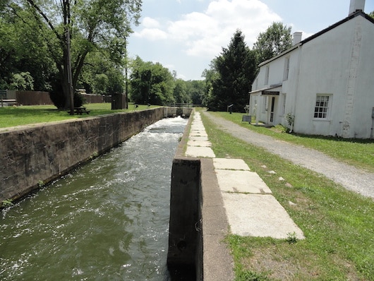
The D&R Canal State Park Trail runs for 70 miles, with a section in the Princeton area along Carnegie Lake and the Millstone River. The mainly gravel path features wooden bridges and 19th century bridge tender houses, remnants of locks, cobblestone spillways and hand-built stone-arched culverts. In several parts, there are paths on both sides of the water, allowing a choice of ‘woods’ or ‘water views’. It’s always a treat to see the rowers on Lake Carnegie. This page has excellent information on the Trail, with numerous maps and loop options.
We’ve mapped a couple of routes from near the Princeton University campus. Use either Alexander Rd. or Washington Rd. (~ 1 mile to canal). Our preferred direction is north. From Alexander Rd., it’s 5.8 miles to Rocky Hill, and 9 miles to Griggstown. You can also head south for 4.4 miles to the intersection of US 1 & I-295.
For variety, you can return on Prospect Ave. (access from Rt. 27 in Kingston), which is a lovely, tree-lined street with good sidewalks and set back homes. We’ve included a 9-mile loop run by GR friend Kassie Helm, from the Princeton campus to the canal trail, north to Kingston, and looping back on Prospect.
- From Alexander Rd., it's 5.8 miles (9.3 km) north to Rocky Hill or 4.2 miles south to US 1
- Fairly flat
- From Princeton, use Alexander Rd. or Washington Rd. (1 mile east of campus)
- Alexander Rd. or Washington Rd. (1 mile east of campus). Numerous access points/parking lots along the trail


Comment on this Route/Share a Photo!
Share your feedback on this route and see that of other Great Runs users. Click on the image icon to upload a photo. And please let us know if there are notes or changes we should incorporate!