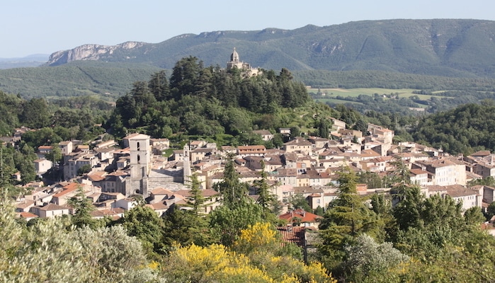
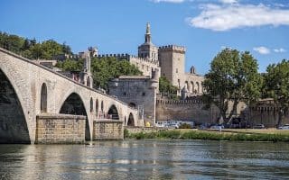
DIGNE LES BAINES (Capital of Alpes de Haute)
Trois Chapelles (Three Chapels): An easy loop starting from Digne-les-Bains, this 7 km course combines scenic rolling hills with a visit to three of the beautiful local chapels. Start at the local tourist office and run along the river towards the convention center. Turn RIGHT at the Arches school and turn RIGHT at the football field to begin you climb towards the chapels. First, reach La Croix Chapel, then descend towards Saint Vincent Chapel. Reach the final chapel before heading west towards the river and back to the start. ROUTE MAP. TRAIL INFO.
 River Alternative: A nice alternative to the Three Chapels route is to simply loop along the river. Continue north up to river path until reaching the bridge, then turn LEFT to cross over to the other side. Turn LEFT again onto Montee Bernard Dellacasagrande, and head south through the Parc de Musee Promenade. When you reach Grand Pont, turn LEFT again over the river to return to the start. ROUTE MAP. TRAIL INFO.
Runners can create a longer route by following the trails north from the Parc de Musee up to La Gomberge and returning on the Grand Traverse des Prealps. TRAIL INFO & MAP.
For more information, and other routes in the area, visit the Station de Trail Digne Les Baines website.
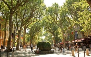
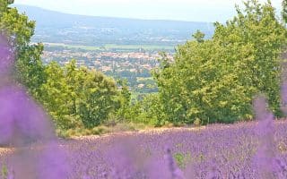
FORCALQUIER
Urban Trail: Forcalquier is a great place to explore a quintessential Provence village, and get in a solid runseeing workout. This 8 km urban trail circuit winds through the parks and alleys of the historic locale, beginning from Forcalquier stadium. Set out down the Poudrière road towards the silo, then join the Giloux road by the Cordeliers convent. Turn RIGHT onto the footpath towards La Bombardière, then arrive on the south side of the Citadel. Use the paved paths to climb up to the Chapel of Notre Dame de Provence and take in the views. Descending, pass the Palace of Justice Square and wind through alleys to Bourget place. Take Avenue Marcel André to the historic stone cabins of Cabanon Pointu and enjoy the views from the balcony. Follow Avenue d’Argenlieu and climb back past the Bombardière and the Citadel to return to the sports complex. ROUTE MAP. TRAIL INFO.
La Mère des Fontaines (Mother of Fountains): This 13 km trail run sets out from the town of Forcalquier and follows easy forest roads and dirt trails up to the Clot de Melly. Start from the Forcalquier stadium and take Fontauris Avenue (following the Trail No. 4 markers) towards the center of the village. Go up Avenue Marcel André and Avenue Saint-Marc to arrive at the intersection of “Les Arnauds.” Keep straight on the main road towards La Mère des Fontaines, which soon becomes a path. At the Charbonniers, turn LEFT onto the path to Clot de Melly. Turn RIGHT up the short incline to the highest point, then RIGHT again, downhill to the Mourres. Head through the car park, cross the road, and join the road on the right side. Turn LEFT onto the road descending along a farm and through La Parise. Head towards Chambarels, then find the path on the right hand side to return to the stadium. ROUTE MAP. TRAIL INFO.
Les Mourres Alternative: For a shorter, 7 km trail run around the area, follow this alternative to Les Mourres geological site and return in a loop. The site offers a sweeping view of the valley before returning down the same ridgeline. ROUTE MAP. TRAIL INFO.
PRA LOUP
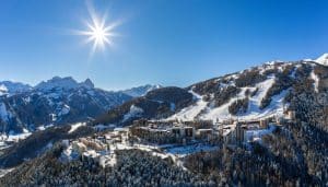 Urban Trail: The ski village of Pra Loup is little more than a hamlet of ski resorts, but it certainly is a picturesque backdrop for a run. There are several trails in the area, which make for challenging runs up the mountain as well as simpler loops around Barcelonette and the resort area of Pra Loup. One of the best, most straightforward routes is a 5k loop around the base of Pra Loup. From the cinema, go southeast along Pra Loup, then take the trail on the other side of D 109 out to Les Moulanes. Turn RIGHT onto Les Blancs, which winds back northwest to the area around the cinema. For more information, and other routes in the area, visit the Ubaye Tourism website. This site has detailed descriptions of some great trail running in the area. MAP & TRAIL INFO.
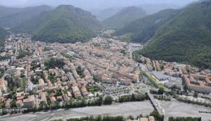
JABRON
Piedblacun: Runners will find plenty of lovely trails throughout the Jabron Valley, but this 9.5 km course from the village of Mairie Les Omergues is one of our favorites for its easygoing terrain and lovely farm fields. The route heads north from the village on roads, then turns RIGHT onto a trail in Les Michelets. Continue north and east to a road crossing in Les Ricoux, then pass south through Montfroc. Cross D946 twice, then loop south and west to La Fontaine. From here, continue north on the road back to Les Omergues. ROUTE MAP. TRAIL INFO.
For more information, and other routes in the area, visit the Station de Trail Jabron website.


Review or Comment on This Route/Share a Photo!
Share your feedback on this route and see that of other Great Runs users. Click on the image icon to upload a photo. And please let us know if there are notes or changes we should incorporate!