The Bonneville Shoreline Trail is a long-distance hiking trail which will ultimately cover 280 miles from the Idaho Border to Nephi, UT. Currently, about 100 miles are complete. Several sections of the trail pass through the Provo/Orem area. It’s generally easier footing than many of the other hiking trails in the canyons. Here are a couple of good options:
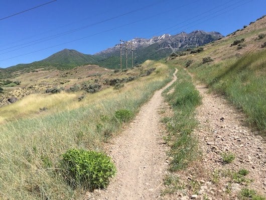
Springville to Rock Canyon. A longer distance, easier trail run in the foothills of Provo Canyon on a fairly wide gravel path, with good footing. The trail runs for 10.6 miles from Springville north to Rock Canyon. You can also catch the trail at the Slate Canyon Trailhead, Y Mountain trailhead and the Rock Canyon Trailhead. The trail climbs 1,570 feet over 10.6 miles. It’s not too steep and the footing is good. The ‘flatter’ section is south of Slate Canyon. Also popular for biking. ROUTE MAP
- Add-Ons: Iur Y Mountain and Rock Canyon Trail routes run off this section of the Bonneville Trail.
Orem: Aqueduct Section. This section of the trail, in Provo/Orem, heads into the ‘aqueduct’ area, just north of Provo Canyon Rd., in the shadow of Mt. Timpanogos. It’s good footing, climbing 650 feet over 2.8 miles. ROUTE MAP
Orem: Cascade Dr. to Battle Creek Falls. This is a steeper section of the trail, climbing 720 feet over 3.9 miles from the trailhead off Casade Dr. to Battle Creek Falls. ROUTE MAP


Review or Comment on This Route/Share a Photo!
Share your feedback on this route and see that of other Great Runs users. Click on the image icon to upload a photo. And please let us know if there are notes or changes we should incorporate!