There’s lovely running in this area. Mystic is popular for the historic Mystic Seaport, aquarium & museums. Stonington, 4 miles north, is a pretty coastal town with some pleasant running options. And there are a couple of fantastic waterside running spots in nearby Groton. Here are some good runs, working our way from Stonington south:
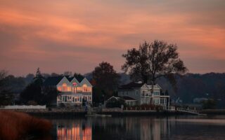
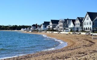
Streets of Stonington: Pretty coastal town with nice water views and historic homes and buildings. Rather than map a specific route, we suggest at a minimum you run on Water St. and Main St. from from Matthews Park to Stonington Point (each is 0.8 miles one-way). Many historic buildings, specimen trees, and nice shops. Then, enjoy some of the other side streets. Also fun to run on Rt. 1A to the bridge, another 0.5 miles.
Between Mystic and Stonington: Coming off Route 1 south of Stonington, there are some lovely, quiet roads that offer some nice water views. Wamphassuc Rd. is a quiet, shaded road that runs 1 mile from Rt. 1 to the water. Another really nice 4-5 mile loop is down to Latimer Point (nice shore running), then using Wilcox Rd. along the water to cross Rt. 1 onto Cove Rd., which is a pleasant, quiet road along Quiambog Cove (especially nice for 1 mile to Wehpittituck Farm). Finally, a beautiful run is down to Mason’s Island — very pretty road, with gorgeous shore views down to Enders Island (signs say private road but we’ve not had a problem). It’s OK to use Rt. 1 as a connector between these spots, as there’s a very wide shoulder.
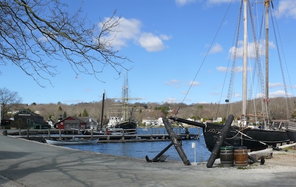
Mystic Seaport Loop. Pleasant waterside running and paths in Mystic. The nicest running is on Gravel St./River Rd., with beautiful water views for nearly 3 miles from Mystic Center to Rt. 27. ROUTE MAP. We’ve also put together a ~7 mile Mystic Loop, around the grounds of the Museum and Shipyard Point, up to Coogan Farm, then cross the drawbridge, and a 3-mile out and back section of the waterside Water St./Gravel St., and River Rd. ROUTE MAP
Groton: Noank. Classic seaside running in the village of Noank, 2 miles south of Mystic off Rt. 215. A nice ~2 mile loop of the area. ROUTE MAP For a longer run, connect to Groton Long Point (below), using Marsh Rd. Note: Hilly!
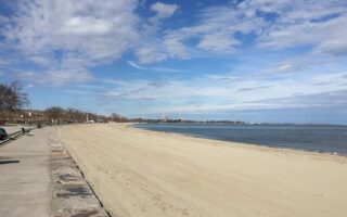
Groton: Long Point. Wonderful waterside running along E. Shore Ave. for about 1 mile, then a path along a lagoon and then W. Shore Dr./Atlantic Ave. along the Harbor. It’s a ~3-4 mile loop. ROUTE MAP For a longer run, connect to Noank (above), using Marsh Rd.
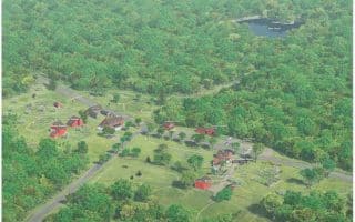
Barn Island Wildlife Management Area. 1,000 acres of salt and freshwater marshes, hardwood forests, and fields in Pawcatuck. The 3-mile main loop trail offers great views into the marshes and ponds. Trail Map
Bluff Point State Park. At 800 acres, the last remaining piece of undeveloped land along the Connecticut coastline. Combination of wooded areas and open views on the lovely trails, where a loop is ~2.5 miles. Trail Map. Trail Map
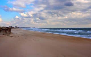
Westerly, Misquamicut, Watch Hill. Wonderful beach and coastal area on the CT/RI border. See our guide to running there.
There’s lovely running in this area. Mystic is popular for the historic Mystic Seaport, aquarium & museums. Stonington, 4 miles north, is a pretty coastal town with some pleasant running options. And there are a couple of fantastic waterside running spots in nearby Groton. Here are some good runs, working our way from Stonington south:
Streets of Stonington: Pretty coastal town with nice water views and historic homes and buildings. Rather than map a specific route, we suggest at a minimum you run on Water St. and Main St. from from Matthews Park to Stonington Point (each is 0.8 miles one-way). Many historic buildings, specimen trees, and nice shops. Then, enjoy some of the other side streets. Also fun to run on Rt. 1A to the bridge, another 0.5 miles.
Between Mystic and Stonington: Coming off Route 1 south of Stonington, there are some lovely, quiet roads that offer some nice water views. Wamphassuc Rd. is a quiet, shaded road that runs 1 mile from Rt. 1 to the water. Another really nice 4-5 mile loop is down to Latimer Point (nice shore running), then using Wilcox Rd. along the water to cross Rt. 1 onto Cove Rd., which is a pleasant, quiet road along Quiambog Cove (especially nice for 1 mile to Wehpittituck Farm). Finally, a beautiful run is down to Mason’s Island — very pretty road, with gorgeous shore views down to Enders Island (signs say private road but we’ve not had a problem). It’s OK to use Rt. 1 as a connector between these spots, as there’s a very wide shoulder.
Mystic Seaport Loop. Pleasant waterside running and paths in Mystic. The nicest running is on Gravel St./River Rd., with beautiful water views for nearly 3 miles from Mystic Center to Rt. 27. ROUTE MAP. We’ve also put together a ~7 mile Mystic Loop, around the grounds of the Museum and Shipyard Point, up to Coogan Farm, then cross the drawbridge, and a 3-mile out and back section of the waterside Water St./Gravel St., and River Rd. ROUTE MAP
Groton: Noank. Classic seaside running in the village of Noank, 2 miles south of Mystic off Rt. 215. A nice ~2 mile loop of the area. ROUTE MAP For a longer run, connect to Groton Long Point (below), using Marsh Rd. Note: Hilly!
Groton: Long Point. Wonderful waterside running along E. Shore Ave. for about 1 mile, then a path along a lagoon and then W. Shore Dr./Atlantic Ave. along the Harbor. It’s a ~3-4 mile loop. ROUTE MAP For a longer run, connect to Noank (above), using Marsh Rd.
Barn Island Wildlife Management Area. 1,000 acres of salt and freshwater marshes, hardwood forests, and fields in Pawcatuck. The 3-mile main loop trail offers great views into the marshes and ponds. Trail Map
Bluff Point State Park. At 800 acres, the last remaining piece of undeveloped land along the Connecticut coastline. Combination of wooded areas and open views on the lovely trails, where a loop is ~2.5 miles. Trail Map. Trail Map
Westerly, Misquamicut, Watch Hill. Wonderful beach and coastal area on the CT/RI border. See our guide to running there.


Review or Comment on This Route/Share a Photo!
Share your feedback on this route and see that of other Great Runs users. Click on the image icon to upload a photo. And please let us know if there are notes or changes we should incorporate!