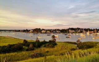
Narragansett has been a popular vacation spot in Rhode Island dating back to the late 1800s. Some of our favorite spots to run in the Narragansett area:
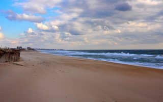
Narragansett Beach. One of the best beaches for running in Rhode Island. It’s flat and quite pretty, and among the more consistent wave beaches in New England. There’s even a surf school. The beach is 1 mile from end-to-end. The beach can get crowded in summer, and at high tide on a busy day you might find it challenging to find room to run. To make this a slightly longer run, at the southern end of the beach, hop onto the sidewalk off Ocean Rd., and continue along the road, heading south, past the Narragansett Chamber of Commerce, which is a historic building that bridges over the road. There are great ocean views, and nice running for 0.7 miles, before the road turns inland.
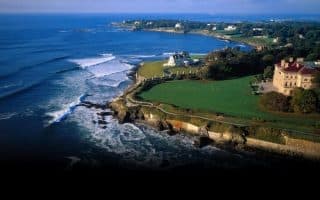
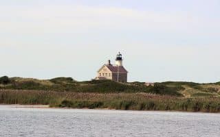
Point Judith. Further south, toward Point Judith, is Scarborough Beach, which is not quite as pretty as ‘Gansett, but also has about 1 mile of on the beach running. Another nice loop is out to Point Judith Lighthouse. We’ve mapped a fun ~3 mile route starting at the famous Aunt Carrie’s clam shack to the Lighthouse, using Calef Ave. out, and Rt. 108 back, and then a jaunt around the classic, intimate beach house community, using Shore Rd. and the various lanes. ROUTE MAP
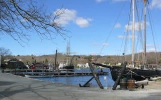
Galilee. Some nice running in the area around the Point Judith ferry and out to Great Island. Quiet roads, nice water views in parts. It’s a nearly 3-mile route from George’s of Galilee to the end of Great Island, using Great Island Rd. & East Shore Rd. Note: Sand Hill Rd., Galilee Escape Rd., and much of Rt. 108 south of Narragansett are more interior and don’t have water views. But they have wide shoulders and are runnable. ROUTE MAP
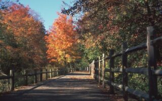
William C. O’Neill Bike Path. This is the best opportunity for a longer off-road run in the Narragansett area. The paved multi-use trail is nearly 7 miles between Narragansett and the Amtrak train station in West Kingston (just west of the URI campus). It’s wonderfully shaded. The east end starts at the Narragansett Elementary School. After 0.5 miles there’s a brief section on MacArthur Blvd. Cross 1A in Wakefield at 1.4 miles, and then continue through Peace Dale and South Kingston. Choose any section! Note it’s a gradual uphill running east to west. ROUTE MAP (One-Way, headed west)
Narragansett has been a popular vacation spot in Rhode Island dating back to the late 1800s. Some of our favorite spots to run in the Narragansett area:
Narragansett Beach. One of the best beaches for running in Rhode Island. It’s flat and quite pretty, and among the more consistent wave beaches in New England. There’s even a surf school. The beach is 1 mile from end-to-end. The beach can get crowded in summer, and at high tide on a busy day you might find it challenging to find room to run. To make this a slightly longer run, at the southern end of the beach, hop onto the sidewalk off Ocean Rd., and continue along the road, heading south, past the Narragansett Chamber of Commerce, which is a historic building that bridges over the road. There are great ocean views, and nice running for 0.7 miles, before the road turns inland.
Point Judith. Further south, toward Point Judith, is Scarborough Beach, which is not quite as pretty as ‘Gansett, but also has about 1 mile of on the beach running. Another nice loop is out to Point Judith Lighthouse. We’ve mapped a fun ~3 mile route starting at the famous Aunt Carrie’s clam shack to the Lighthouse, using Calef Ave. out, and Rt. 108 back, and then a jaunt around the classic, intimate beach house community, using Shore Rd. and the various lanes. ROUTE MAP
Galilee. Some nice running in the area around the Point Judith ferry and out to Great Island. Quiet roads, nice water views in parts. It’s a nearly 3-mile route from George’s of Galilee to the end of Great Island, using Great Island Rd. & East Shore Rd. Note: Sand Hill Rd., Galilee Escape Rd., and much of Rt. 108 south of Narragansett are more interior and don’t have water views. But they have wide shoulders and are runnable. ROUTE MAP
William C. O’Neill Bike Path. This is the best opportunity for a longer off-road run in the Narragansett area. The paved multi-use trail is nearly 7 miles between Narragansett and the Amtrak train station in West Kingston (just west of the URI campus). It’s wonderfully shaded. The east end starts at the Narragansett Elementary School. After 0.5 miles there’s a brief section on MacArthur Blvd. Cross 1A in Wakefield at 1.4 miles, and then continue through Peace Dale and South Kingston. Choose any section! Note it’s a gradual uphill running east to west. ROUTE MAP (One-Way, headed west)

Review or Comment on This Route/Share a Photo!
Share your feedback on this route and see that of other Great Runs users. Click on the image icon to upload a photo. And please let us know if there are notes or changes we should incorporate!