Rock Canyon is the go-to hiking and trail running spot in the Provo area. It is just northeast of downtown and steps from BYU. This tends to be more hilly and fairly challenging trail running. Here are some of the more popular options:
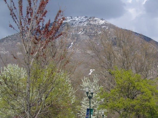
Running ‘The Y’. A popular hike/run is Y Mountain. This is steep and challenging. It’s 1 mile to ‘The Y’, climbing 1,000 feet, and 3 miles to the summit of Y Mountain, with a 3,000 foot gain. Trail can be narrow and rocky. ROUTE MAP
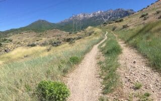
Rock Canyon Trail. A pretty trail heading into Rock Canyon. Great views. It’s 2.5 miles from the trailhead to Rock Canyon Campground, so a 5 mile out and back. Steep, climbing 1,500 feet over 2.5 miles with grades often >10%. It’s a fairly wide, gravel trail with decent footing. Parking lot off N 1450 E. For an added challenge, run up to Squaw Peak! ROUTE MAP
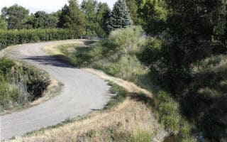
Bonneville Shoreline Trail. A longer distance, easier trail run in the foothills of Provo Canyon on a fairly wide gravel path, with good footing. The trail runs for 10.6 miles from Springville north to Rock Canyon. You can also catch the trail at the Slate Canyon Trailhead, Y Mountain trailhead and the Rock Canyon Trailhead. The trail climbs 1,570 feet over 10.6 miles. It’s not too steep and the footing is good. The ‘flatter’ section is south of Slate Canyon. Also popular for biking. ROUTE MAP
Rock Canyon is the go-to hiking and trail running spot in the Provo area. It is just northeast of downtown and steps from BYU. This tends to be more hilly and fairly challenging trail running. Here are some of the more popular options:
Running ‘The Y’. A popular hike/run is Y Mountain. This is steep and challenging. It’s 1 mile to ‘The Y’, climbing 1,000 feet, and 3 miles to the summit of Y Mountain, with a 3,000 foot gain. Trail can be narrow and rocky. ROUTE MAP
Rock Canyon Trail. A pretty trail heading into Rock Canyon. Great views. It’s 2.5 miles from the trailhead to Rock Canyon Campground, so a 5 mile out and back. Steep, climbing 1,500 feet over 2.5 miles with grades often >10%. It’s a fairly wide, gravel trail with decent footing. Parking lot off N 1450 E. For an added challenge, run up to Squaw Peak! ROUTE MAP
Bonneville Shoreline Trail. A longer distance, easier trail run in the foothills of Provo Canyon on a fairly wide gravel path, with good footing. The trail runs for 10.6 miles from Springville north to Rock Canyon. You can also catch the trail at the Slate Canyon Trailhead, Y Mountain trailhead and the Rock Canyon Trailhead. The trail climbs 1,570 feet over 10.6 miles. It’s not too steep and the footing is good. The ‘flatter’ section is south of Slate Canyon. Also popular for biking. ROUTE MAP


Review or Comment on This Route/Share a Photo!
Share your feedback on this route and see that of other Great Runs users. Click on the image icon to upload a photo. And please let us know if there are notes or changes we should incorporate!