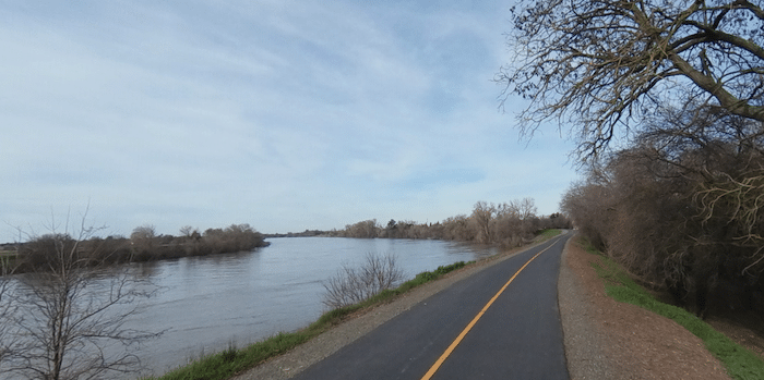
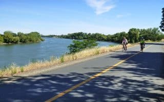
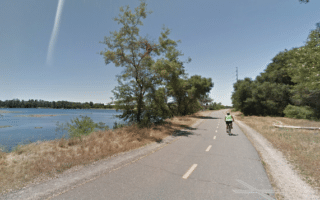
The Sacramento River Bike Trail is another one of a series of riverfront trails in the heart of Sacramento. We’ve focused on the 5 miles from Discovery Park south to the Pocket neighborhood. It’s a paved multi-use trail that runs alongside train tracks with some nice water views. Due to the proximity of I-5, we wouldn’t call this trail ‘bucolic’. NOTE: There’s a scenic southern section of the trail that picks up in Garcia Bend in the Freeport area, but currently there’s a 3+ mile gap through Pocket — though there are plans to make the connection along the levee. MAP
Start at Discovery Park and head south along the trail, which runs along a riverside levee. At 3 miles is the riverside Miller Regional Park. Continue for another 2 miles to the terminus of this section, at 25th Ave. in the Pocket neighborhood.
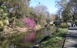
NOTE: At the northern end, you can add some nice running on the west side of the river on the River Walk Trail and River Walk Park. Use Tower Bridge to cross. There’s ~1.2 miles of paved, developed trail. North of I St., there trail continues for another 3 miles, but it is a bit more rugged.
Add-Ons: This trail also serves as a good connection to other routes: trails along the American River, Downtown, and William Land Park. At the Sacramento Zoo, you can also connect to the Del Rio Trail, a new paved rail-trail that runs south for 5 miles toward Freeport.
The Sacramento River Bike Trail is another one of a series of riverfront trails in the heart of Sacramento. We’ve focused on the 5 miles from Discovery Park south to the Pocket neighborhood. It’s a paved multi-use trail that runs alongside train tracks with some nice water views. Due to the proximity of I-5, we wouldn’t call this trail ‘bucolic’. NOTE: There’s a scenic southern section of the trail that picks up in Garcia Bend in the Freeport area, but currently there’s a 3+ mile gap through Pocket — though there are plans to make the connection along the levee. MAP
Start at Discovery Park and head south along the trail, which runs along a riverside levee. At 3 miles is the riverside Miller Regional Park. Continue for another 2 miles to the terminus of this section, at 25th Ave. in the Pocket neighborhood.
NOTE: At the northern end, you can add some nice running on the west side of the river on the River Walk Trail and River Walk Park. Use Tower Bridge to cross. There’s ~1.2 miles of paved, developed trail. North of I St., there trail continues for another 3 miles, but it is a bit more rugged.
Add-Ons: This trail also serves as a good connection to other routes: trails along the American River, Downtown, and William Land Park. At the Sacramento Zoo, you can also connect to the Del Rio Trail, a new paved rail-trail that runs south for 5 miles toward Freeport.


Review or Comment on This Route/Share a Photo!
Share your feedback on this route and see that of other Great Runs users. Click on the image icon to upload a photo. And please let us know if there are notes or changes we should incorporate!