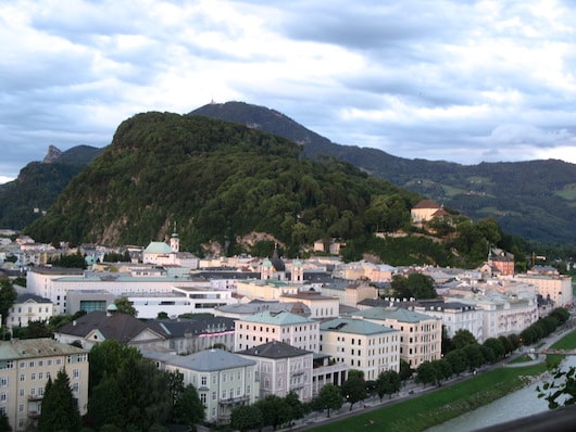
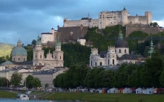
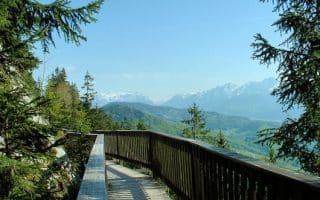
Kapuzinerberg is the other hill close to Salzburg city center, along with Mönchsberg. A steeper, more rugged run/hike, the 640 meter high hilll lies to the right of the River Salzach and is a popular outdoor recreation spot. It’s home to churches, an abbey, along with meandering hiking paths, and even chamois!
This is a challenging run! Over 1.3 km you’ll climb 200 meters (600 feet), with grades of up to 21%! We’ve mapped a route from the northeastern part of the park, in Doblerweg, along the path for 1.5 km to the summit, and then out to the southwestern part of the park. There are additional wooded paths in the park.
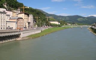
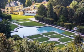
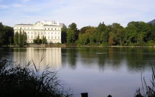
Add-On: Combine this run with Mönchsberg, just across the river, some of the paths along the Salzach, or the landscaped Schloss Mirabell just to the west.
Kapuzinerberg is the other hill close to Salzburg city center, along with Mönchsberg. A steeper, more rugged run/hike, the 640 meter high hilll lies to the right of the River Salzach and is a popular outdoor recreation spot. It’s home to churches, an abbey, along with meandering hiking paths, and even chamois!
This is a challenging run! Over 1.3 km you’ll climb 200 meters (600 feet), with grades of up to 21%! We’ve mapped a route from the northeastern part of the park, in Doblerweg, along the path for 1.5 km to the summit, and then out to the southwestern part of the park. There are additional wooded paths in the park.
Add-On: Combine this run with Mönchsberg, just across the river, some of the paths along the Salzach, or the landscaped Schloss Mirabell just to the west.


Review or Comment on This Route/Share a Photo!
Share your feedback on this route and see that of other Great Runs users. Click on the image icon to upload a photo. And please let us know if there are notes or changes we should incorporate!