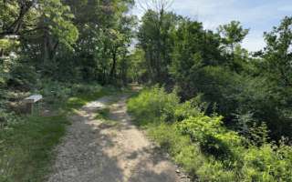
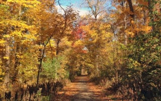
The best bet for a long off-road run in the Sandusky area is the North Shore Inland Trail. It’s a multi-use path that runs about 15 miles north of the lakeshore, for ~21 miles between Fremont and Norwalk. We’ve divided our map of the trail into two sections, starting in Bellevue, which is the closest location to the Sandusky area. Note there’s a ~3 mile break of the trail in Bellevue, with a marked on-road section. Pick a section and run as many miles as you like!
Bellevue to Norwalk. 10.3 miles one-way. This section of the trail is mainly gravel, following an old rail line for 10.3 miles from Bellevue east to Fremont. The trail runs just south of Highway 20 to Monroeville and then just north of it to Norwalk. The terrain is a mix of some open fields and woods.
Bellevue to Fremont. 13.5 miles one-way. The western section of the path picks up just west of Bellevue off Portland Rd. just south of Highway 20. This section is mainly paved, and runs for 13.5 miles west to Fremont, mainly forming a straight line just south of Highway 20. There are fields, woods, and a couple of nice bridge/river crossings. At the western end in Fremont is the Rutherford B. Hayes Presidential Library.

Review or Comment on This Route/Share a Photo!
Share your feedback on this route and see that of other Great Runs users. Click on the image icon to upload a photo. And please let us know if there are notes or changes we should incorporate!