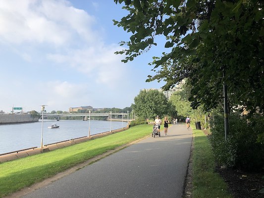
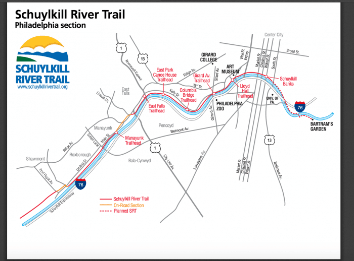
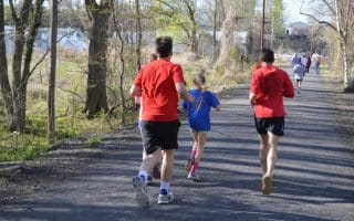
The Schuykill River Trail is a great run and one of the anchors for running in Philadelphia. Overall, this trail runs for 100 miles from Philadelphia to Pottsville. As of 2025, there are 75 miles of completed trail in sections, including about 30 miles in the Philadelphia area, from downtown northwest to Mont Clare, where the Upper Schuykill River Trail continues. There are ongoing plans to close the gaps. This interactive map is a great resource.
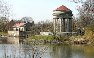
We’ve mapped the 25 miles between downtown Philadelphia and Valley Forge National Park. The heart of the Philadelphia section is the ~8 miles between downtown and Manayunk. There are good river views most of the way, and a festive scene, with rowers in season. Most of the route is on the eastern side, though there are a few sections where the path is on both sides. The downtown section runs from just south of South St., north to the Philadelphia Art Museum (~2 miles), and then into Fairmount Park. A highlight is the 2,000 foot long boardwalk, running parallel to the eastern shore of the river from Locust Street to the new stair tower on the south side of the South St. Bridge. This project provides an important link to the Schuylkill River Trail and Center City from University City and West Philadelphia.
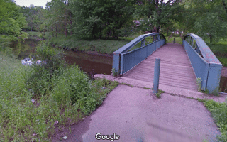
At the 8-mile mark in Manayunk, the Manayunk Bridge Trail is a scenic pedestrian bridge crossing the river and connecting to the Cynwyd Heritage Trail in Bala Cynwyd.
Loop Option: A great 8.2 mile loop option is from the Philadelphia Museum of Art and Falls Rd., using the east side out and the west side for the return. Add with the extensive running options in Fairmount Park.
One-Way Option: A train line runs near the trail as far as Norristown, allowing for great one-way options!
Add-Ons: See the trail map for additional sections north of Valley Forge. It’s mainly a dedicated trail for another 25 miles north to Union Meadows. The northern 50 miles to Pottsville is a mix of on-road sections and dedicated trail, and some gaps in the trail that still need to be completed.
The Schuykill River Trail is a great run and one of the anchors for running in Philadelphia. Overall, this trail runs for 100 miles from Philadelphia to Pottsville. As of 2025, there are 75 miles of completed trail in sections, including about 30 miles in the Philadelphia area, from downtown northwest to Mont Clare, where the Upper Schuykill River Trail continues. There are ongoing plans to close the gaps. This interactive map is a great resource.
We’ve mapped the 25 miles between downtown Philadelphia and Valley Forge National Park. The heart of the Philadelphia section is the ~8 miles between downtown and Manayunk. There are good river views most of the way, and a festive scene, with rowers in season. Most of the route is on the eastern side, though there are a few sections where the path is on both sides. The downtown section runs from just south of South St., north to the Philadelphia Art Museum (~2 miles), and then into Fairmount Park. A highlight is the 2,000 foot long boardwalk, running parallel to the eastern shore of the river from Locust Street to the new stair tower on the south side of the South St. Bridge. This project provides an important link to the Schuylkill River Trail and Center City from University City and West Philadelphia.
At the 8-mile mark in Manayunk, the Manayunk Bridge Trail is a scenic pedestrian bridge crossing the river and connecting to the Cynwyd Heritage Trail in Bala Cynwyd.
Loop Option: A great 8.2 mile loop option is from the Philadelphia Museum of Art and Falls Rd., using the east side out and the west side for the return. Add with the extensive running options in Fairmount Park.
One-Way Option: A train line runs near the trail as far as Norristown, allowing for great one-way options!
Add-Ons: See the trail map for additional sections north of Valley Forge. It’s mainly a dedicated trail for another 25 miles north to Union Meadows. The northern 50 miles to Pottsville is a mix of on-road sections and dedicated trail, and some gaps in the trail that still need to be completed.
Scroll Down For Route Maps
Essentials
Our route is 8.2 miles (13 km) from Museum of Art to Falls Br. and return on west side. Or, distance of youir choice!
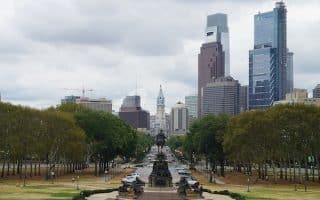
A 10k 'runseeing' tour of Philadelphia's scenic, cultural, and historic highlights in the heart of downtown, west of Broad St: Avenue of the Arts, Schuylkill River, Fairmount Park, and more, starting from City Hall. Good add-on options. Includes the Rocky Steps & Statue!
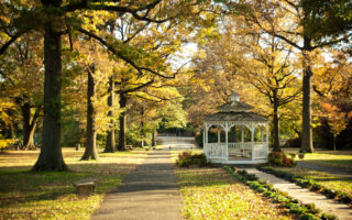
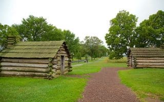
One of the largest urban green spaces in the country. Many options, including paved multi-use trails, an Arboretum, trail running options, and a famous cross-country course.
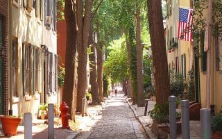
See Old Philadelphia's important visitor sights and museums and run the area's historic streets on this 5k 'runseeing' tour. Includes the historic Society Hill neighborhood. For a longer run, add the Delaware River paths.
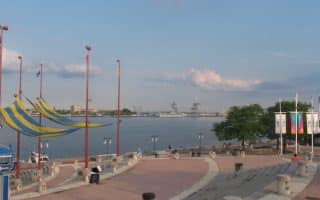
Two states, the Ben Franklin Bridge, Delaware river paths, and tons of history -- all in one run! We've mapped routes incorporating 2.5 miles of waterfront paths on the Philly side & 1 mile in Camden on the NJ side. Run over the Bridge, 1.5 miles each way.
Just across from Philadelphia Old City, Camden NJ has some nice running options. There's 1 mile along the Delaware River (part of our 'two-state run"), and several miles of mutli-use paths along the Cooper River, with some nice loop options.
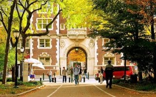
Very pretty campus for running. Tree-lined pedestrian paths graced by buildings boasting a range of architectural styles. One can put together a 3-4 mile route incorporating Locust Walk, Woodland Walk, and other sections.
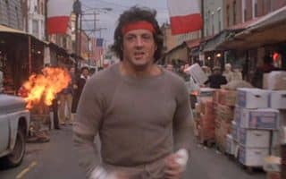
It’s impossible to replicate the actual “Rocky Run”, but here’s the route the organizers of the annual Rocky Run Road Race use to replicate the ‘iconic’ parts of this ‘iconic’ run.
Olmsted-designed FDR Park has numerous trails, a golf course, and other recreational options. A lap of the park is about 3 miles. Includes a tour of Philadelphia Navy Yard, for views of the boats and some of the ‘grittier’ side of Philadelphia.
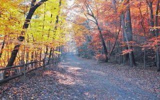
An 1,800 acre park north of Fairmount Park in the northwest section of Philadelphia. 50+ miles of trails, many of them wooded. The flat run along ‘Forbidden Drive’ (a road closed to cars) parallels a creek.
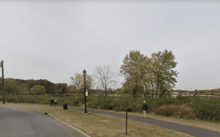
Long linear park path in eastern Philadeplphia follows Pennypack Creek through historic Pennypack Park -- a former gristmill -- for 9 miles. Mainly wooded, with some creek views. An upper section continues for another 7 miles to the Bristol County line.
Share your feedback on this route and see that of other Great Runs users. Click on the image icon to upload a photo. And please let us know if there are notes or changes we should incorporate!
Subscribe
0 Comments
Oldest
Newest
Inline Feedbacks
View all comments
Essentials
Our route is 8.2 miles (13 km) from Museum of Art to Falls Br. and return on west side. Or, distance of youir choice!


Review or Comment on This Route/Share a Photo!
Share your feedback on this route and see that of other Great Runs users. Click on the image icon to upload a photo. And please let us know if there are notes or changes we should incorporate!