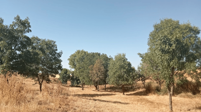
Just outside of Segovia, there’s a large network of quiet roads and trails that make for some scenic running. The terrain is fairly open and exposed, as the area is quite dry. Some of these roads/trails are in designated ‘hiking’ areas you’ll see on the map, but range from easy to moderate trail running. A few specific suggestions:
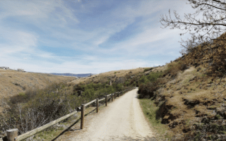
Vias Verdes del Eresmo Tramo. This is a long-distance trail that runs for some 70 km between Segovia and Olmedo. The wide path has good footing and is the best opportunity in Segovia for a long, easy-to-follow off-road run. It’s open, scenic, and dry terrain. We’ve mapped 48 km to Nava de la Asunción. In Segovia, it starts as the the Camino Natural Vía Verde Valle del Eresma hiking area, off Carr. de Villacastín. Some parts are along the Eresmo River, and some sections are alongside a train track. The first 10 km of the path are a steady downhill, losing 200m.
Fuente del Pájaro Hiking Area. This is a large area of quiet roads and trails north of Segovia and west of the CL-607 road. Even though this is a designated ‘hiking’ area, these are generally wide dirt roads, through open, dry, grassland type terrain. Create your own route and rack up some miles! Rolling hills.
Just outside of Segovia, there’s a large network of quiet roads and trails that make for some scenic running. The terrain is fairly open and exposed, as the area is quite dry. Some of these roads/trails are in designated ‘hiking’ areas you’ll see on the map, but range from easy to moderate trail running. A few specific suggestions:
Vias Verdes del Eresmo Tramo. This is a long-distance trail that runs for some 70 km between Segovia and Olmedo. The wide path has good footing and is the best opportunity in Segovia for a long, easy-to-follow off-road run. It’s open, scenic, and dry terrain. We’ve mapped 48 km to Nava de la Asunción. In Segovia, it starts as the the Camino Natural Vía Verde Valle del Eresma hiking area, off Carr. de Villacastín. Some parts are along the Eresmo River, and some sections are alongside a train track. The first 10 km of the path are a steady downhill, losing 200m.
Fuente del Pájaro Hiking Area. This is a large area of quiet roads and trails north of Segovia and west of the CL-607 road. Even though this is a designated ‘hiking’ area, these are generally wide dirt roads, through open, dry, grassland type terrain. Create your own route and rack up some miles! Rolling hills.


Review or Comment on This Route/Share a Photo!
Share your feedback on this route and see that of other Great Runs users. Click on the image icon to upload a photo. And please let us know if there are notes or changes we should incorporate!