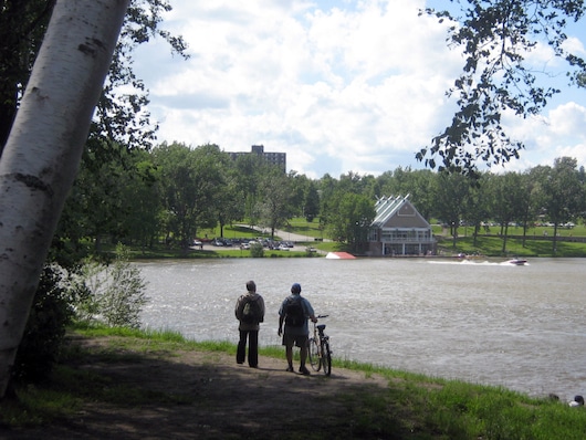
The paths along the Magog and Saint-François rivers are at the heart of running in Sherbrooke, and can be combined in various ways. This loop of up to 13 km on Axe [Trail] de La Magog features multi-use paths along both sides of the Magog River, as well as Lac des Nations. The terrain is a combination of wooded sections and some water views.
Start at Rue Belvédère at the Gorge de Magog, and head east along the north side of the river. Great views of the Lac des Nations on a wide, paved, path (lit at night!). It’s 2 km to Parc Jacques-Cartier, 3.3 km to Parc 4 Pins, and 5.5 km to Boisé de la Sauvagine. Cross to the south side at Highway 410 (pedestrian path), and return on the south side. There’s a 1 km section on road, before reaching Boisé/Park Lucien-Blanchard. Nearly the entire south side is a path passing through a series of parks. Cross back over using the pedestrian bridge at Lac des Nations.
Options/Add-Ons: For a shorter loop, it’s 3.5 km around Lac des Nations. Can also combine with the Saint-François river paths. Use Rue Terrill to cross over.

Review or Comment on This Route/Share a Photo!
Share your feedback on this route and see that of other Great Runs users. Click on the image icon to upload a photo. And please let us know if there are notes or changes we should incorporate!