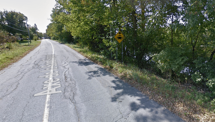
The paths along the Magog and Saint-François rivers are at the heart of running in Sherbrooke, and can be combined in various ways. This route showcases the ~9 km path along the north side of the Saint-François River. Most of the path will be labeled Route Verte or Axe. de la Saint-François.
A central starting spot is Parc de la Saint-François at the Grand Forks (Fourches). From there, it’s ~4.5 km east to St. Francis St., near Île-Marie, part of it on dedicated path, part on sidewalk along Rue Saint-François. You can also head west for 4.5 km, from Parc du Mena’sen to Parc Jeffrey-Gingras. This section is mainly on a dedicated path. There are some river views, though in many spots trees block the view.
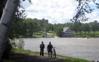
Options/Add-Ons: Can be combined with the Magog River/Lac des Nations paths.
The paths along the Magog and Saint-François rivers are at the heart of running in Sherbrooke, and can be combined in various ways. This route showcases the ~9 km path along the north side of the Saint-François River. Most of the path will be labeled Route Verte or Axe. de la Saint-François.
A central starting spot is Parc de la Saint-François at the Grand Forks (Fourches). From there, it’s ~4.5 km east to St. Francis St., near Île-Marie, part of it on dedicated path, part on sidewalk along Rue Saint-François. You can also head west for 4.5 km, from Parc du Mena’sen to Parc Jeffrey-Gingras. This section is mainly on a dedicated path. There are some river views, though in many spots trees block the view.
Options/Add-Ons: Can be combined with the Magog River/Lac des Nations paths.

Review or Comment on This Route/Share a Photo!
Share your feedback on this route and see that of other Great Runs users. Click on the image icon to upload a photo. And please let us know if there are notes or changes we should incorporate!