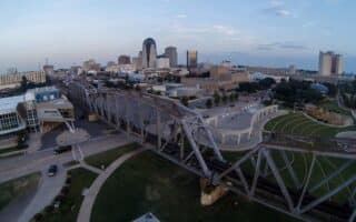
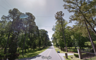
The mighty Red River is at the heart of the running scene in Shreveport. There are two long, paved pedestrian pathways lining the waterfront: The Clyde Fant Memorial Parkway path on the west (Shreveport) side, and the Arthur Ray Teague Parkway path on the east (Bossier City) side. Either path makes a pleasant out and back along the water, or runners can cross over the Long-Allen Bridge (Rt. 79) or Westgate Dr. bridge to connect the two walkways.
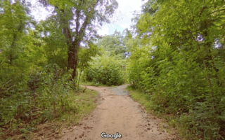
The Clyde Fant Memorial Parkway spans from the Downtown Waterfront near the Aquarium all the way south to the Charles and Marie Hamel Memorial Park. It’s about 5.5 miles one way, but there are plenty of alternate paths (through Hamel Park, Preston Avenue Park, and Veterans Park) to keep the route fresh. There is also some dirt singletrack south of the Stoner Avenue Boat Launch, but the area has suffered significant flood damage.
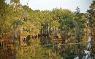
The Arthur Ray Teague Parkway follows a similar trajectory of 4.5 miles, from Diamondjacks Boulevard in the north to the CenturyLink Center in the south. Another 1.5 mile extension reaches south into the Red River National Wildlife Refuge.
The mighty Red River is at the heart of the running scene in Shreveport. There are two long, paved pedestrian pathways lining the waterfront: The Clyde Fant Memorial Parkway path on the west (Shreveport) side, and the Arthur Ray Teague Parkway path on the east (Bossier City) side. Either path makes a pleasant out and back along the water, or runners can cross over the Long-Allen Bridge (Rt. 79) or Westgate Dr. bridge to connect the two walkways.
The Clyde Fant Memorial Parkway spans from the Downtown Waterfront near the Aquarium all the way south to the Charles and Marie Hamel Memorial Park. It’s about 5.5 miles one way, but there are plenty of alternate paths (through Hamel Park, Preston Avenue Park, and Veterans Park) to keep the route fresh. There is also some dirt singletrack south of the Stoner Avenue Boat Launch, but the area has suffered significant flood damage.
The Arthur Ray Teague Parkway follows a similar trajectory of 4.5 miles, from Diamondjacks Boulevard in the north to the CenturyLink Center in the south. Another 1.5 mile extension reaches south into the Red River National Wildlife Refuge.

Review or Comment on This Route/Share a Photo!
Share your feedback on this route and see that of other Great Runs users. Click on the image icon to upload a photo. And please let us know if there are notes or changes we should incorporate!