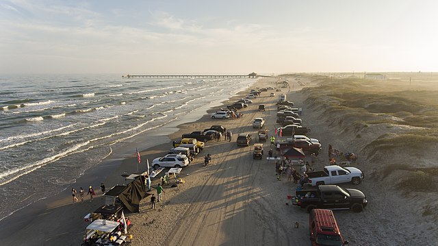
South Padre Island is a resort town on a barrier island, located 25 miles east of Brownsville. It’s popular for its miles of beaches and warm, calm waters. The best places to run on South Padre Island are on the 10+ miles of beach. Note:The Queen Isabella Causeway to South Padre Island is not runnable.
Google Street View
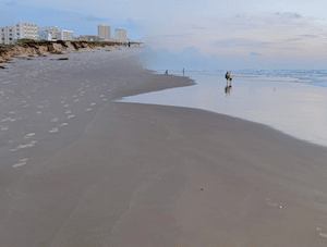
Beach Running. There are 10+ miles of runnable beach. The sand can be firm and compact near the water, though situational and tidally dependent. It’s 9 miles from Isla Blanca Beach at the southern end of the island to Beach Access 6. The beach continues for another 3 miles north of there, becoming more rugged.
Isla Blanca Area. Put together a run here on the bike path that runs along the Channel View Loop. It’s ~1.5 miles. Can add with a section of Isla Blanca Beach. If you’re intrepid, “run” out the fishing jetty at the extreme south end, on the large rocks (can be slippery!).
Road Running. Gulf Blvd. runs for 3 miles north along the island. It has a sidewalk and a protected bike lane, so it’s a decent spot for a road run. It’s a busy road and won’t win any awards for scenery, since buildings block beach/water views most of the way. If you like, start at the Largest Outdoor Sandcastle In The USA, which is 0.5 miles south of Gulf Blvd. Padre Blvd. has a sidewalk. You can also run on the quieter, sidewalked east-west residential side streets off Gulf Blvd.
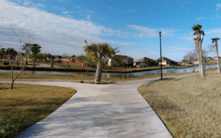
Laguna Madre Nature Trail. Located 1 mile north of the northern end of Gulf Blvd., there’s ~1 mile of scenic running on this nature trail on the bay side off Padre Blvd. Can be combined with some running on the bay side beach (sand conditions situational).
South Padre Island is a resort town on a barrier island, located 25 miles east of Brownsville. It’s popular for its miles of beaches and warm, calm waters. The best places to run on South Padre Island are on the 10+ miles of beach. Note:The Queen Isabella Causeway to South Padre Island is not runnable.
Google Street View
Beach Running. There are 10+ miles of runnable beach. The sand can be firm and compact near the water, though situational and tidally dependent. It’s 9 miles from Isla Blanca Beach at the southern end of the island to Beach Access 6. The beach continues for another 3 miles north of there, becoming more rugged.
Isla Blanca Area. Put together a run here on the bike path that runs along the Channel View Loop. It’s ~1.5 miles. Can add with a section of Isla Blanca Beach. If you’re intrepid, “run” out the fishing jetty at the extreme south end, on the large rocks (can be slippery!).
Road Running. Gulf Blvd. runs for 3 miles north along the island. It has a sidewalk and a protected bike lane, so it’s a decent spot for a road run. It’s a busy road and won’t win any awards for scenery, since buildings block beach/water views most of the way. If you like, start at the Largest Outdoor Sandcastle In The USA, which is 0.5 miles south of Gulf Blvd. Padre Blvd. has a sidewalk. You can also run on the quieter, sidewalked east-west residential side streets off Gulf Blvd.
Laguna Madre Nature Trail. Located 1 mile north of the northern end of Gulf Blvd., there’s ~1 mile of scenic running on this nature trail on the bay side off Padre Blvd. Can be combined with some running on the bay side beach (sand conditions situational).
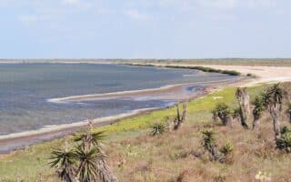
Very scenic spot in this wildlife refuge 30 miles from Brownsviile. 70 miles of trails through wetlands, tidal flats, desert & prairie habitats. Also some good roads for running. See brochure for guidelines about wildlife & seasonal closures.
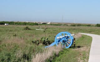
Run 1.5 miles of paved paths in Palo Alto Battlefield National Historical Park, site of the first major battle of the U.S.-Mexican War. From the park, access the Battlefield Trail, an 8-mile multi-use path that runs between the Park and Brownsville's cultural district.
The Event Center Running Trail is the other principal off-road path in Brownsville. The trail runs along a small river through sort of a linear park in one of the city's more upscale neighborhoods. Up to 6.5 miles. Also connects with the Brownsville Historic Battlefield Trail.
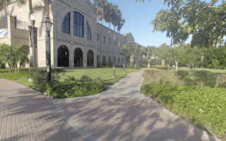
A good way to see a good number of Brownsville's highlights. Most scenic sections are ~1.5 miles along the Belden West Trail to Riverside Park, and the ~2 mile loop around the campuses of the adjoining Texas Southmost College and UTRGV University.
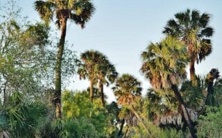
An oasis of green and a popular birding area, located in south Brownsville on the Rio Grande near the Mexican border. The 557-acre Sanctuary, run by Audubon, is home to many native species of plants and animals. 3 miles of nature trails -- OK to run if you tread lightly.
Share your feedback on this route and see that of other Great Runs users. Click on the image icon to upload a photo. And please let us know if there are notes or changes we should incorporate!
Review or Comment on This Route/Share a Photo!
Share your feedback on this route and see that of other Great Runs users. Click on the image icon to upload a photo. And please let us know if there are notes or changes we should incorporate!