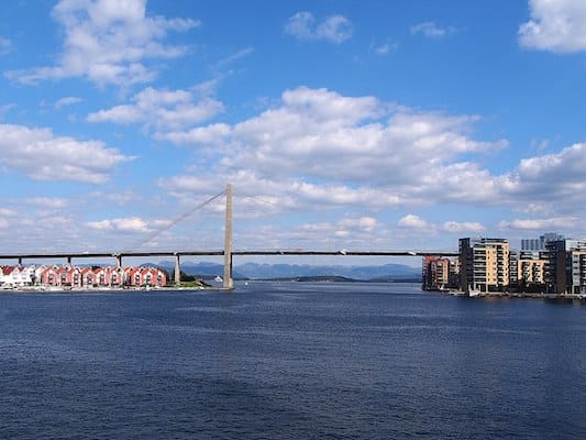
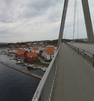
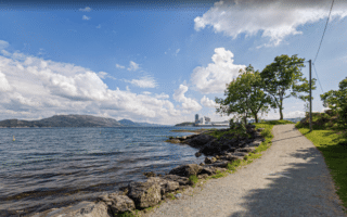
If you fancy a dramatic crossing on a pedestrian-friendly bridge, this is the run for you! The Stavanger City Bridge (Stavanger bybru) connects Stavanger with Sølyst and Buøy, and features a wide, dedicated multi-use path. It’s quite high — not for those with vertigo. The bridge access is from the west side of Johannesparken. The crossing is ~1 km, and features some great water views. Retrace your steps, and then enjoy 1.2 km along the waterfront path, passing underneath the bridge, returning to Johannesparken.
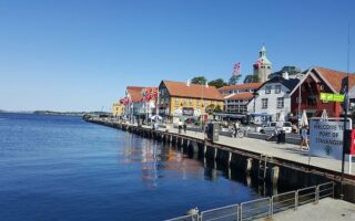
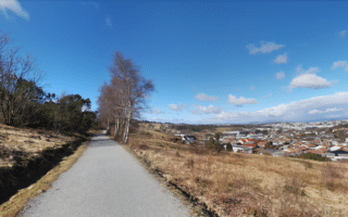
Longer Run: This route is only 3.7 km, so you might want to combine it with our Stavanger Center/waterfront route. From Johannesparken, use Pedersgata headed west for ~1 km into the largely pedestrianized historic centre.
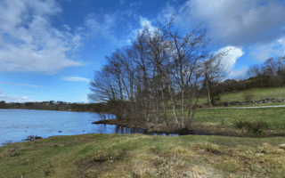
Bridge path. Google Street View
If you fancy a dramatic crossing on a pedestrian-friendly bridge, this is the run for you! The Stavanger City Bridge (Stavanger bybru) connects Stavanger with Sølyst and Buøy, and features a wide, dedicated multi-use path. It’s quite high — not for those with vertigo. The bridge access is from the west side of Johannesparken. The crossing is ~1 km, and features some great water views. Retrace your steps, and then enjoy 1.2 km along the waterfront path, passing underneath the bridge, returning to Johannesparken.
Longer Run: This route is only 3.7 km, so you might want to combine it with our Stavanger Center/waterfront route. From Johannesparken, use Pedersgata headed west for ~1 km into the largely pedestrianized historic centre.
A 5-6 km tour of the historic center of Stavanger, paths along the water, a loop around a small lake in Byparken, and great views from the hilltop Valberg Tower.
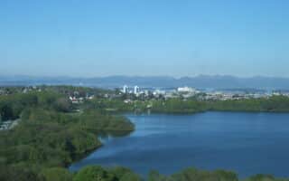
A pleasant loop around Mosvatnet Lake, with the option to add some paths in adjacent Vålandsparken. All on wide gravel paths. Combination of open & wooded, with some water views.
A popular running spot in western Stavanger. Paths on both sides of the lake, with some lovely water views. Full lake loop is 8.6 km. Can combine with linear park paths headed south of the lake.
A lovely series of waterfront paths around a series of small harbors and marinas, including Golden Strand Beach. Lovely views and scenic running. It's a 7.2 km out and back. Combine with a dip in the Strømvik public pool!
The largest contiguous green space in Stavanger is a good spot for an easy to moderate trail run. 8 km of trails over 370 acres. Mostly wooded and fairly hilly. Great views from the Ullandhaugstårnet Tower!
Two nice routes on Hundvåg, an island located 6 km north of Stavanger. The east end route combines waterfront paths with interior paths through farmland. The northern route is on paths around the northern tip. Can be combined with a 1 km road connection.
Share your feedback on this route and see that of other Great Runs users. Click on the image icon to upload a photo. And please let us know if there are notes or changes we should incorporate!

Review or Comment on This Route/Share a Photo!
Share your feedback on this route and see that of other Great Runs users. Click on the image icon to upload a photo. And please let us know if there are notes or changes we should incorporate!