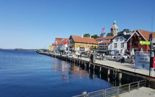
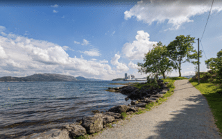
Hundvåg is an island 6 km north of Stavanger, connected by an easy to drive bridge or quick bus. There’s some nice waterfront running on the east and north ends of the island.
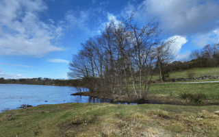
East End Run from Klampen. A series of waterfront paths and roads runs from the Klampen hiking north for 1.5 km. There are some nice views of the water along here. Just past the Poseideon school, take Hundvåg Ring Rd. briefly, to connect to a gravel path that cuts west through the interior of the island for 1.5 km. This is pretty running through open farmland type terrain. Retrace your steps, and add on with a quick jaunt over the bridge to Bjørnøy Island. It’s a scenic bridge for running across, with a wide pedestrian path. Total route is 7.4 km.
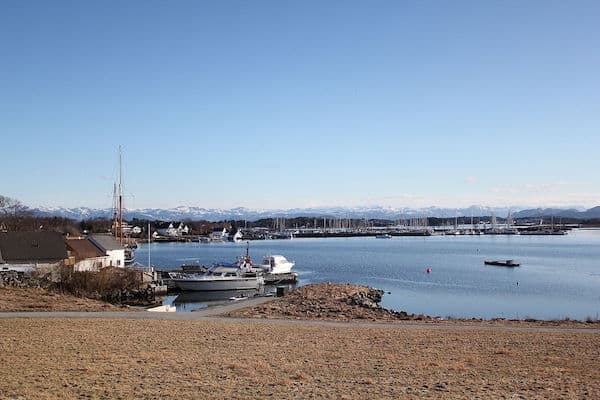
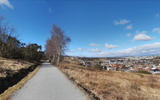
North End Route. This is a scenic 5 km out and back run along gravel paths at the northern end of Hundvåg. Start at the parking at Lundsneset and run on the gravel path through the park, passing the Lundsneset Memorial Park at the northern tip, then around the tip and then heading south along the western side to the Sandvågen marina.
Combining the East & North Routes: The two routes can be combined, using a ~1 km road connection. From Hundvåg Ring Rd., take Lundebakken north, then RIGHT on Bosteberget to the Lundsneset parking area to begin the north end route.
Hundvåg is an island 6 km north of Stavanger, connected by an easy to drive bridge or quick bus. There’s some nice waterfront running on the east and north ends of the island.
East End Run from Klampen. A series of waterfront paths and roads runs from the Klampen hiking north for 1.5 km. There are some nice views of the water along here. Just past the Poseideon school, take Hundvåg Ring Rd. briefly, to connect to a gravel path that cuts west through the interior of the island for 1.5 km. This is pretty running through open farmland type terrain. Retrace your steps, and add on with a quick jaunt over the bridge to Bjørnøy Island. It’s a scenic bridge for running across, with a wide pedestrian path. Total route is 7.4 km.
North End Route. This is a scenic 5 km out and back run along gravel paths at the northern end of Hundvåg. Start at the parking at Lundsneset and run on the gravel path through the park, passing the Lundsneset Memorial Park at the northern tip, then around the tip and then heading south along the western side to the Sandvågen marina.
Combining the East & North Routes: The two routes can be combined, using a ~1 km road connection. From Hundvåg Ring Rd., take Lundebakken north, then RIGHT on Bosteberget to the Lundsneset parking area to begin the north end route.


Review or Comment on This Route/Share a Photo!
Share your feedback on this route and see that of other Great Runs users. Click on the image icon to upload a photo. And please let us know if there are notes or changes we should incorporate!