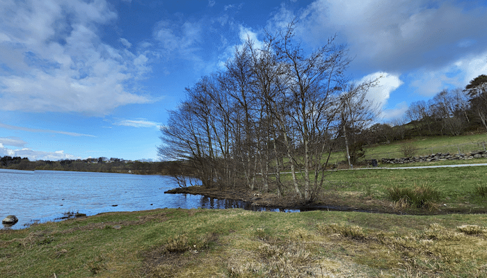
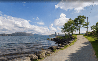
In the western part of Stavanger, Stokkavannet Lake is a scenic spot and a popular recreation area. It’s also a great place for a run, with a mix of paved & gravel paths on both sides of the lake. It’s a combination of wooded & open, with some lovely lake views. Choose a section or do the full 8.6 km loop!
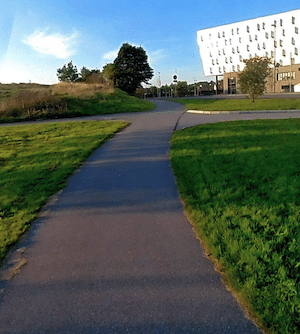
Linear Park Path. Google Street View
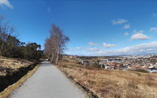
For an add-on or combination, there’s a nice series of paths passing through several parks headed south of the lake. It’s up to 2.4 km one-way. The terrain is fairly open. Note it’s a gradual climb headed south. The full route combining the two is 13.4 km.
In the western part of Stavanger, Stokkavannet Lake is a scenic spot and a popular recreation area. It’s also a great place for a run, with a mix of paved & gravel paths on both sides of the lake. It’s a combination of wooded & open, with some lovely lake views. Choose a section or do the full 8.6 km loop!
Linear Park Path. Google Street View
For an add-on or combination, there’s a nice series of paths passing through several parks headed south of the lake. It’s up to 2.4 km one-way. The terrain is fairly open. Note it’s a gradual climb headed south. The full route combining the two is 13.4 km.
Scroll Down For Route Maps
Essentials
Lake Loop: 8.6 km (5.3 miles); Park paths south of lake are up to 2.4 km (1.5 miles) one-way
Lake Loop is 46m (153 feet); Park path is 70m (229 feet) one-way
South end of Stokkavannet Lake
Parking lot at southern end of lake, off Ragbakken
A 5-6 km tour of the historic center of Stavanger, paths along the water, a loop around a small lake in Byparken, and great views from the hilltop Valberg Tower.
A dramatic run over the 1 km Stavanger City Bridge on a wide multi-use path. Great views of the water & surrounding geography. Then, enjoy 1.2 km along the eastern waterfront. Combine with our Stavanger Centre route for a longer run.
A pleasant loop around Mosvatnet Lake, with the option to add some paths in adjacent Vålandsparken. All on wide gravel paths. Combination of open & wooded, with some water views.
A lovely series of waterfront paths around a series of small harbors and marinas, including Golden Strand Beach. Lovely views and scenic running. It's a 7.2 km out and back. Combine with a dip in the Strømvik public pool!
The largest contiguous green space in Stavanger is a good spot for an easy to moderate trail run. 8 km of trails over 370 acres. Mostly wooded and fairly hilly. Great views from the Ullandhaugstårnet Tower!
Two nice routes on Hundvåg, an island located 6 km north of Stavanger. The east end route combines waterfront paths with interior paths through farmland. The northern route is on paths around the northern tip. Can be combined with a 1 km road connection.
Share your feedback on this route and see that of other Great Runs users. Click on the image icon to upload a photo. And please let us know if there are notes or changes we should incorporate!
Subscribe
0 Comments
Oldest
Newest
Inline Feedbacks
View all comments
Essentials
Lake Loop: 8.6 km (5.3 miles); Park paths south of lake are up to 2.4 km (1.5 miles) one-way
Lake Loop is 46m (153 feet); Park path is 70m (229 feet) one-way
South end of Stokkavannet Lake
Parking lot at southern end of lake, off Ragbakken


Review or Comment on This Route/Share a Photo!
Share your feedback on this route and see that of other Great Runs users. Click on the image icon to upload a photo. And please let us know if there are notes or changes we should incorporate!