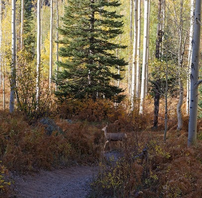
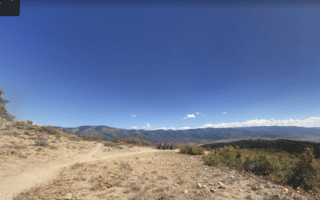
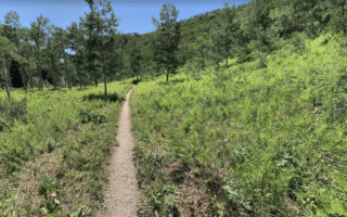
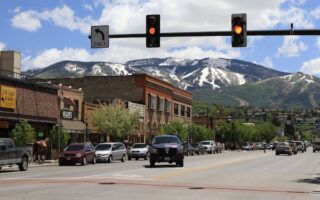
For some climbing on a fairly easy surface, the Spring Creek Trail is a good bet. The trail is popular for running, hiking, and cycling in Steamboat Springs. Overall, the trail is nearly 6 miles if accessed from downtown. The upper 3 miles are more rugged. The rolling uphill trail passes through a a combination of woods and open terrain, crosses 15 bridges over beautiful bubbling Spring Creek as it heads north through the Routt National Forest. Overall, the full trail involves 1,500 of climbing. After the first two miles, the trail can be narrow. NOTE: the 3.6 ‘Upper Trail’ segment is closed November 15-May 15. Pro Tip: Post-run dip in the hot springs!
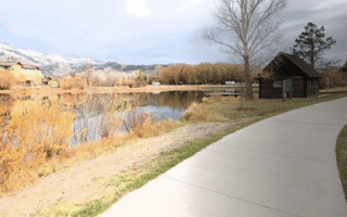
We’ve mapped a 5.7 mile out and back from downtown to the end of Spring Creek Rd. Starting at Old Town Hot Springs off Fish Creek Rd., head north for 0.6 miles, where you’ll find the official trail head. Continue for another 2 miles, following Spring Creek and Spring Creek Rd. It’s a steady climb. From the end of our mapped route, the trail continues for another 2+ miles, climbing another ~900 feet. Sections here are more rugged.
Add-Ons: There’s a running track at Steamboat Springs High School, which is off a short spur at the 0.3 mile mark of the trail. You can access the Yampa River Core Trail from the south end of the Old Town Hot Springs, or off 5th St. downtown. There’s also the 0.6 mile Butcher Knife Canyon Trail, which heads toward Steamboat Springs Middle School from Stanley Park.
For some climbing on a fairly easy surface, the Spring Creek Trail is a good bet. The trail is popular for running, hiking, and cycling in Steamboat Springs. Overall, the trail is nearly 6 miles if accessed from downtown. The upper 3 miles are more rugged. The rolling uphill trail passes through a a combination of woods and open terrain, crosses 15 bridges over beautiful bubbling Spring Creek as it heads north through the Routt National Forest. Overall, the full trail involves 1,500 of climbing. After the first two miles, the trail can be narrow. NOTE: the 3.6 ‘Upper Trail’ segment is closed November 15-May 15. Pro Tip: Post-run dip in the hot springs!
We’ve mapped a 5.7 mile out and back from downtown to the end of Spring Creek Rd. Starting at Old Town Hot Springs off Fish Creek Rd., head north for 0.6 miles, where you’ll find the official trail head. Continue for another 2 miles, following Spring Creek and Spring Creek Rd. It’s a steady climb. From the end of our mapped route, the trail continues for another 2+ miles, climbing another ~900 feet. Sections here are more rugged.
Add-Ons: There’s a running track at Steamboat Springs High School, which is off a short spur at the 0.3 mile mark of the trail. You can access the Yampa River Core Trail from the south end of the Old Town Hot Springs, or off 5th St. downtown. There’s also the 0.6 mile Butcher Knife Canyon Trail, which heads toward Steamboat Springs Middle School from Stanley Park.

Review or Comment on This Route/Share a Photo!
Share your feedback on this route and see that of other Great Runs users. Click on the image icon to upload a photo. And please let us know if there are notes or changes we should incorporate!