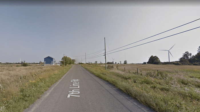
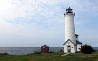
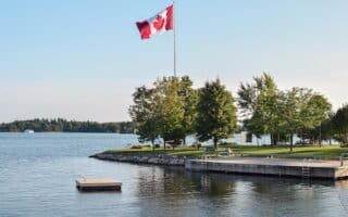
If you fancy some languid, flat, open running on nearly traffic-free farm roads, head to Wolfe Island. This island, officially located in Ontario and connected to Cape Vincent (NY) on the south end and Kingston (ON) by ferries, the island is mainly crisscrossed by a series of roads passing by farms. Only the main road (Rt. 95) is paved. The south end of Wolfe Island is Point Alexandria, and is connected to Cape Vincent via a 10-minute ferry ($5 for passenger only, $25 for vehicle). The north end at Dawson Point/Marysville connects to Kingston via a 20-minute ferry (free!). REMEMBER YOUR PASSPORT!!FERRY INFO
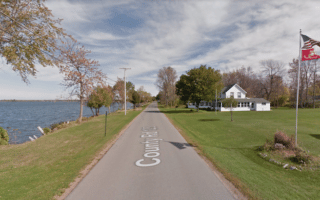
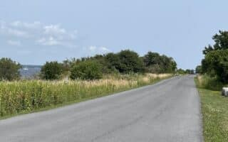
Once on Wolfe Island, create your own route. The main road, Rt. 95, is nearly 7 miles (11 km) north-south. The other north-south roads are 2nd Line to 9th Line, from east to west, and are 4-6 miles in length. The main east-west roads are State Line Rd. and Reeds Bay Rd. and are 5-6 miles in length. All are dirt surface.
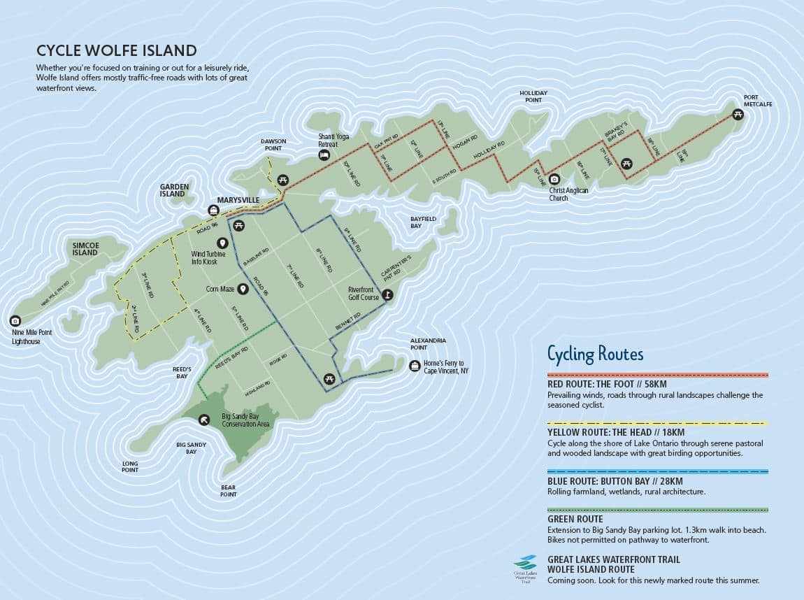
You can also follow parts of some of the cycling routes on the island.
If you fancy some languid, flat, open running on nearly traffic-free farm roads, head to Wolfe Island. This island, officially located in Ontario and connected to Cape Vincent (NY) on the south end and Kingston (ON) by ferries, the island is mainly crisscrossed by a series of roads passing by farms. Only the main road (Rt. 95) is paved. The south end of Wolfe Island is Point Alexandria, and is connected to Cape Vincent via a 10-minute ferry ($5 for passenger only, $25 for vehicle). The north end at Dawson Point/Marysville connects to Kingston via a 20-minute ferry (free!). REMEMBER YOUR PASSPORT!!FERRY INFO
Once on Wolfe Island, create your own route. The main road, Rt. 95, is nearly 7 miles (11 km) north-south. The other north-south roads are 2nd Line to 9th Line, from east to west, and are 4-6 miles in length. The main east-west roads are State Line Rd. and Reeds Bay Rd. and are 5-6 miles in length. All are dirt surface.
You can also follow parts of some of the cycling routes on the island.
Scroll Down For Route Maps
Essentials
Create your own route. Roads are 5-7 miles (8-11 km) north-south and 5-6 miles east-west
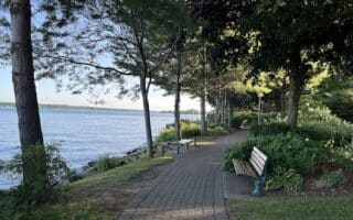
Surrounded on three sides by the St. Lawrence River, Wellesley Island is one of the largest of the Thousand Islands. Lovely running in historic Thousand Island Park and some nice waterfront roads.
Nice running options in Clayton: Waterfront & attractive residential streets; Zenda Farms Preserve, which has lovely trails around pastureland & grassland; and the longer Rivergate Trestle Trail.
This cute town on the St. Lawrence River offers some nice waterfront running. Up to 6.8 miles out and back, with great river views. Interior farm roads a good add-on. Also the location of the Hope Ferry to Wolfe Island.
The 6.7 mile loop around Point Salubrious is a lovely, flat run with great views of Guffin Bay and Chaumont Bay. The entire route is on the lightly trafficked Rt. 125. Water views, the Point Salubrious Historic District, farm fields.
A worth-it drive to Sackets Harbor to do a scenic run combining a nice waterfront road and trails around a historic battlefield, the site of an important battle in the War of 1812.
This 1,000-acre state park in Henderson is the former estate of Robert Wehle, and consists of 10 miles of wide, scenic trails along Lake Ontario, and around the estate grounds. We've mapped a 4.7 mile loop along the Snakefoot Trail.
Gananoque is the western gateway to the Thousand Islands area in Ontario. There's some nice running along the water, around pretty residential streets, and a 12 km trail system, with various loop options.
The 37 km paved multi-use trail along the Thousand Islands Parkway is a great running option in Thousand Islands NP. Some sections feature great water views. Also trail running at Landon Bay and Jones Creek Trails.
A nice run in this small city on the St. Lawrence River, considered the eastern gateway to the Thousand Islands area in Ontario. Combines waterfront paths, small parks, and the Brock Trail. Includes the unique railroad tunnel trail!
A great run on the Ontario side of the Thousand Islands. The Waterfront Trail runs for 9.4 km from Upper Canada Village to Ingleside, and the famous Long Sault Parkway features a wide shoulder and scenic views as it crosses 11 islands.
Share your feedback on this route and see that of other Great Runs users. Click on the image icon to upload a photo. And please let us know if there are notes or changes we should incorporate!
Subscribe
1 Comment
Oldest
Newest
Inline Feedbacks
View all comments
Essentials
Create your own route. Roads are 5-7 miles (8-11 km) north-south and 5-6 miles east-west

Review or Comment on This Route/Share a Photo!
Share your feedback on this route and see that of other Great Runs users. Click on the image icon to upload a photo. And please let us know if there are notes or changes we should incorporate!