The Toronto suburb of Etobicoke stretches from the waterfront north to Pearson International Airport. The area is home to many corporate offices, hotels, and residential neighborhoods, and a number of excellent running spots. The best places to run in Etobicoke are along the several ‘linear park’ trails, plus some good waterfront spots.
STAY: Best area to stay near the airport with access to the Etobicoke Creek Trail and Centennial Park is right near Centennial Park off Eglinton Ave W.
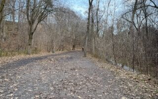
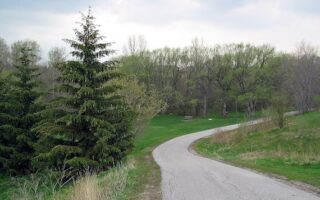
Etobicoke Creek Trail. This 11 km trail straddling the Etobicoke/Mississauga border runs between Pearson Airport and Fleetwood Park. The ~6 km section near the airport to the Highway 401 is a bit industrial. The more attractive section of the trail is south of the 401, through Centennial Park and other parks for another 4 km, ending at Fleetwood Park. STAY: Hotels off Dixie Blvd., north of Highway 401. TRAIL MAP. ROUTE MAP
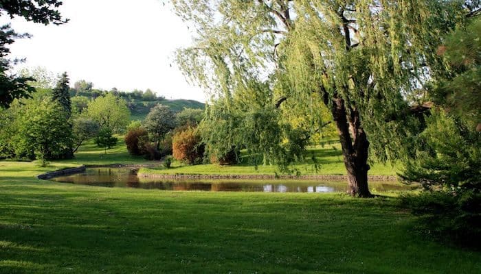
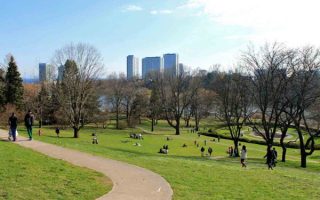
Centennial Park. Originally a dairy farm, it was opened as a park in 1967 to commemorate Canada’s 100th anniversary. Recently one of the main venues for the 2015 Pan Am Games. The park also has a number of playgrounds, sport fields, baseball and softball diamonds, picnic areas, and a small ski hill built on top of a former dump! There are many km of trails in the park, and even some spots to do some hills! Connect to the Etobicoke Creek Trail at southern end of the park at Centennial Park Blvd. STAY: Hotels off Eglinton Ave. West near Centennial Park Blvd.
West Deane Park Linear Path. About 4 km miles south of the Toronto Congress Center, a linear path connects several parks, with West Dean Park as the connector. From Eglinton Ave./Martin Grove Rd., it’s 4.5 km one-way, passing through West Dean Park, Hampshire Heights Park, Ravenscrest Park, and Echo Valley Park.
West Humber Trail and Parkland. Pick a section of this 14 km linear park trail that runs along the Humber River for nearly 14 km between Highway 427 and Highway 401. The northern section starts near Pearson Airport at Humberwood Park. It’s 2 km to the Arboretum, and then another 6 km to the West Humber Parkland, where you can enjoy several km in Summerlea Park as well. ROUTE MAP
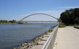
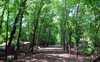
Humber River Recreational Trail. Sort of a continuation of the West Humber Trail, this 9.5 km linear path is another great off-road option in Etobicoke, where you’ll want to choose a section through these grassy, riverside parks. The north end starts at Cruickshank Park, heading south to Baymore Park (2 km), Eglinton Flats (4 km), Scarlett Mills Park (5 km), Lambton Woods (6 km), and Magwood Park (8 km), before ending at Old Mill. ROUTE MAP
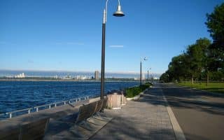
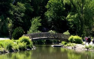
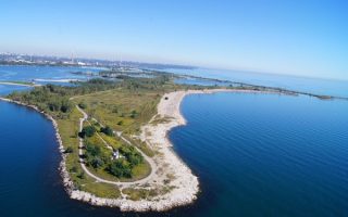
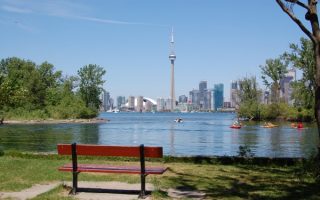
Humber Bay Parks. Two adjoining waterfront parks with wonderful paths, ponds, and birding areas. Etobicoke Point has great views of Lake Ontario and the Toronto skyline. A run of all the trails can be ~10 km. ROUTE MAP
The Toronto suburb of Etobicoke stretches from the waterfront north to Pearson International Airport. The area is home to many corporate offices, hotels, and residential neighborhoods, and a number of excellent running spots. The best places to run in Etobicoke are along the several ‘linear park’ trails, plus some good waterfront spots.
STAY: Best area to stay near the airport with access to the Etobicoke Creek Trail and Centennial Park is right near Centennial Park off Eglinton Ave W.
Etobicoke Creek Trail. This 11 km trail straddling the Etobicoke/Mississauga border runs between Pearson Airport and Fleetwood Park. The ~6 km section near the airport to the Highway 401 is a bit industrial. The more attractive section of the trail is south of the 401, through Centennial Park and other parks for another 4 km, ending at Fleetwood Park. STAY: Hotels off Dixie Blvd., north of Highway 401. TRAIL MAP. ROUTE MAP
Centennial Park. Originally a dairy farm, it was opened as a park in 1967 to commemorate Canada’s 100th anniversary. Recently one of the main venues for the 2015 Pan Am Games. The park also has a number of playgrounds, sport fields, baseball and softball diamonds, picnic areas, and a small ski hill built on top of a former dump! There are many km of trails in the park, and even some spots to do some hills! Connect to the Etobicoke Creek Trail at southern end of the park at Centennial Park Blvd. STAY: Hotels off Eglinton Ave. West near Centennial Park Blvd.
West Deane Park Linear Path. About 4 km miles south of the Toronto Congress Center, a linear path connects several parks, with West Dean Park as the connector. From Eglinton Ave./Martin Grove Rd., it’s 4.5 km one-way, passing through West Dean Park, Hampshire Heights Park, Ravenscrest Park, and Echo Valley Park.
West Humber Trail and Parkland. Pick a section of this 14 km linear park trail that runs along the Humber River for nearly 14 km between Highway 427 and Highway 401. The northern section starts near Pearson Airport at Humberwood Park. It’s 2 km to the Arboretum, and then another 6 km to the West Humber Parkland, where you can enjoy several km in Summerlea Park as well. ROUTE MAP
Humber River Recreational Trail. Sort of a continuation of the West Humber Trail, this 9.5 km linear path is another great off-road option in Etobicoke, where you’ll want to choose a section through these grassy, riverside parks. The north end starts at Cruickshank Park, heading south to Baymore Park (2 km), Eglinton Flats (4 km), Scarlett Mills Park (5 km), Lambton Woods (6 km), and Magwood Park (8 km), before ending at Old Mill. ROUTE MAP
Humber Bay Parks. Two adjoining waterfront parks with wonderful paths, ponds, and birding areas. Etobicoke Point has great views of Lake Ontario and the Toronto skyline. A run of all the trails can be ~10 km. ROUTE MAP


Review or Comment on This Route/Share a Photo!
Share your feedback on this route and see that of other Great Runs users. Click on the image icon to upload a photo. And please let us know if there are notes or changes we should incorporate!