There are some good running options in Richmond Hill, in the south-central York Region. The best places to run in Richmond Hill are:
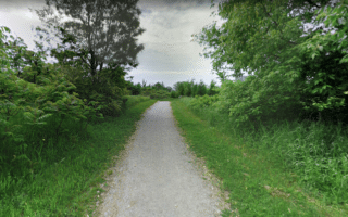
Oak Ridges Trail. Google Street View
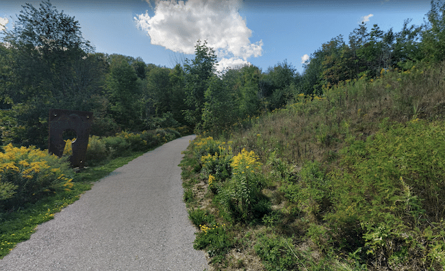
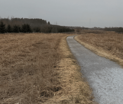
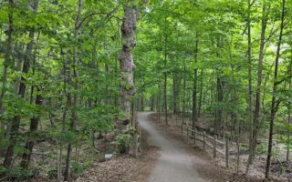
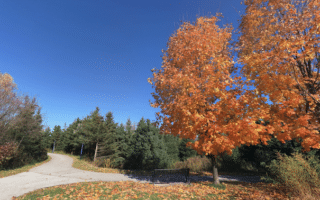
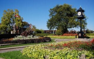
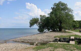
Oak Ridges Trail. Choose a section of this longer distance path. The gravel path is a combination of open and wooded, with some rolling hills. We’ve mapped 8.6 km one-way between Lake Wilcox Park and Jefferson Side Rd. From Lake Wilcox, run south. The first 3.5 km are east of Bayview Ave., in the Oak Ridges Corridor. Cross Bayview, where there’s a nice, open section in the Bond Lake area. Follow the Oak Ridges Trail to Jefferson Ave. You can pick up the Saigeon Trail just south of there, at Meander Park. ROUTE MAP
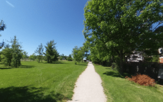
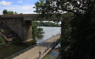
Saigeon Trail & Trans Richmond Trail. In the central part of Richmond Hill, one can put together a run of several km combining these two trails. Starting at Meander Park, pick up the Saigeon Extension Trail and run for 1 km south to Tower Hill Rd. Then pick up the main part of the Saigeon Trail, for 1.5 km to Gamble Rd. Here, there’s a road connection: LEFT on Gamble for 0.2 km, LEFT on Gamble for 0.4 km, connecting to the Trans Richmond Trail — a paved path along a narrow ribbon of green running east-west for 2 km between Yonge and Bathurst. There are some small parks along the way. Combining these two trails is 5.2 km one-way. ROUTE MAP
There are some good running options in Richmond Hill, in the south-central York Region. The best places to run in Richmond Hill are:
Oak Ridges Trail. Google Street View
Oak Ridges Trail. Choose a section of this longer distance path. The gravel path is a combination of open and wooded, with some rolling hills. We’ve mapped 8.6 km one-way between Lake Wilcox Park and Jefferson Side Rd. From Lake Wilcox, run south. The first 3.5 km are east of Bayview Ave., in the Oak Ridges Corridor. Cross Bayview, where there’s a nice, open section in the Bond Lake area. Follow the Oak Ridges Trail to Jefferson Ave. You can pick up the Saigeon Trail just south of there, at Meander Park. ROUTE MAP
Saigeon Trail & Trans Richmond Trail. In the central part of Richmond Hill, one can put together a run of several km combining these two trails. Starting at Meander Park, pick up the Saigeon Extension Trail and run for 1 km south to Tower Hill Rd. Then pick up the main part of the Saigeon Trail, for 1.5 km to Gamble Rd. Here, there’s a road connection: LEFT on Gamble for 0.2 km, LEFT on Gamble for 0.4 km, connecting to the Trans Richmond Trail — a paved path along a narrow ribbon of green running east-west for 2 km between Yonge and Bathurst. There are some small parks along the way. Combining these two trails is 5.2 km one-way. ROUTE MAP
There's a nice selection of trails through parks in Markham: the 2.5 km 'Waterway' trail; trails anchored by Toogood Pond Park; and a longer run along the Rouge River valley for up to 7.5 km between Austin Drive Park and Fairway Vista Park.
Choose a section of the 12.6 km Tom Taylor/Nokiidaa bike trail, a scenic, paved multi-use path that connects several parks in Aurora and Newmarket. Additional paths in the parks and in Optimist Park in central Aurora.
Vaughan is a fast-growing city in the York Municipality. The best place for a run is a path headed south from Routley Park, following a creek and passing several small parks. Can run up to 10 km between Vaughan and North York, where there are additional trails.
Great running options in this city that's the eastern anchor of the GTA. Highlights include the 15 km Waterfront Trail, Oshawa Creek Bike Path, Darlington Provincial Park, and three multi-use paths near downtown.
Some of the nicest waterfront running in the GTA is 11.5 km along Lake Ontario between Pickering and Ajax. Paved multi-use path with some great water views. There's also some nice running on the Trans Canada Trail along Duffins Creek
Some good running in this Toronto bedroom community. Two distinct lakeshore paths centered around Lakefront Promenade Park and Port Credit, a greenbelt starting in Erindale Park, and some pleasant residential neighborhoods for running.
In this GTA city just northwest of Pearson Airport, there's excellent running in three major linear park areas, connected by multi-use paths: Etobicoke Creek Trail, Esker Lake Trail, & Chinguacousy Trail. Plus, good trail running in Heart Lake Conservation Area.
Some nice waterfront running in Oakville, part of GTA's Halton region between Toronto and Oakville. We've mapped three sections of waterfront park paths. Lakeshore Rd. is runnable and can be used as a connector. Lovely parks and water views!
Oakville has a rich collection of parks that are terrific for running. There are several groups of linear park paths that run north-south, through woods and along creeks. The east-west Crosstown Trail and Indian Ridge Trail are good connectors.
The running highlight in this city at the western end of the GTA is the 16 km Waterfront Trail, a paved multi-use path along Burlington Beach and Hamilton Beach, with great water views. The 5.2 km Centennial Trail connects parks & neighborhoods.
Share your feedback on this route and see that of other Great Runs users. Click on the image icon to upload a photo. And please let us know if there are notes or changes we should incorporate!
Review or Comment on This Route/Share a Photo!
Share your feedback on this route and see that of other Great Runs users. Click on the image icon to upload a photo. And please let us know if there are notes or changes we should incorporate!