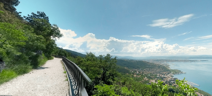
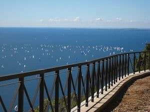
The Napoleonic trail (Strada Vicentina) is the must-do run in Trieste. This old road, now a wide gravel path closed to cars, runs along the hills above Trieste, with fantastic views of the city and the waterfront. It’s a popular place for a stroll or a run. There are numerous marked viewpoints along the way. This 8 km (5 miles) out and back route is mainly downhill headed north and uphill (4-5% grades) headed south
Creative Commons License
Start at the Obelisco monument at the south end of the path. Head north along the Strada Napoleonica path for 4 km, enjoying the views. At the 3 km mark, you’ll see the modern Sanctuary Monte Grisa viewing platform to your right, and pass several observation decks. At 4 km, reach the southern end of the trail. Retrace your steps for the return.
Loop Option for Return: For variety, you can take the Sentiero Niccolò Cobolli – Žlanjiva for the return. To access it from the southern end of the Strada Napoleonica, take Strada Vicentina and then the road to the Monte Grisa parking lot. Join the trail at Monte Grisa. At the northern end, you’ll have to take the SP35 for 1.5 km (busy road but decent shoulder) back to the Obelisco. There are other trail running options in this area.
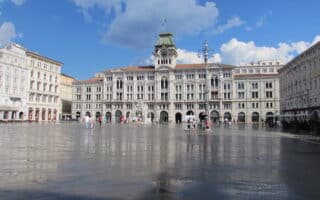
Our 7 km 'runseeing' tour of Trieste hits the major highlights, from the harbor and Canale Grande to the major piazzas and the climb up to the San Giusto Castle and Cathedral.
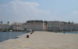
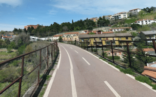
A very nice run around the extensive harbor in Trieste. A series of waterfront paths and marinas connect the New Harbor in the south with the Old Port in the north. Wide boulevards and seafront promenades connect the four piers.
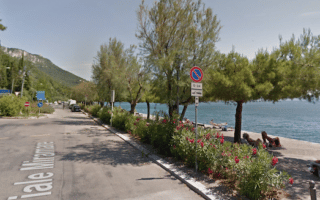
Lovely seafront promenade path from Barcola to Miramare, with great views of the Gulf of Trieste. It's 10.5 km out and back, including a loop of the beautifully landscaped grounds of the Miramare Castle and a tour of Miramare harbor.
Trieste's two 'green lungs' are Parco Farneto and Parco di Villa Giulia, located ~2 km from the city center. Each has 2-3 km of mainly gravel, wooded paths. Run the parks separately or combine for a longer run -- they're about 1.5 km apart.
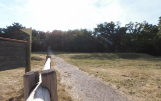
Paved multi-use trail from Trieste to Draga Sant'Elia is a great off-road run. Highlights of the 10.6 km path include Aleppo pines, views to the Rosandra Valley, and the Church of Stena Maria in Siaris. Steady uphill, average grade 3%.
Share your feedback on this route and see that of other Great Runs users. Click on the image icon to upload a photo. And please let us know if there are notes or changes we should incorporate!

Review or Comment on This Route/Share a Photo!
Share your feedback on this route and see that of other Great Runs users. Click on the image icon to upload a photo. And please let us know if there are notes or changes we should incorporate!