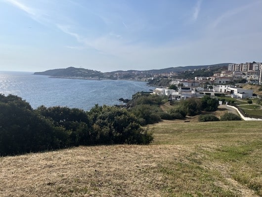
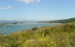
Toward the southern end of the Tuscan Coast, Populonia is known for its Etruscan remains, while Piombino, which sits on the border between the Ligurian Sea and the Tyrrhenian Sea, is a departure for ferries to Elba and elsewhere. There are some excellent running options in the area.
Archaeological Park (Populonia).This large archaeological park is a major visitor destination, for its huge collection of Etruscan remains. One can run on the extensive paths through the park. MAP OF PARK. Note: Fee required, set opening times. MAP
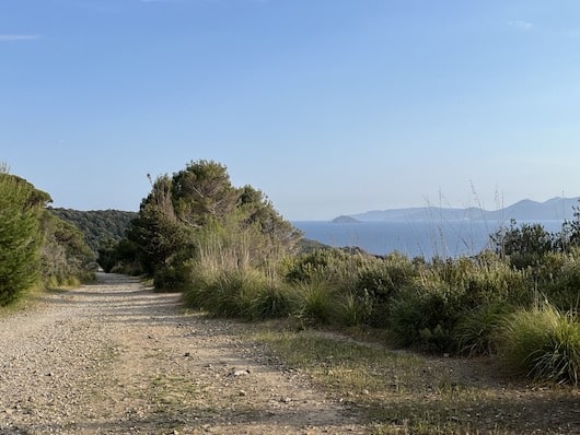
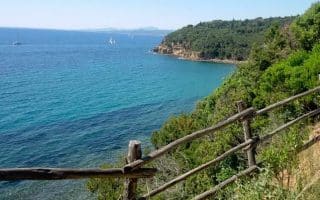
Promontory Trail #302. Mark Lowenstein
Promontory Trails: The extensive network of trails along the promontory between Populonia and Piombino is the best choice for running in this area. These well-marked trails are generally wide and make for an easy trail run, with some ups and downs. Our favorite is Trail 302, which is the ancient Via Dei Cavalleggeri road, now a walking trail. It’s a 10 km out and back atop the cliff between the two towns, affording great views of the sea. Route 300 is another good option, interior and more wooded. See this trail map and description of the route. Note these trails can be accessed from either Piombino or Populonia. Well waymarked. TRAIL MAP
Piombino Waterfront.One can put a decent 5-7 km run in Piombino, mainly following the water and passing several of the city’s most important sites. It’s not a seamless coastal path, but it’s quite easy to follow. A good place to start is a the Stadium, which has a perimeter path and running track. Then head down to the water, using V. Guiseppe Pietri, and follow the waterfront roads/paths, popping down to the lighthouse (Faro), then along the marina, and then above the water to the Cittadella (fort), along the Leonardo Walls, to the Archeological Museum. There, continue along the main road, which has a red-painted cycle path, to a panorama and on some short trails into the Parco di “Viale Amendola“, and down to the beach. Our mapped route is 3.6 km one-way. ROUTE MAP
Toward the southern end of the Tuscan Coast, Populonia is known for its Etruscan remains, while Piombino, which sits on the border between the Ligurian Sea and the Tyrrhenian Sea, is a departure for ferries to Elba and elsewhere. There are some excellent running options in the area.
Archaeological Park (Populonia).This large archaeological park is a major visitor destination, for its huge collection of Etruscan remains. One can run on the extensive paths through the park. MAP OF PARK. Note: Fee required, set opening times. MAP
Promontory Trail #302. Mark Lowenstein
Promontory Trails: The extensive network of trails along the promontory between Populonia and Piombino is the best choice for running in this area. These well-marked trails are generally wide and make for an easy trail run, with some ups and downs. Our favorite is Trail 302, which is the ancient Via Dei Cavalleggeri road, now a walking trail. It’s a 10 km out and back atop the cliff between the two towns, affording great views of the sea. Route 300 is another good option, interior and more wooded. See this trail map and description of the route. Note these trails can be accessed from either Piombino or Populonia. Well waymarked. TRAIL MAP
Piombino Waterfront.One can put a decent 5-7 km run in Piombino, mainly following the water and passing several of the city’s most important sites. It’s not a seamless coastal path, but it’s quite easy to follow. A good place to start is a the Stadium, which has a perimeter path and running track. Then head down to the water, using V. Guiseppe Pietri, and follow the waterfront roads/paths, popping down to the lighthouse (Faro), then along the marina, and then above the water to the Cittadella (fort), along the Leonardo Walls, to the Archeological Museum. There, continue along the main road, which has a red-painted cycle path, to a panorama and on some short trails into the Parco di “Viale Amendola“, and down to the beach. Our mapped route is 3.6 km one-way. ROUTE MAP
Scroll Down For Route Maps
Essentials
Depends on route chosen.
The promontory trails are up and down
Depends on route chosen. Promontory trails can be accessed from either Piombino or Populonia
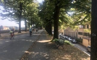
Some excellent running routes in the Pisa area: our 'runseeing' tour, paths along the Arno, a route along the marina/waterfront, trails in a large natural park, and a 13 km cycle path.
A 4.2 km loop around the green parks atop the walls surrounding the city of Lucca. This run offers a nice tour of the city and a panorama of the gorgeous surrounding scenery. Best to go early or off-peak to avoid the crowds.
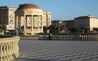
Pleasant seafront promenade run in this city on the western Tuscan coast. It's up to 5.5 between Piazza Mascagni and the Scoglio della Ballerina. Great views of the water, distant islands, and some important Livorno sites.
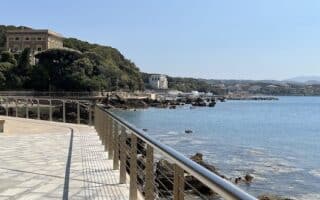
Castiglioncello is a bucolic coastal Tuscan town and is a particularly nice spot for a run. One can put together a route combining the grounds of Castello Pasquini, a 3.5 km seafront promenade, and some pleasantly shaded parks.
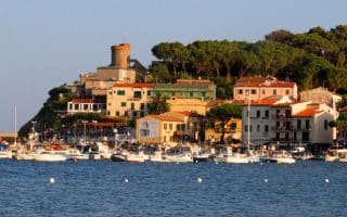
This unique island destination includes great running along the Marina di Campo promenade and many nearby coastal trails. Also some more challenging trail running options on Monte Capanne.
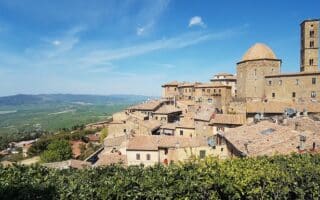
A 'runseeing' tour of the walled city of Volterra. You'll run on paths along and outside the city walks, through several ancient gates, and see numerous archeological sites. Great views!
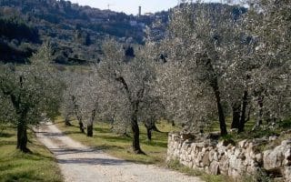
This network of unpaved, quiet roads winding through the Tuscan countryside is fantastic for running. We've researched some of the most beautiful of these, which are a great option since many of the main roads aren't safe for running.
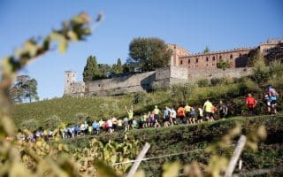
These courses of the Chianti Marathon and Half Marathon feature wonderful running in the rolling hills of Chianti, just east of Siena. Use the routes as a guide to some lovely, quiet roads, using Castelnuovo Berardenga as the anchor point.
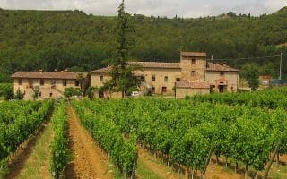
Sure, the Chianti region is famous for its wine, but the landscape here is unbeatable in terms of scenery. Take it all in on a this 13 km tour through the heart of Chianti.
This ancient 62 km trail along the Canale Maestro della Chiana is an ideal cycling and running path through fruit and farmlands. The path runs between Arezzo, Siena, and Umbria.
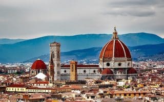
Several great routes in Florence: two historic 'runseeing' toutes, a run up to the Piazzale Michelangelo, the tree-lined streets and paths of the Arno River, beautiful Cascine Park, quieter Oltrarno, and the nearby Etruscan town of Fiesole.
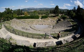
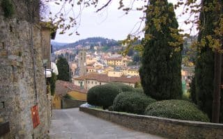
Near Florence, this Etruscan town offers a respite from the crowds, wonderful quiet road, and an opportunity to sample the Tuscan hills. We've created a 6 km Fiesole Highlights run, and a 15 km loop to the hillside town of Settignano.
The 7 km hilly run to the Etruscan town Fiesole is in the steps of E.M. Forster's book, 'A Room with a View'. Some streets are narrow. Can run one way and take transport back. We've also put together a couple of routes in Fiesole.
For trail lovers, the scenic paths between Fiesole and Firenze are a must-run destination. You can get in up to 17 km (10 miles) here, starting just outside of Florence.
The nearby towns of Pistoia and Prato are often part of a Florence itinerary. In Pistoia, run in Villoni Puccini, a lovely city park with ~3 km of paths. In Prato, nice path along the river, the Parco di Galceti, and hill running in Natural Protected Area of Monteferrato.
A beautiful artificial lake in the Mugello region, the Lago di Bilancino is a great spot to run in a scenic spot brimming with wildlife. Runners can get in a nice 10 km around the lake, starting from Barberino di Mugello square.
Share your feedback on this route and see that of other Great Runs users. Click on the image icon to upload a photo. And please let us know if there are notes or changes we should incorporate!
Subscribe
0 Comments
Oldest
Newest
Inline Feedbacks
View all comments
Essentials
Depends on route chosen.
The promontory trails are up and down
Depends on route chosen. Promontory trails can be accessed from either Piombino or Populonia


Review or Comment on This Route/Share a Photo!
Share your feedback on this route and see that of other Great Runs users. Click on the image icon to upload a photo. And please let us know if there are notes or changes we should incorporate!