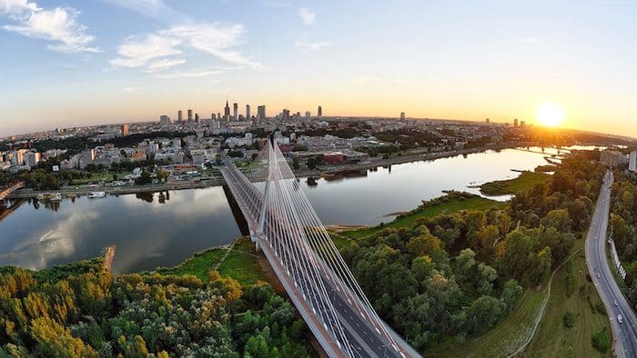
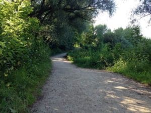
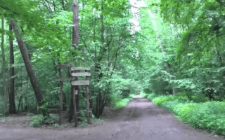
The paths along the Vistula River form the signature running route in Warsaw. Beginning at Grot-Rowecki Bridge, there is a nearly 10-kilometre marked gravel path running up to Siekierkowski Bridge. The ~5 km of paths between the Łazienkowski Bridge and the Gdański Bridge are the most developed, and feature good views of the water and access to some of Warsaw’s most important sights. The path on the left (west) side is more developed, offering a continuous, paved path. The east side, path is greener, generally gravel surface, and not 100% continuous.
Path on east bank. Source: Warsaw Running Tours
There are numerous options for loops here, given the numerous bridges and transport options. On the west side, enjoy the Copernicus Science Center, King’s Castle, and Warsaw Old Town. The east side paths feature the renowned Warsaw Zoo and adjoining park, the Praga neighborhood, and the modern PGE Narodowy Central Stadium. You can run along the sidewalks of the main road, but there is a good gravel path closer to the river for much of the way. Note: in May 2024, a new 0.5 km bicycle/pedestrian bridge opened, connecting Karowa St.in Powiśle with Okrzei Street in Praga.
Key distances, heading north from Łazienkowski Bridge:
1.7 km: Science Ctr. and Świętokrzyski Bridge
2.5 km: Karowa St. Bridge (newly opened bicycle/pedestrian bridge)
3 km: Old Town
4 km: New Town
4.6 km: Gdański Bridge
Scroll Down For Route Maps
Essentials
Loop between the Łazienkowski & Gdański Bridges is 12 km (7.5 miles)
126 feet
Any spot along this loop. Świętokrzyski Bridge & Karowa St. bridges are good for running
Good transport along most of route. The Centrum Nauki Kopernik metro (M2) is a cenrally located stop
An 11+ km 'runseeing' tour of the best of Warsaw. Starting from Old Town, takes in many of Warsaw's most important sites, through the Ujazdowski Castle and the Lazienki Park to end at the Palace in Wilanowa. Run one way and take tram back!
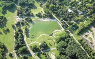
A classic European city park, located along the 'Royal Route'. Several paths wonderful for running -- can easily put together a few km within the park. The park features several museums, cultural institutions, gardens, and the Palace on the Isle.
A guide to running in central Warsaw, known as Śródmieście. The area just south of Old Town is Powiśle, between the river and a strict city center. Also, Karowa St., Królewska St. bordering the Saxon Garden, and Aleje Ujazdowskie.
A 140 acre park in the Praga Południe district. Skaryszewski was designed in the early 1900s, and features wonderful paths through meadows & fields, a lake, sculptures, & more. Route also includes a loop around PGE Narodowy stadium.
A 172 acre field, with paved and unpaved paths in the Mokotów neighborhood. It's a bit over 4 km around the paths. Combine with Łazienki Park and other nearby parks for a longer run.
A 370 acre preserve about 8 km north of Warsaw. Several km of trails for running, including dedicated cycling and walking trails. We've mapped a route that combines two parks and a lake just to the east.
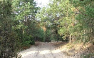
A 2,200 acre forest that's 14km south of Warsaw, with many km of trails great for running. It's best to design your own route through the many wooded and shaded trails.
Large park in the north-west outskirts of Warsaw, with extensive trails for running. A great escape with lots of variety, and types of terrain. Mainly for trail running, with options for various distances & difficulty. Good hills if you want them!
Share your feedback on this route and see that of other Great Runs users. Click on the image icon to upload a photo. And please let us know if there are notes or changes we should incorporate!
Subscribe
0 Comments
Oldest
Newest
Inline Feedbacks
View all comments
Essentials
Loop between the Łazienkowski & Gdański Bridges is 12 km (7.5 miles)
126 feet
Any spot along this loop. Świętokrzyski Bridge & Karowa St. bridges are good for running
Good transport along most of route. The Centrum Nauki Kopernik metro (M2) is a cenrally located stop


Review or Comment on This Route/Share a Photo!
Share your feedback on this route and see that of other Great Runs users. Click on the image icon to upload a photo. And please let us know if there are notes or changes we should incorporate!