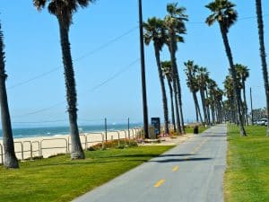
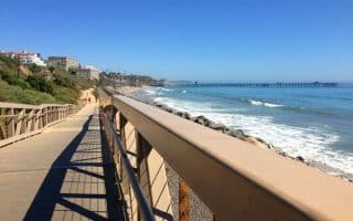
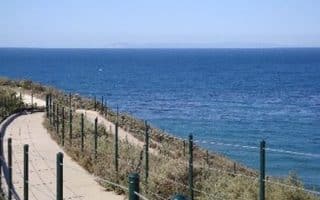
Another in a series of wonderful paths along the beach in southern California. This path is particularly helpful because there are buildings blocking the water view from all of the interior roads.
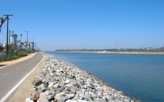
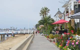
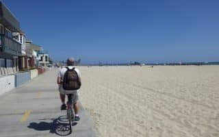
The paved path goes for 10.5 miles, from Bolsa Chica State Beach in the Huntington Beach Area to Newport Blvd. in Newport Beach. There are great water views the whole way, and you’ll always find lots of runners, cyclists, bladers, and more on nice day. Main St. in Huntington Beach is about the half-way point of the trail — it’s ~5 miles in each direction. The path is wide and paved, literally bumping up against the sand. There are lots of spots along the way to eat, grab a drink, rest, or hit the restroom. At the 8.5 mile mark (or about 3 miles south of Huntington Beach), you can also join the Santa Ana River Trail.
See our route map, and table with distances.
Add-Ons: You can continue for even longer, heading south, on the Newport-Balboa bike path, which goes for 2.9 miles. At West Newport Park, get off path and go along Seashore Rd. for 1 mile to join the path. You can also join the Santa Ana River trail at the 8.5 mile mark on the path.
Another in a series of wonderful paths along the beach in southern California. This path is particularly helpful because there are buildings blocking the water view from all of the interior roads.
The paved path goes for 10.5 miles, from Bolsa Chica State Beach in the Huntington Beach Area to Newport Blvd. in Newport Beach. There are great water views the whole way, and you’ll always find lots of runners, cyclists, bladers, and more on nice day. Main St. in Huntington Beach is about the half-way point of the trail — it’s ~5 miles in each direction. The path is wide and paved, literally bumping up against the sand. There are lots of spots along the way to eat, grab a drink, rest, or hit the restroom. At the 8.5 mile mark (or about 3 miles south of Huntington Beach), you can also join the Santa Ana River Trail.
See our route map, and table with distances.
Add-Ons: You can continue for even longer, heading south, on the Newport-Balboa bike path, which goes for 2.9 miles. At West Newport Park, get off path and go along Seashore Rd. for 1 mile to join the path. You can also join the Santa Ana River trail at the 8.5 mile mark on the path.
Scroll Down For Route Maps
Essentials
10.5 miles
167 feet
Anywhere along path. North end is Bolsa Chica State Beach at Warner Ave; South End is Newport Beach at Newport Blvd.
Numerous access points and parking along path. Parking can be tight
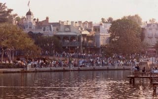
The largest city in Orange County and home to Disneyland and a major convention center. Best spots in the immediate area are Mile Square Park, the Colony Historic District, and Anaheim Hills, which has gorgeous parks and pretty residential streets.
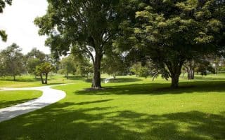
Pleasant, 475-acre park with several miles of trails nestled among a grove of heritage oak and sycamore trees. Best bets are 4-mile Equestrian Loop, 3 mile Horseshoe Loop Trail 1.3 mile Road Runner loop. Paved & dirt paths.
Tons of great running in the area. Campus highlight is Aldrich Park, a hilly, grassy expanse with great views. Within 1 mile of campus are Mason Park (2 mile trail), San Joaquin Marsh and Wildlife Sanctuary (11 miles of trails), and Newport Back Bay Loop.
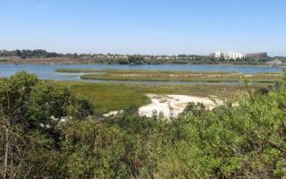
Nature preserve connecting the Upper Newport Bay and Newport Harbor is a popular 10.5 mile loop. It's paved and relatively flat. Numerous access points and options to make it shorter. South part is prettiest.
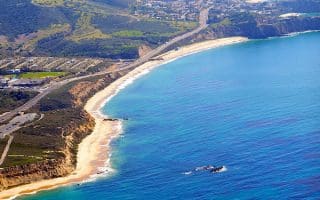
A beach and a canyon all in one run! Fantastic state park has a 2.5+ mile paved coastal trail and 10+ miles of backcountry trails in Moro Canyon. The promenade has great water views. Canyon trails are moderate to challenging, with some serious hills.
Terrific trail along side San Clemente Beach, paralleling the train tracks. The path runs 2.6 miles one-way, combination paved, sand, boardwalk, and dirt.
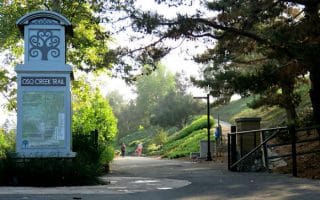
One can put together 3-4 miles of trails in the Oso Viejo Community Park. The trails feature an Oak Grove, garden maze, butterfly garden, and a walkway made of recycled glass. For a longer run, the residential area east of the park is pleasant.
One of the most spectacular runs in southern California. A series of headlands and cliffs overlooking Dana Point and Strands Beach, with great views. One can put together a terrific run, with parks, trails, and paths along the harbor and marina.
30-mile recreational trail along the Santa Ana River between Huntington Beach and Riverside. Paths on both sides of the water. Several parks and other landmarks along the way.
A wonderful 2.5 mile dedicated pedestrian path, with great harbor views. Reachable by bridge, or quick ferry ride from the Balboa Peninsula. For a longer run, hop the ferry and do the 2.9 mile Newport Balboa bike trail.
Wonderful 3 mile paved trail on the Balboa Peninsula, with great beach & views. Fun jaunts out to Newport Beach Pier and Balboa Pier. Combined, with piers, it's 7 miles total. Good add-on opportunities.
This 670 acre park is one of the best spots to run near Anaheim/Disney. It's 1 mile along each side of the park. Or, enjoy some of the interior trails. There are lakes, golf courses, nature trails, recreational fields, and more.
Share your feedback on this route and see that of other Great Runs users. Click on the image icon to upload a photo. And please let us know if there are notes or changes we should incorporate!
Subscribe
0 Comments
Oldest
Newest
Inline Feedbacks
View all comments
Essentials
10.5 miles
167 feet
Anywhere along path. North end is Bolsa Chica State Beach at Warner Ave; South End is Newport Beach at Newport Blvd.
Numerous access points and parking along path. Parking can be tight

 The paved path goes for 10.5 miles, from Bolsa Chica State Beach in the Huntington Beach Area to Newport Blvd. in Newport Beach. There are great water views the whole way, and you’ll always find lots of runners, cyclists, bladers, and more on nice day. Main St. in Huntington Beach is about the half-way point of the trail — it’s ~5 miles in each direction. The path is wide and paved, literally bumping up against the sand. There are lots of spots along the way to eat, grab a drink, rest, or hit the restroom. At the 8.5 mile mark (or about 3 miles south of Huntington Beach), you can also join the Santa Ana River Trail.
Review or Comment on This Route/Share a Photo!
Share your feedback on this route and see that of other Great Runs users. Click on the image icon to upload a photo. And please let us know if there are notes or changes we should incorporate!