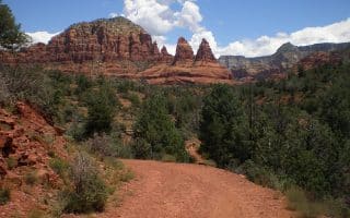
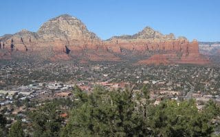
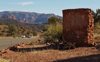
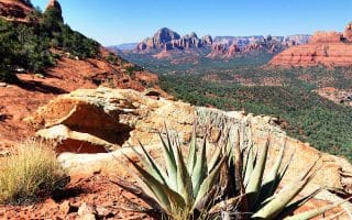
A nice long stretch of pavement radiating out from the Village of Oak Creek, The Verde Valley School Road is a good choice for up to 10 miles round trip. Start where the Verde Valley School Road meets Highway 179 and set out west on the wide shoulder past a series of classic ranch homes. It’s just east of Red Rock State Park. As you run further from town, the shoulder dwindles, but the views and some of the more remote homes here are impressive. You can continue all the way to the road’s end at Oak Creek before turning back. If you do the full length, it’s 10 miles, but you can turn around at any time for a shorter run.

Features:
Scroll Down For Route Maps
Essentials
- Up to 10 miles out and back
- 246 feet
- Village of Oak Creek Center
- Highway 179
Current Weather & Forecast

Sedona, US
8:45 am,
Jun 3, 2026
L: 28°
H: 31°
Daily ForecastHourly Forecast
Today
2:00 pm
28° / 31°°C
0.3 mm
30%
6 mph
75 %
1007 mb
0 mm/h
Tomorrow
2:00 pm
15° / 21°°C
1 mm
100%
14 mph
93 %
1005 mb
0 mm/h
Friday
2:00 pm
12° / 16°°C
0.71 mm
71%
13 mph
88 %
1017 mb
0 mm/h
Saturday
2:00 pm
9° / 21°°C
1 mm
100%
7 mph
91 %
1017 mb
0 mm/h
Sunday
2:00 pm
13° / 18°°C
1 mm
100%
18 mph
96 %
1021 mb
0 mm/h
Today
11:00 am
18° / 20°°C
0.3 mm
30%
6 mph
66 %
1007 mb
0 mm/h
Today
2:00 pm
17° / 18°°C
0 mm
0%
6 mph
75 %
1006 mb
0 mm/h
Today
5:00 pm
16° / 16°°C
0.2 mm
20%
10 mph
79 %
1004 mb
0 mm/h
Today
8:00 pm
16° / 16°°C
1 mm
100%
10 mph
93 %
1003 mb
0 mm/h
Today
11:00 pm
18° / 18°°C
0.85 mm
85%
11 mph
88 %
1003 mb
0 mm/h
Tomorrow
2:00 am
20° / 20°°C
1 mm
100%
13 mph
81 %
1003 mb
0 mm/h
Tomorrow
5:00 am
21° / 21°°C
1 mm
100%
14 mph
70 %
1002 mb
0 mm/h
Other Routes in Sedona, AZ
A flat 3.5 mile hard packed gravel walkway with great views of Bell Rock. A good option for a non-technical trail run.
A hiking loop around Table Top Mountain through basalt boulders & red rocks to panoramic views from the Tabletop Plateau. Officially called the Airport Loop Trail, this well-worn, marked 3.3 mile loop makes for a good hike/walk/run.
Formerly a staging ground for the Sheriff's Posse, this park a couple of miles west of downtown offers a nice option for those looking for some paved, off-road flat running in Sedona. About 2 miles of trails.
Explore Sedona’s various architectural styles with this 4 mile loop through West Sedona’s neighborhood streets. Relatively light traffic and good desert views.
This 8.5 mile paved loop ends in a tough hill climb. Starts with a short section of trail and continues on the road shoulder. Nice views of Red Rock State Park.
Enjoy a popular Hollywood western backdrop with this 8 mile loop on three fairly technical trails.
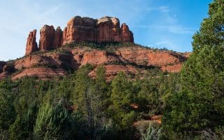
A moderately challenging 7.6 mile singletrack around Cathedral Rock. Steep climbs, but great views. Can combine with run or hike around this famous Sedona landmark!
User Ratings
Leave A Review or Comment
Review or Comment on This Route/Share a Photo!
Share your feedback on this route and see that of other Great Runs users. Click on the image icon to upload a photo. And please let us know if there are notes or changes we should incorporate!