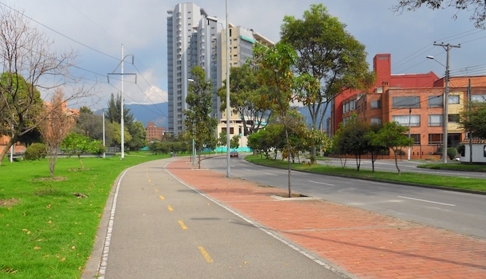
In recent years, Bogota has invested significant money in the rehabilitation and reconstruction of public spaces, including over 300 km of bike paths. The result is one of the most extensive cycling networks in the world, called Ciclorutas. This opens up vast opportunities for running on a bike path from almost anywhere in the city. Rather that list each bike path individually, we’ve included a terrific Google Map of the Ciclorutas (courtesy of mejorenbici.com via a Creative Commons License) that outlines the city wide network. A list of bike paths with corresponding mileage can be found here.
Features:
Scroll Down For Route Maps
Essentials
Current Weather & Forecast

Bogota, CO
8:07 am,
Jun 8, 2026
L: 13°
H: 14°
Daily ForecastHourly Forecast
Today
4:00 pm
13° / 14°°C
1 mm
100%
6 mph
91 %
1020 mb
0 mm/h
Tomorrow
4:00 pm
10° / 16°°C
1 mm
100%
7 mph
97 %
1019 mb
0 mm/h
Wednesday
4:00 pm
3° / 10°°C
1 mm
100%
10 mph
100 %
1023 mb
0.44 mm/h
Thursday
4:00 pm
2° / 11°°C
0 mm
0%
9 mph
96 %
1026 mb
0 mm/h
Friday
4:00 pm
4° / 15°°C
0 mm
0%
9 mph
98 %
1026 mb
0 mm/h
Today
10:00 am
18° / 19°°C
1 mm
100%
6 mph
56 %
1018 mb
0 mm/h
Today
1:00 pm
15° / 16°°C
1 mm
100%
4 mph
71 %
1019 mb
0 mm/h
Today
4:00 pm
13° / 13°°C
0.96 mm
96%
3 mph
91 %
1020 mb
0 mm/h
Today
7:00 pm
11° / 11°°C
0.61 mm
61%
3 mph
91 %
1019 mb
0 mm/h
Today
10:00 pm
10° / 10°°C
0.25 mm
25%
2 mph
91 %
1018 mb
0 mm/h
Tomorrow
1:00 am
11° / 11°°C
0 mm
0%
4 mph
79 %
1017 mb
0 mm/h
Tomorrow
4:00 am
14° / 14°°C
1 mm
100%
7 mph
76 %
1016 mb
0 mm/h
Other Routes in Bogotá, Colombia
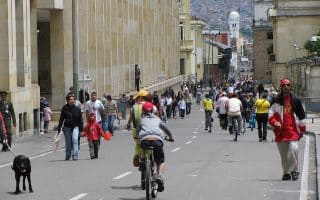
In an effort to promote citywide recreation, Bogota closes 76 miles of main streets to car traffic every Sunday and holiday from 7 am until 2 pm. We've recommended a few sections that are a particular treat to run.
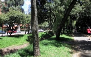
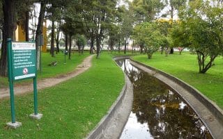
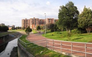
This narrow linear park between Calle 87 and Calle 89 in the Chapinero neighborhood of Bogota runs along the green El Virrey creek corridor. A full circuit is about 1.4 km (.8 miles).
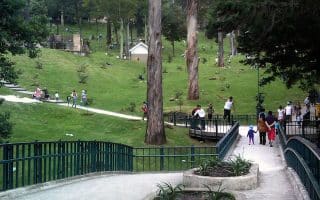
Parque Simón Bolívar is the largest, and usually the most crowded park in Bogota. It’s popular among runners for its large network of trails, ranging from hilly dirt trails to long paved flats.
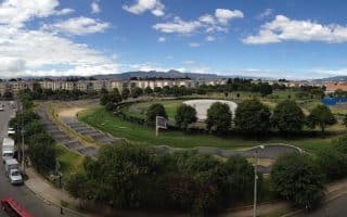
This community center in the Suba region of Bogota is relatively small, but it does have a 1 km (.6 miles) long designated jogging track.
Another small but locally popular park, San Andres is a go-to exercise destination in the northwest of Bogota. Includes a .7 km (.4 miles) crushed rock jogging path.
A hilly 6.4 km road run just outside Bogota, the ascenso de Patios is a favorite of locals seeking a longer run.
Put in some laps of this 283 hectare green space consisting of gardens, playing fields, a famous Swiss Clock, and a section of the Arzobispo River.
User Ratings
Leave A Review or Comment
Review or Comment on This Route/Share a Photo!
Share your feedback on this route and see that of other Great Runs users. Click on the image icon to upload a photo. And please let us know if there are notes or changes we should incorporate!