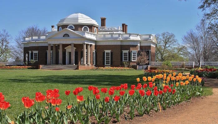
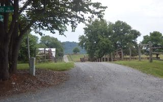
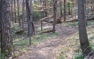
Just off the Thomas Jefferson Parkway, the Saunders Monticello Trail is a 4 mile out and back run leading around Carter Mountain to Monticello. The trail starts in Kemper Park and winds east to the historic home of Thomas Jefferson. It’s surface is a mix of asphalt and crushed stone, and long stretches of boardwalk add a fun bounce as you run through scenic woods. For more mileage, tack on the various other trails of the Monticello system, which have varying degrees of difficulty.
Features:
Scroll Down For Route Maps
Essentials
- 4 miles
- Max grade 5%
- Kemper Park
- Thomas Jefferson Parkway
Current Weather & Forecast

Charlottesville, US
11:49 am,
Jun 9, 2026
L: 22°
H: 24°
Daily ForecastHourly Forecast
Today
5:00 pm
22° / 24°°C
0 mm
0%
8 mph
60 %
1023 mb
0 mm/h
Tomorrow
5:00 pm
23° / 29°°C
1 mm
100%
8 mph
98 %
1018 mb
0 mm/h
Thursday
5:00 pm
21° / 36°°C
0.5 mm
50%
7 mph
95 %
1013 mb
0 mm/h
Friday
5:00 pm
20° / 37°°C
1 mm
100%
9 mph
98 %
1013 mb
0 mm/h
Saturday
5:00 pm
21° / 32°°C
1 mm
100%
10 mph
98 %
1015 mb
0 mm/h
Today
2:00 pm
24° / 26°°C
0 mm
0%
8 mph
60 %
1023 mb
0 mm/h
Today
5:00 pm
25° / 26°°C
0 mm
0%
8 mph
57 %
1020 mb
0 mm/h
Today
8:00 pm
24° / 24°°C
0 mm
0%
6 mph
69 %
1018 mb
0 mm/h
Today
11:00 pm
24° / 24°°C
0 mm
0%
5 mph
72 %
1017 mb
0 mm/h
Tomorrow
2:00 am
23° / 23°°C
0 mm
0%
3 mph
81 %
1016 mb
0 mm/h
Tomorrow
5:00 am
23° / 23°°C
0.14 mm
14%
4 mph
85 %
1015 mb
0 mm/h
Tomorrow
8:00 am
23° / 23°°C
1 mm
100%
3 mph
98 %
1016 mb
0 mm/h
Other Routes in Charlottesville, VA
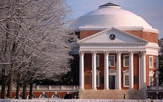
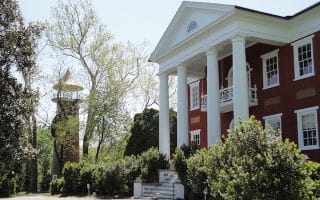
The University of Virginia is the heart of Charlottesville, and the Jeffersonian architecture of its beautiful grounds makes for a wonderful run of any length. We have several mapped routes, ranging from 3 to 7 miles.
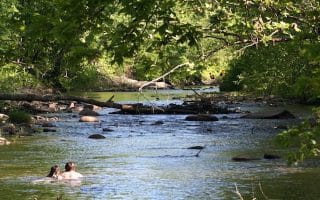
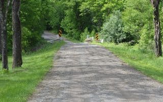
The Rivanna Trail encircles Charlotteville for about 20 miles, covering prime ground on the banks of the Rivanna River and through a series of city parks. Paved and dirt trail sections.
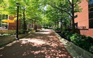
Our friends in Charlottesville have mapped 3 mile and 8 mile loops of the city's pretty downtown, with its tree-lined streets, pedestrian mall, and fun commercial areas. Can be combined with the UVA campus and the Rivanna Trails
The 7.5 mile hilly gravel sprawl of Dick Woods is something of a legend among Charlottesville area runners.
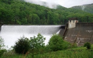
This beautiful 4.5 mile paved road leads to the Sugar Hollow Reservoir and dam, the scenic doorway to the Ragged Mountain Natural Area.
This paved 2.25 mile route circles one of the most prestigious residential areas in Charlottesville. Can be combined with the Sugar Hollow route or the Rivanna Trail for more mileage.
A series of scenic dirt roads through a quiet oasis of farmland just south of the city. 7 mile loop.
Preddy Creek Trail Park occupies 521 relatively flat but beautiful acres. A full loop around the main trail system is about 3.5 miles, but runners can easily add on mileage by exploring cross paths and extensions.
User Ratings
Leave A Review or Comment
Review or Comment on This Route/Share a Photo!
Share your feedback on this route and see that of other Great Runs users. Click on the image icon to upload a photo. And please let us know if there are notes or changes we should incorporate!