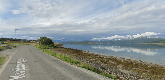
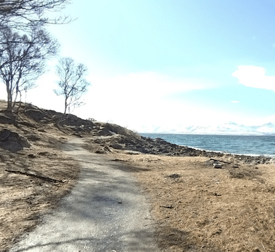
This is the probably the most scenic run in Tromsø. Just a few km from the city center and just south of the airport, there’s some very scenic waterfront running along Kvaløyvegen, down to a fjord. A paved cycle path runs along the Kvaløyvegen road (opposite side of the water), featuring great views of the water & surrounding mountains. At the south end is Folkeparken, a scenic park with lakes and trails. It’s popular in winter for its northern lights viewing. A loop around is ~1.5 km, and it’s fairly hilly. You can also extend for another ~1 km around the tip on a fairly easy trail to enjoy the ‘fjord view’.
The full out and back route, including the Folkeparken loop, is ~8.5 km, or ~10.5 km including the fjord section at the tip.
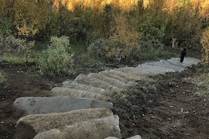
Folkeparken. Google Street View
This is the probably the most scenic run in Tromsø. Just a few km from the city center and just south of the airport, there’s some very scenic waterfront running along Kvaløyvegen, down to a fjord. A paved cycle path runs along the Kvaløyvegen road (opposite side of the water), featuring great views of the water & surrounding mountains. At the south end is Folkeparken, a scenic park with lakes and trails. It’s popular in winter for its northern lights viewing. A loop around is ~1.5 km, and it’s fairly hilly. You can also extend for another ~1 km around the tip on a fairly easy trail to enjoy the ‘fjord view’.
The full out and back route, including the Folkeparken loop, is ~8.5 km, or ~10.5 km including the fjord section at the tip.
Scroll Down For Route Maps
Essentials
It's ~3 km along Kvaløyvegen to Folkeparken, and then a ~1.5 km loop around Folkeparken. Full route is 8.4 km (5.3 miles)
Flat, and then hilly in Folkeparken
The Canoe & Kayak Club along Kvaløyvegen is a good place to start. Can also start in Folkeparken and head north
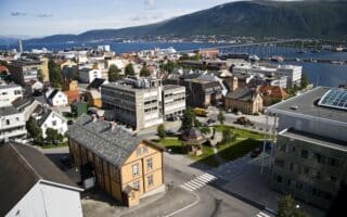
An enjoyable 'runseeing' tour of Tromsø, covering its scenic & historical highlights: waterfront, Old Town, colorful wooden houses, several small parks, and the iconic Tromsø Bridge. The route can be a tad confusing -- use our map as a guideline.
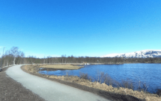
Prestvannet Lake, just to the west of town, anchors an area of extensive trails that are wide & scenic with good footing. Head north through Charlottenlund to the Tromsøhallen sports complex, and south to the Mountain Viewpoint. Fairly wooded.
A unique & scenic run on the mainland. Hike/run 1300 steps to the summit of Mount Storsteinen, enjoying spectacular views. There are additional scenic hilltop trails. Especially magical during the Midnight Sun to catch the golden sunlight. Cable car access too.
Share your feedback on this route and see that of other Great Runs users. Click on the image icon to upload a photo. And please let us know if there are notes or changes we should incorporate!
Subscribe
0 Comments
Oldest
Newest
Inline Feedbacks
View all comments
Essentials
It's ~3 km along Kvaløyvegen to Folkeparken, and then a ~1.5 km loop around Folkeparken. Full route is 8.4 km (5.3 miles)
Flat, and then hilly in Folkeparken
The Canoe & Kayak Club along Kvaløyvegen is a good place to start. Can also start in Folkeparken and head north

Review or Comment on This Route/Share a Photo!
Share your feedback on this route and see that of other Great Runs users. Click on the image icon to upload a photo. And please let us know if there are notes or changes we should incorporate!