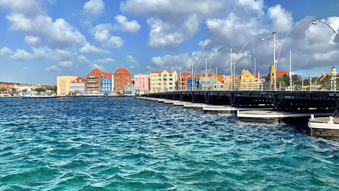
One can stitch together some nice waterfront running in Willemstad, Curaçao’s capital and largest city. There’s a mix of waterfront paths and roadside sidewalks. There are two primary sections we recommend, which can be combined for a longer run. Note: Penstraat, Willemstad’s main waterfront road headed east, is not great for running — although there’s a sidewalk, there aren’t water views and there isn’t much to see.
Waigaat Lagoon. Google Street View
Willemstad Waterfront Plus Waaigat Lagoon. This is a nice little loop in Willemstad, mainly along the water. Start at the National Archaeological Museum and head west along Pietermaai, past the Sunset Viewpoint and around Fort Wilem. It’s a festive scene, with the colorful houses, shops, & water views as you pass several monuments and statues. Pass the Queen Emma Bridge @ 2km, for a ~2 km loop around the Waaigat lagoon. It’s on a nice waterfront sidewalk along the main road. Here, you can return to the start, either by the fort (making this a ~6k run), or using one of the small roads through the historic section of Willemstad. Pro Tip: Beautiful sunsets!
Connect to Zakitó: It’s 2.5 km to connect to our John F Kennedy Blvd. run in Zakitó. Use the Queen Emma Bridge (scenic!) to Pater Euwensweg, pass by the Mangrove Park, then LEFT on Weg Naar Welgelegen to JFK Blvd.
JFK Blvd. Google Street View
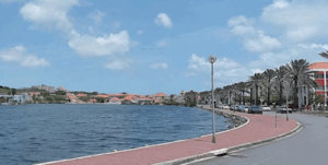
John F Kennedy Boulevard. This is one of the most popular waterfront runs on Curaçao. This road runs along the water/beach in the Zakitó area in western Willemstad. It’s a fairly quiet road, since the main Helmin Magno Wiels Blvd. carries most of the traffic. There’s a sidewalk alongside John F Kennedy Blvd. (though on the non-water side). It’s ~2 km long, reaching the Curacao Marriott Beach Resort and an area of numerous hotels. There are nice beach & water views the whole way. Note: Nice at sunset. Beach not great for running. Longer Options: It’s possible to continue along the Piscaderaweg road, which passes by several resorts — there’s a decent sidewalk. Also, see above for connection to Willemstad waterfront route.
One can stitch together some nice waterfront running in Willemstad, Curaçao’s capital and largest city. There’s a mix of waterfront paths and roadside sidewalks. There are two primary sections we recommend, which can be combined for a longer run. Note: Penstraat, Willemstad’s main waterfront road headed east, is not great for running — although there’s a sidewalk, there aren’t water views and there isn’t much to see.
Waigaat Lagoon. Google Street View
Willemstad Waterfront Plus Waaigat Lagoon. This is a nice little loop in Willemstad, mainly along the water. Start at the National Archaeological Museum and head west along Pietermaai, past the Sunset Viewpoint and around Fort Wilem. It’s a festive scene, with the colorful houses, shops, & water views as you pass several monuments and statues. Pass the Queen Emma Bridge @ 2km, for a ~2 km loop around the Waaigat lagoon. It’s on a nice waterfront sidewalk along the main road. Here, you can return to the start, either by the fort (making this a ~6k run), or using one of the small roads through the historic section of Willemstad. Pro Tip: Beautiful sunsets!
Connect to Zakitó: It’s 2.5 km to connect to our John F Kennedy Blvd. run in Zakitó. Use the Queen Emma Bridge (scenic!) to Pater Euwensweg, pass by the Mangrove Park, then LEFT on Weg Naar Welgelegen to JFK Blvd.
JFK Blvd. Google Street View
John F Kennedy Boulevard. This is one of the most popular waterfront runs on Curaçao. This road runs along the water/beach in the Zakitó area in western Willemstad. It’s a fairly quiet road, since the main Helmin Magno Wiels Blvd. carries most of the traffic. There’s a sidewalk alongside John F Kennedy Blvd. (though on the non-water side). It’s ~2 km long, reaching the Curacao Marriott Beach Resort and an area of numerous hotels. There are nice beach & water views the whole way. Note: Nice at sunset. Beach not great for running. Longer Options: It’s possible to continue along the Piscaderaweg road, which passes by several resorts — there’s a decent sidewalk. Also, see above for connection to Willemstad waterfront route.
Scroll Down For Route Maps
Essentials
Willemstad Loop: ~6 km; JFK Blvd: 2 km (one-way); It's ~2.5 km to connect the two routes.
Fairly flat
Willemstad: Near the Archeological Museum; JFK Blvd: near Zakitó sign
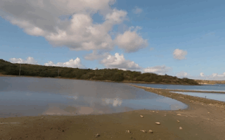
Scenic, easy trail running just east of Willemstad. There's a 2 km coastal trail from Mambo Beach. At the Jan Thiel Salt Pans, several km of trails, both along the lagoon and inland. It's also a prime bird watching area. Keep an eye out for flamingos!
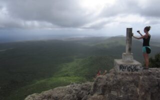
Some of our favorite trail running options among Curaçao's significant network of hiking trails. They're all over the island, ranging from coastal hiking trails to more rugged, mountainous trails in the interior.
Share your feedback on this route and see that of other Great Runs users. Click on the image icon to upload a photo. And please let us know if there are notes or changes we should incorporate!
Subscribe
0 Comments
Oldest
Newest
Inline Feedbacks
View all comments
Essentials
Willemstad Loop: ~6 km; JFK Blvd: 2 km (one-way); It's ~2.5 km to connect the two routes.
Fairly flat
Willemstad: Near the Archeological Museum; JFK Blvd: near Zakitó sign


Review or Comment on This Route/Share a Photo!
Share your feedback on this route and see that of other Great Runs users. Click on the image icon to upload a photo. And please let us know if there are notes or changes we should incorporate!