Google Street View
Features:
Categories:
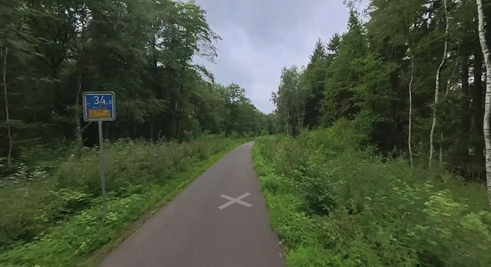
For some lovely running on wide, forested trails, head to Roetgen — a small village in the Nordeifel, ~20 km south of Aachen. The area is known for its network of old railway tracks now turned into an extensive network of paved and gravel trails. This area also straddles the Germany-Belgium border. Thanks to Lukas Melcher for the route recommendation!
There are many trails to choose from. Lukas has mapped a 7.2 km loop, starting from the large Schlehbachbrücke parking lot. Use Wilhelmstraße to the Hubertusweg path, then LEFT onto Birkhahnsweg at the Hubertusteiche nature preserve. At 3.65 km, LEFT on Vennbahweg, the paved former rail line, for 2.7 km. Complete the loop with Birkhahnsweg & Roter Weg.
Essentials
- We've mapped a 7.2 km (4.5 mile) loop; Many other distance & loop options
- 108m (355 feet)
- Near Schlehbachbrücke parking area
- Parking: Schlehbachbrücke

Comment on this Route/Share a Photo!
Share your feedback on this route and see that of other Great Runs users. Click on the image icon to upload a photo. And please let us know if there are notes or changes we should incorporate!