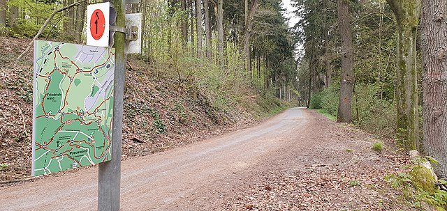
The Aachen Woods offers an opportunity for some great running on a large network of mainly wooded trails. Referred to by locals as the “Öcher Bösch”, the woods are south of Aachen near the Belgian border, and stretch over a huge area. Most of the trails are fairly wide, with good footing. You can create your own route, or run one of the six signposted, color-coded loops, which range in length from 3 km to 5 km. The area is fairly hilly. The 5.5 km Waldrundweg “Gelb” (yellow) is the easiest in terms of elevation gain, while the Waldrundweg “Blau“ (blue) has the steepest grades.
This two-page trail map has excellent information on the different loops, with descriptions (in German) and elevation profiles.


Review or Comment on This Route/Share a Photo!
Share your feedback on this route and see that of other Great Runs users. Click on the image icon to upload a photo. And please let us know if there are notes or changes we should incorporate!