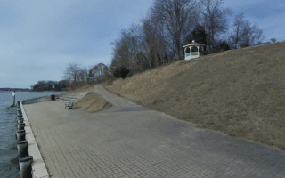
Those who are looking for a longer waterside run along Chesapeake Bay in the Annapolis area will be frustrated. The area’s setting is attractive, but the geography consists of a series of small coves jutting into the bay and the mouth of the Severn River. For those who’d like to get a glimpse of the water while on a run, here are the best bets in the area. Note that some of the connector roads, such as Bay Ridge Rd. and Arundel on the Bay Rd. are busy and lack a decent sidewalk/shoulder.
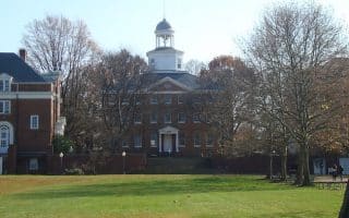
Naval Academy Campus. When conditions permit, this is a great 3-4 mile run around the campus’ waterside setting, and over the Fitch bridge to Bluff Point. ROUTE MAP
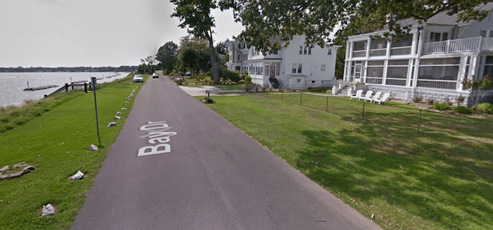
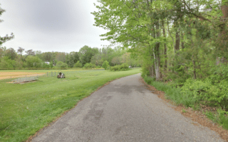
Magnolia Ave., Arundel on the Bay. GSV
Annapolis Cove. Located 4 miles east of downtown, this is an attractive residential neighborhood with 1.6 miles of waterside running combining River Dr. and Bay Rd.
Arundel on the Bay & Thomas Point. Just south of Annapolis Cove (but not easily connected by roads), this is another pleasant neighborhood by the bay. Take Narragansett Ave. to Magnolia Ave. and loop back through the neighborhood. You could combine this with Thomas Point. From Thomoas Point Rd., use Hidden River Rd., then Thomas Point Rd. to Thomas Point Park. Overall, a route of ~7.5 miles. ROUTE MAP
Those who are looking for a longer waterside run along Chesapeake Bay in the Annapolis area will be frustrated. The area’s setting is attractive, but the geography consists of a series of small coves jutting into the bay and the mouth of the Severn River. For those who’d like to get a glimpse of the water while on a run, here are the best bets in the area. Note that some of the connector roads, such as Bay Ridge Rd. and Arundel on the Bay Rd. are busy and lack a decent sidewalk/shoulder.
Naval Academy Campus. When conditions permit, this is a great 3-4 mile run around the campus’ waterside setting, and over the Fitch bridge to Bluff Point. ROUTE MAP
Magnolia Ave., Arundel on the Bay. GSV
Annapolis Cove. Located 4 miles east of downtown, this is an attractive residential neighborhood with 1.6 miles of waterside running combining River Dr. and Bay Rd.
Arundel on the Bay & Thomas Point. Just south of Annapolis Cove (but not easily connected by roads), this is another pleasant neighborhood by the bay. Take Narragansett Ave. to Magnolia Ave. and loop back through the neighborhood. You could combine this with Thomas Point. From Thomoas Point Rd., use Hidden River Rd., then Thomas Point Rd. to Thomas Point Park. Overall, a route of ~7.5 miles. ROUTE MAP
Scroll Down For Route Maps
Essentials
Depends on section chosen. We've mapped a 7.5 mile route combining Arundel on the Bay and Thomas Point
A pleasant run exploring the Historic District, State House, U.S. Naval Academy, St. John's College, and bridges over Spa Creek/Severn River. We've created a separate route for just the Naval Academy, which can be combined with the 'Runseeing' tour.
340-acre park is the largest park in Annapolis and the best for a run. We recommend creating your own run on the 6 miles of trails, combining woods, open spaces, shoreline. The park features art pavilions, a small lake, and formal gardens.
The B&A Trail is 13.3-mile paved mutli-use path stretching from Glen Burnie, near BWI, south to Annapolis. It's one of the the best spots in the area for a long off-road run. It's mainly wooded, and quite flat. There are half-mile markers along the way. Choose a section!
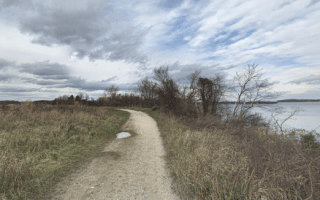
Nice running on the trails at this conservation center at the mouth of the Severn River overlooking Whitehall Bay. There's a 2.3 mile peninsula loop on wide gravel paths featuring good water views. Combine with the nature trails for a 4-miler.
A pleasant, short park run on paved multi-use trails. Combine the park perimeter walking trail with the Broadneck Peninsula Trail for a nearly 3-mile run. For longer, add the Bay Hills Park and Cape St. Claire neighborhoods.
This 288-acre farm turned country park is a great spot for a destination run. There's a 2.8 mile paved perimeter trail and several miles of natural trails, combination of fields and woods. Can also connect to the B&A Trail, 0.5 miles east. Video preview!
Share your feedback on this route and see that of other Great Runs users. Click on the image icon to upload a photo. And please let us know if there are notes or changes we should incorporate!
Subscribe
0 Comments
Oldest
Newest
Inline Feedbacks
View all comments
Essentials
Depends on section chosen. We've mapped a 7.5 mile route combining Arundel on the Bay and Thomas Point


Review or Comment on This Route/Share a Photo!
Share your feedback on this route and see that of other Great Runs users. Click on the image icon to upload a photo. And please let us know if there are notes or changes we should incorporate!