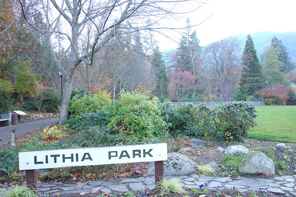
Lithia Park, and the area around it, offers some of the most scenic running in Ashland. The 93-acre park, officially dedicated in 1916, is listed on the National Register of Historic Places. The park features ponds, a bandshell, grassy lawns, and beautifully landscaped gardens. Run standalone, add with nearby roads & trails, or combine with our Ashland Tour.
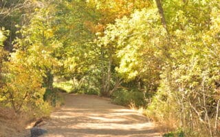
In the park itself, the ~1 mile paved Lithia Park Trail features 100 interpretive signposts (guide). You can also do a nearly 3 mile loop around the park on the perimeter roads (note: no sidewalk).
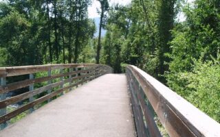
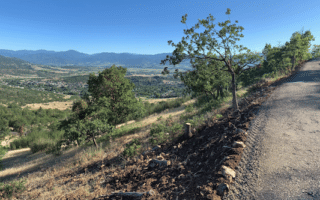
For a longer run, there are good options near Lithia Park. To the west, run north-south along Scenic Dr. (no sidewalk) to Strawberry Ln. and then on the Dutch Rd. path alongside Hald/Strawberry Park. To the east, there are some pleasant residential streets, among them Iowa St. & Holly St., which head toward Southern Oregon University. To the north, there’s some decent running downtown, especially on A, B, & C streets. To the south, there’s a short trail along Ashland Creek, and extensive, challenging roads and trails into the mountains.
Lithia Park, and the area around it, offers some of the most scenic running in Ashland. The 93-acre park, officially dedicated in 1916, is listed on the National Register of Historic Places. The park features ponds, a bandshell, grassy lawns, and beautifully landscaped gardens. Run standalone, add with nearby roads & trails, or combine with our Ashland Tour.
In the park itself, the ~1 mile paved Lithia Park Trail features 100 interpretive signposts (guide). You can also do a nearly 3 mile loop around the park on the perimeter roads (note: no sidewalk).
For a longer run, there are good options near Lithia Park. To the west, run north-south along Scenic Dr. (no sidewalk) to Strawberry Ln. and then on the Dutch Rd. path alongside Hald/Strawberry Park. To the east, there are some pleasant residential streets, among them Iowa St. & Holly St., which head toward Southern Oregon University. To the north, there’s some decent running downtown, especially on A, B, & C streets. To the south, there’s a short trail along Ashland Creek, and extensive, challenging roads and trails into the mountains.

Review or Comment on This Route/Share a Photo!
Share your feedback on this route and see that of other Great Runs users. Click on the image icon to upload a photo. And please let us know if there are notes or changes we should incorporate!