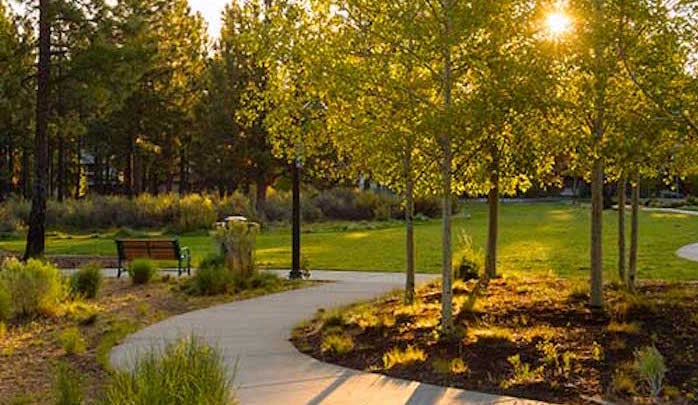
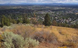
You won’t find many McMansions around Bend, but if you’d like to explore some of the nicer residential areas of the city on your run, there’s no better choice than Northwest Crossing (affectionately shortened to NWX) which was built on a Ponderosa Tree Farm. The tree-lined sidewalks of Northwest Crossing Drive end in a large loop, which encircles the family friendly Compass Park. For a look at Bend’s impressive environmentally friendly contemporary cottages, follow the streets which form concentric circles out from Compass Park. When you reach the outer limits, the linear path of Sunset Park will carry you back towards the start.
NorthwestCrossing.com
Features:
Scroll Down For Route Maps
Essentials
- 3.8 miles (6.2 km) loop
- 121 feet
- Summit High School
- Northwest Crossing Drive
Current Weather & Forecast

Bend, US
9:17 pm,
Jul 13, 2026
L: 24°
H: 25°
Daily ForecastHourly Forecast
Tomorrow
2:00 pm
24° / 25°°C
0 mm
0%
7 mph
51 %
1018 mb
0 mm/h
Wednesday
2:00 pm
13° / 34°°C
0 mm
0%
6 mph
91 %
1018 mb
0 mm/h
Thursday
2:00 pm
17° / 38°°C
0 mm
0%
4 mph
57 %
1012 mb
0 mm/h
Friday
2:00 pm
18° / 38°°C
0.2 mm
20%
5 mph
64 %
1010 mb
0 mm/h
Saturday
2:00 pm
16° / 38°°C
1 mm
100%
7 mph
91 %
1014 mb
0 mm/h
Today
11:00 pm
21° / 23°°C
0 mm
0%
3 mph
50 %
1014 mb
0 mm/h
Tomorrow
2:00 am
18° / 20°°C
0 mm
0%
4 mph
48 %
1015 mb
0 mm/h
Tomorrow
5:00 am
15° / 15°°C
0 mm
0%
4 mph
51 %
1016 mb
0 mm/h
Tomorrow
8:00 am
19° / 19°°C
0 mm
0%
3 mph
45 %
1016 mb
0 mm/h
Tomorrow
11:00 am
25° / 25°°C
0 mm
0%
3 mph
41 %
1018 mb
0 mm/h
Tomorrow
2:00 pm
29° / 29°°C
0 mm
0%
7 mph
27 %
1016 mb
0 mm/h
Tomorrow
5:00 pm
27° / 27°°C
0 mm
0%
6 mph
42 %
1017 mb
0 mm/h
Other Routes in Bend, OR
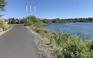
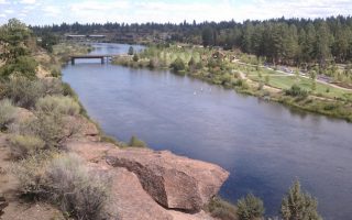
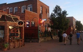
The highlight of running in central Bend. Paved paths run along the river from Drake Park downtown, south to Farewell Bend Park. Beautiful river views, several parks, numerous loop options. Adjacent historic neighborhoods are nice add-ons.
River Run Reach, including First Street Rapids Park is a popular spot for a roughly 4 mile out and back over groomed gravel.
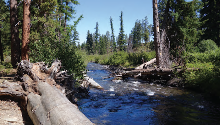
At over 600 acres, Shevlin Park is Bend’s largest park — and it has a great 6 mile loop curling around the rim of Tumalo Creek canyon. The park is 3 miles from Bend. Tumalo Creek rambles through the park with several foot bridges.
The local runners at FootZone recommend heading out on Phil’s Trail, which is the common name for a network of several trails that span a total of about 40 miles between Skyliners Road and Route 372. Starts about 4 miles west of Bend.
Run to the top of an extinct volcano! The Larkspur Trail is the gem of Eastern Bend, and while it curls out into some urban streets, the iconic section is Pilot Butte Park, where the trail plateaus with a stunning view of Bend's high desert.
When it comes to running in Bend, the team at Footzone is the most trusted source for great route advice. In fact, they’ve mapped out a series of road runs between 3 and 10 miles in length to help you choose the best streets to sprint on.
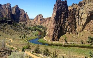
A worth-it destination run! Easy trail run on a canyon valley floor along a river with stunning views of towering rock spires. Located 1/2 hour north of Bend. More advanced trail running options as well. Also fun to watch the rock climbers!
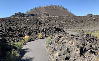
Run a paved path across a basalt lava flow! This is among the running highlights at the Lava Lands, only 15 minutes from Bend. Other great options include running the Lava Butte hill, a 5.3-mile paved multi-use path, and several trail running options.
The Green Lakes/Soda Creek Loop is for those who are serious about trail running — 12 miles of it over smooth dirt singletrack.
User Ratings
Leave A Review or Comment
Review or Comment on This Route/Share a Photo!
Share your feedback on this route and see that of other Great Runs users. Click on the image icon to upload a photo. And please let us know if there are notes or changes we should incorporate!