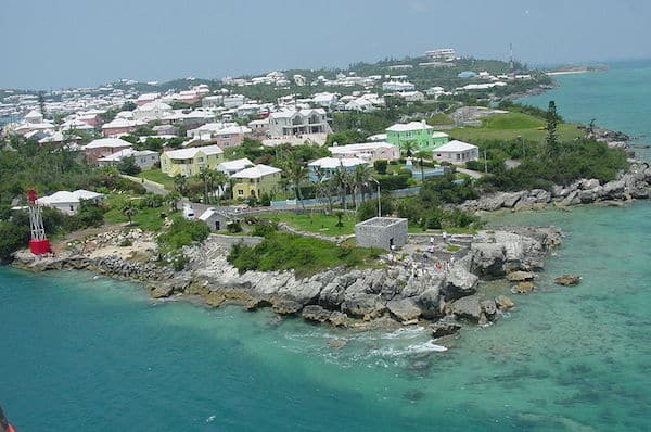
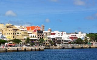
St. George’s Island is in the northeast part of Bermuda. The town was Bermuda’s first English settlement and is known for colonial buildings and St. Peter’s Church, founded in 1612. It is one of the quieter parts of Bermuda and features some very pleasant areas for running. Here are three suggested areas/loops, which can be combined for a longer run:
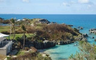
Airport Area. A quiet road run with nice views is to take Kindley Field Rd. from the Causeway for 1.25 miles to the rotary, and then St. David’s Rd. to St. David’s Head. Total is 4.2 miles one-way. MAP
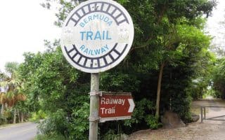
St. George’s Town to Ferry Point. 3 miles one-way. Enjoy some of the pleasant streets around the small town, and then run out to Ferry Island Fort using the Railway Trail. From the town, take Water St. west to Mullet’s Bay Rd. Just past the Railway Trailhead, follow the trail on Wellington Ln. and then the hard dirt trail along the water to Ferry Reach Park. Can add with some of the trails in the park. MAP
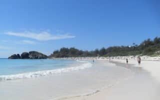
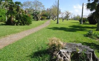
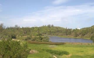
Ferry Reach Park. A lovely area for running on St. George’s. There are about 2 miles of trails, with forested sections, a plantation, some small forts, a lake, a bay, and Whalebone Bay Beach at the western end. The Railway Trail runs into and through the park. Do as a standalone run or combine with other running on St. George’s. Park Information.
Barry Rd./Cut Rd. Loop. Barry Rd. is a particularly scenic road along the water. We’ve put together a 3 mile loop incorporating Barry Rd., Cut Rd. and Govnt. Hill Rd. The roads are narrow and don’t have a sidewalk or shoulder, but the traffic is not too bad. Go early! MAP
St. George’s Island is in the northeast part of Bermuda. The town was Bermuda’s first English settlement and is known for colonial buildings and St. Peter’s Church, founded in 1612. It is one of the quieter parts of Bermuda and features some very pleasant areas for running. Here are three suggested areas/loops, which can be combined for a longer run:
Airport Area. A quiet road run with nice views is to take Kindley Field Rd. from the Causeway for 1.25 miles to the rotary, and then St. David’s Rd. to St. David’s Head. Total is 4.2 miles one-way. MAP
St. George’s Town to Ferry Point. 3 miles one-way. Enjoy some of the pleasant streets around the small town, and then run out to Ferry Island Fort using the Railway Trail. From the town, take Water St. west to Mullet’s Bay Rd. Just past the Railway Trailhead, follow the trail on Wellington Ln. and then the hard dirt trail along the water to Ferry Reach Park. Can add with some of the trails in the park. MAP
Ferry Reach Park. A lovely area for running on St. George’s. There are about 2 miles of trails, with forested sections, a plantation, some small forts, a lake, a bay, and Whalebone Bay Beach at the western end. The Railway Trail runs into and through the park. Do as a standalone run or combine with other running on St. George’s. Park Information.
Barry Rd./Cut Rd. Loop. Barry Rd. is a particularly scenic road along the water. We’ve put together a 3 mile loop incorporating Barry Rd., Cut Rd. and Govnt. Hill Rd. The roads are narrow and don’t have a sidewalk or shoulder, but the traffic is not too bad. Go early! MAP

Review or Comment on This Route/Share a Photo!
Share your feedback on this route and see that of other Great Runs users. Click on the image icon to upload a photo. And please let us know if there are notes or changes we should incorporate!