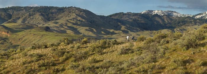
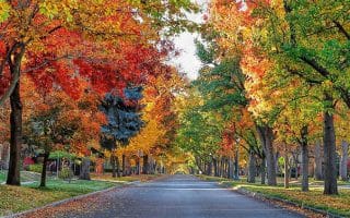
Only minutes from downtown, the Boise Foothills provide one of the more unique running experiences within a city. The ‘Ridge to Rivers’, system has 190 miles of interconnected roads and trails over 80,000 acres between Boise Ridge and the Boise River. There’s incredible variety–from gentle, through fields of wildflowers to more ranch and desert-like terrain. You can do flat, rolling, or steep. It is difficult to proscribe a particular run, since there’s so much choice. See links to their great Google view map,PDF map, and interactive map, with many trail details and suggestions. In a separate post, we’ve included a few loop suggestions for each area. Note: some trails not recommended in certain weather, such as in winter months when temps above freezing make some of the clay trails muddy.
There are numerous access points to the trail system, which we’ve put in our Boise overview map. The areas close to downtown, working from southeast to northwest:
- Table Rock. Many miles of trails, highlight is view from Table Rock. Steeper and more challenging.
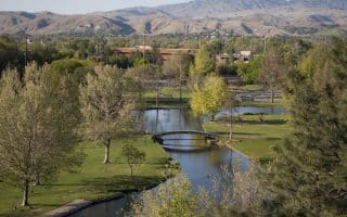
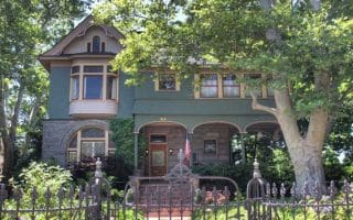
- Old Penitentiary Trailhead. Many trails here, anchored by historic old penitentiary (tours). Also nearby are the Boise Botanical Garden and Quarry Park.
- Military Reserve. Rustic natural-terrain park with trails, military cemetery & many trails.
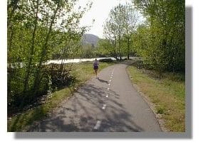
- Camel’s Back. An 11-acre park, leading to a large nature preserve. Closest to downtown. Pedestrian only.
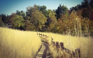
- Hillside to Hollow Reserve. Nice, open trails in here. Can be more self-contained, or connect to Castle Rock trails.
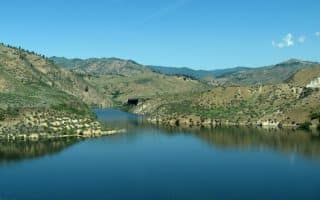
- Shafer Butte. Further from Boise. Located in the mountainous forests and meadows above Boise. Cooler temps in summer. Two categories of trails – above and below Bogus Basin Road.
There are access points further from downtown, where trails get steeper and more rugged: Seaman’s Gulch, Hidden Springs/Veterans Cemetery, Big Springs, and the extensive Shafer Butte.
Route Recommendations
Only minutes from downtown, the Boise Foothills provide one of the more unique running experiences within a city. The ‘Ridge to Rivers’, system has 190 miles of interconnected roads and trails over 80,000 acres between Boise Ridge and the Boise River. There’s incredible variety–from gentle, through fields of wildflowers to more ranch and desert-like terrain. You can do flat, rolling, or steep. It is difficult to proscribe a particular run, since there’s so much choice. See links to their great Google view map,PDF map, and interactive map, with many trail details and suggestions. In a separate post, we’ve included a few loop suggestions for each area. Note: some trails not recommended in certain weather, such as in winter months when temps above freezing make some of the clay trails muddy.
There are numerous access points to the trail system, which we’ve put in our Boise overview map. The areas close to downtown, working from southeast to northwest:
- Table Rock. Many miles of trails, highlight is view from Table Rock. Steeper and more challenging.
- Old Penitentiary Trailhead. Many trails here, anchored by historic old penitentiary (tours). Also nearby are the Boise Botanical Garden and Quarry Park.
- Military Reserve. Rustic natural-terrain park with trails, military cemetery & many trails.
- Camel’s Back. An 11-acre park, leading to a large nature preserve. Closest to downtown. Pedestrian only.
- Hillside to Hollow Reserve. Nice, open trails in here. Can be more self-contained, or connect to Castle Rock trails.
- Shafer Butte. Further from Boise. Located in the mountainous forests and meadows above Boise. Cooler temps in summer. Two categories of trails – above and below Bogus Basin Road.
There are access points further from downtown, where trails get steeper and more rugged: Seaman’s Gulch, Hidden Springs/Veterans Cemetery, Big Springs, and the extensive Shafer Butte.
Route Recommendations

Review or Comment on This Route/Share a Photo!
Share your feedback on this route and see that of other Great Runs users. Click on the image icon to upload a photo. And please let us know if there are notes or changes we should incorporate!