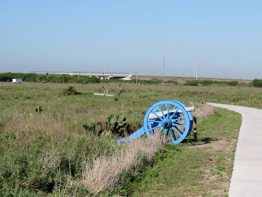
Palo Alto Battlefield National Historical Park is the site of the first major battle of the U.S.-Mexican War and the only National Park Service unit to interpret this important event. It’s also the site of some of the best running options in Brownsville! There are two excellent options for running here:
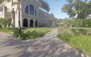
Battlefield Trails. Run the paved trails from the Visitor Center to experience a landscape almost as it existed on the day of the battle. Combining the Battlefield Trail, U.S. Line Trail, and Mexican Line Trail makes for a run of ~1.5 miles.
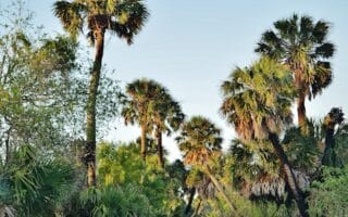
Brownsville Historic Battlefield Trail. This wide, paved path runs for 8 miles between the National Historical Park and the Mitte Cultural District in downtown Brownsville, near the Southern Pacific Linear Park and the Museum of Fine Arts. Can start at any point on trail. It won’t win huge awards for scenery. The prettiest sections are closer to the southern end. It’s fairly open & exposed, so use caution in the heat! Some key distances, starting downtown:
2 miles: Resaca de la Palma National Battlefield unit of the National Park. Take E Price Rd.
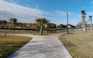
4 miles: Connect to the Brownsville Event Center Running Trail (~7 miles of waterside paths)
Palo Alto Battlefield National Historical Park is the site of the first major battle of the U.S.-Mexican War and the only National Park Service unit to interpret this important event. It’s also the site of some of the best running options in Brownsville! There are two excellent options for running here:
Battlefield Trails. Run the paved trails from the Visitor Center to experience a landscape almost as it existed on the day of the battle. Combining the Battlefield Trail, U.S. Line Trail, and Mexican Line Trail makes for a run of ~1.5 miles.
Brownsville Historic Battlefield Trail. This wide, paved path runs for 8 miles between the National Historical Park and the Mitte Cultural District in downtown Brownsville, near the Southern Pacific Linear Park and the Museum of Fine Arts. Can start at any point on trail. It won’t win huge awards for scenery. The prettiest sections are closer to the southern end. It’s fairly open & exposed, so use caution in the heat! Some key distances, starting downtown:
2 miles: Resaca de la Palma National Battlefield unit of the National Park. Take E Price Rd.
4 miles: Connect to the Brownsville Event Center Running Trail (~7 miles of waterside paths)
Review or Comment on This Route/Share a Photo!
Share your feedback on this route and see that of other Great Runs users. Click on the image icon to upload a photo. And please let us know if there are notes or changes we should incorporate!