Features:
Categories:
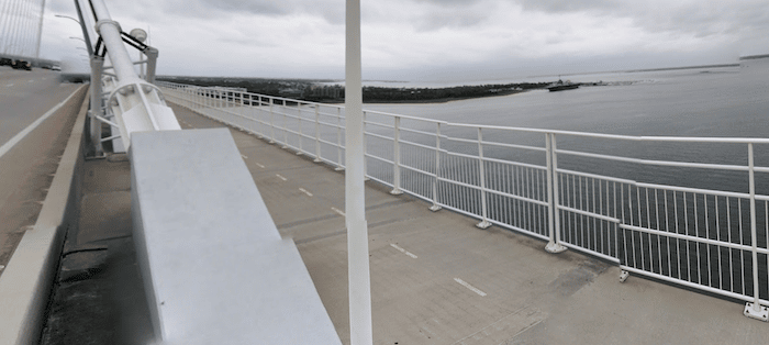
A must-do running experience on Charleston is the run from downtown over the Arthur Ravenel Bridge to Patriots Point. The bridge connects the Charleston peninsula to Mount Pleasant. Sullivan’s Island, and coastal routes. It looks daunting to run, but there’s a wide, well-protected multi-use path that’s popular with pedestrians and cyclists. The views are great and the 2-mile incline to the top affords some of the only ‘hill’ running in the Low Country!
It’s about 3.5 miles from East Bay St. near the Aquarium across the bridge to Mt. Pleasant Memorial Waterfront Park. For more, you can continue another ~1.5 miles all the way to Patriots Point. It would be nearly 10 miles for the full out and back, though there are transport options allowing for a one-way run.
- 4.8 miles one-way, from E Bay St. to Patriots Point
- 89 feet (one-way)
- E Bay St. near Aquarium. Or start elsewhere downtown


Comment on this Route/Share a Photo!
Share your feedback on this route and see that of other Great Runs users. Click on the image icon to upload a photo. And please let us know if there are notes or changes we should incorporate!
Nice run. Bay st. is a bit fraught -iffy sidewalks and lots of traffic. If you have any height issues the bridge’ll be a challenge. I have a slight fear and stayed well away from the fence. The side of the bridge near Yorktown is a fair bit steeper than the Charleston side. Nice 10.3 miles from market street and back though.
Yes, the bridge is not for everyone…